High impact, multi-day lake effect snow event

-
2:49

St. Adalbert Church celebrates Cinco De Mayo, announces fundraising...
-
0:40

Congressman Rudy Yakym awards local high school artists
-
2:06

Thundershowers tonight, a cooldown tomorrow following cold front
-
0:52

Bethel University celebrates 77th commencement
-
1:36

Beautiful start to the weekend despite morning fog
-
1:03

’Pedals and Petals’ in downtown South Bend
-
3:18

Owners urged to vaccinate dogs after puppy left for dead outside...
-
1:54

Threat of drought, even with rainy spring in Michiana
-
3:43

Protestors arrested on campus of Notre Dame
-
1:17

A fair weekend, minus a few showers Saturday night
-
4:50

“Matilda The Musical“ at the Lerner Theatre
-
2:12

More rain this morning, but overall drier weather going into...

Now through Friday evening will be a high impact lake effect snow event. Persistent snowfall will bring at least three to six inches per day in the lake effect zones, including South Bend and Elkhart. Higher amounts of 12 to 18 inches in southwest Michigan. Whiteout conditions are possible when crossing intense squalls. Use extreme caution when traveling the next two days.
There is a break from the snow Saturday, before a system warms the area into the 30s but brings additional snowfall Sunday and Monday.
Tonight: Lake effect snow showers, low of 8. 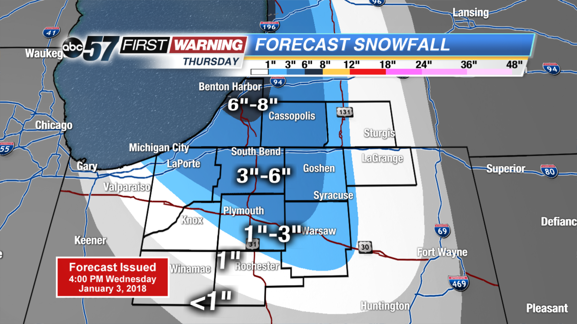 Thursday ONLY snowfall
Thursday: Lake effect snow showers, high of 12.b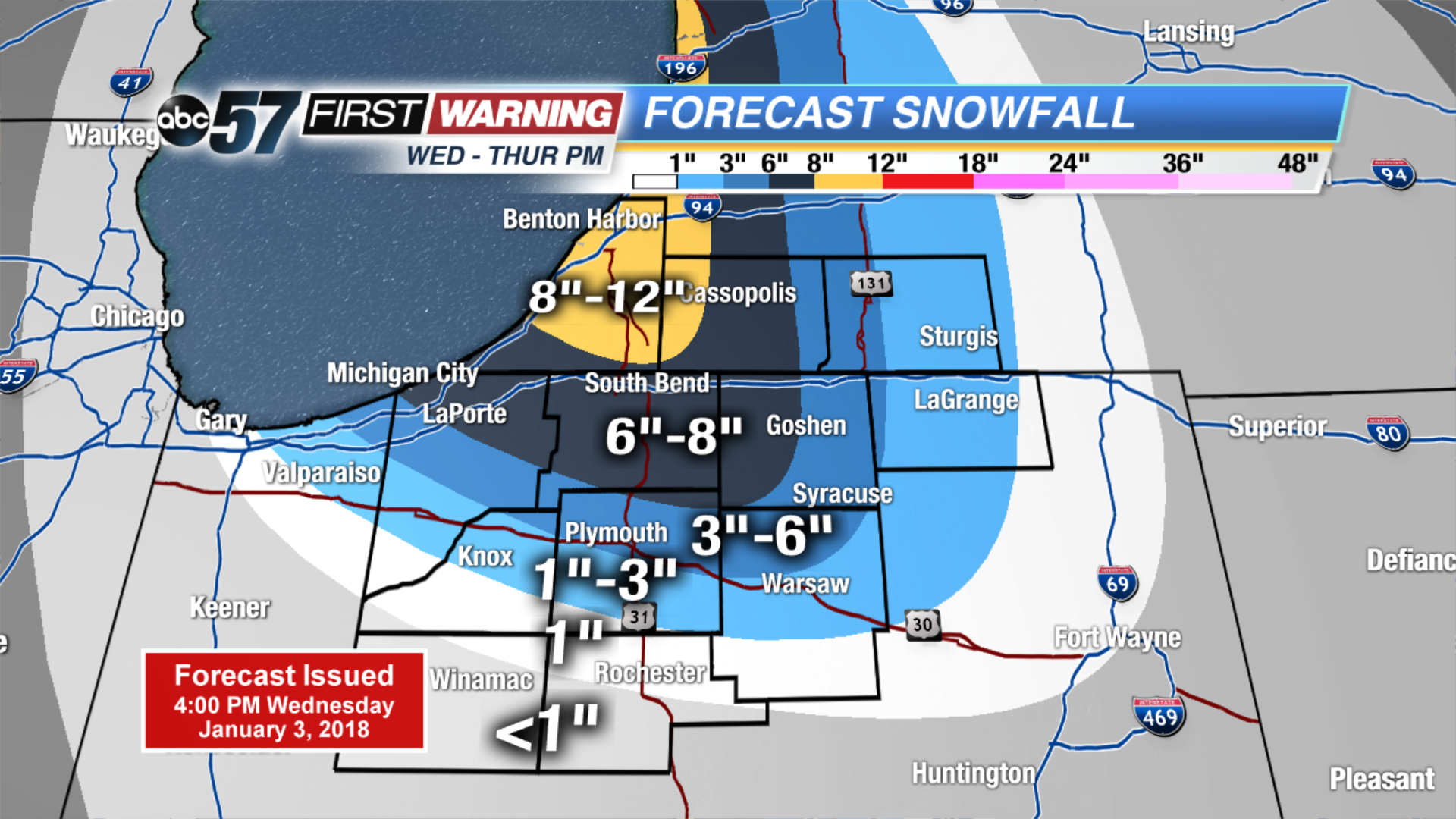 Estimated two day totals
Friday: Lake effect snow showers, high of 10.
Saturday: Partly cloudy, high of 15. ![]() High impact lake effect snow event.
High impact lake effect snow event.
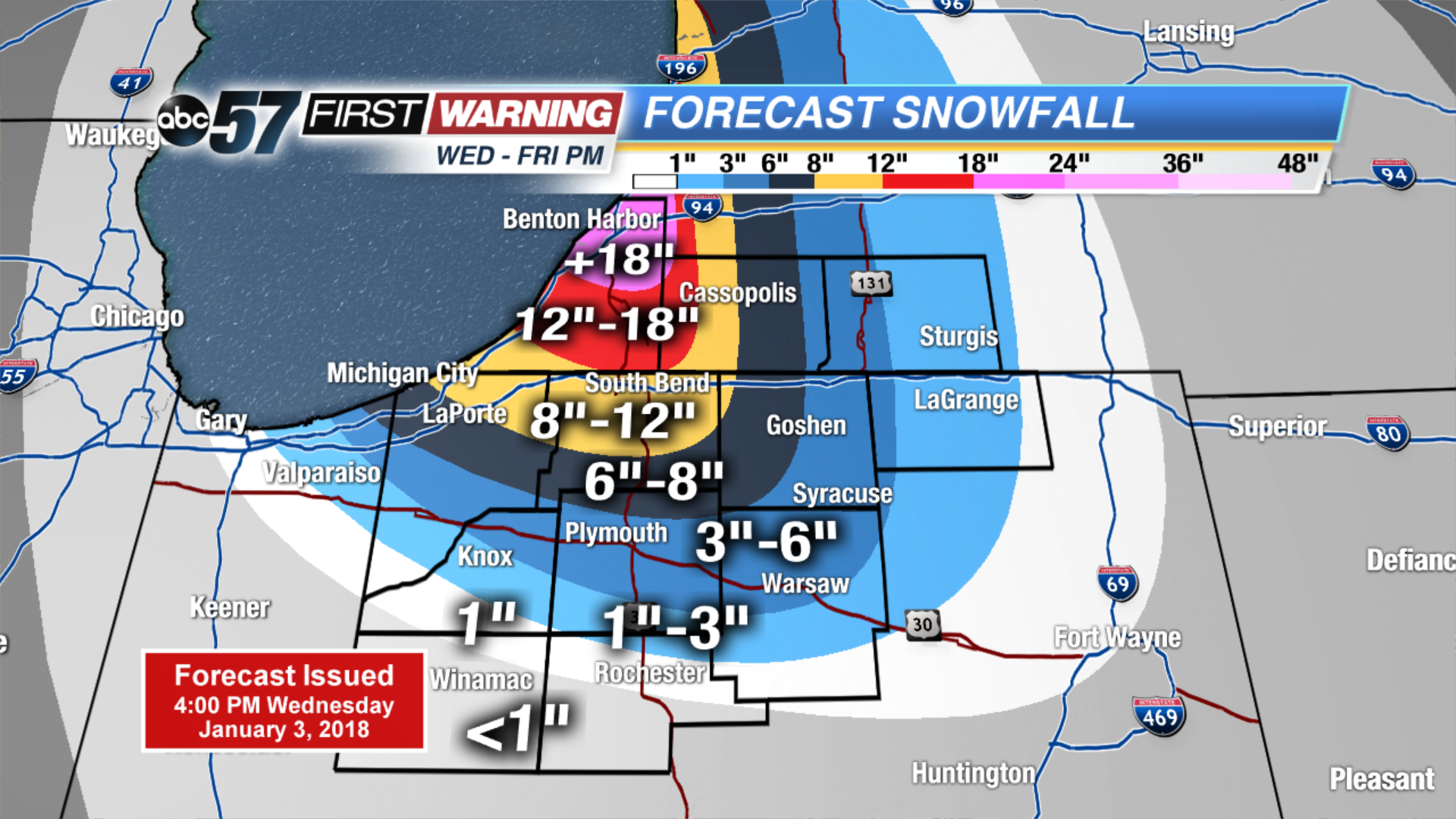 Estimated three day totals