-
5:36

Hannah Hidalgo wins Naismith Defensive Player of the Year
-
2:50

New South Bend Cubs manager Daniel Wasinger ready for opening...
-
2:24

South Bend Cubs pitcher Kenten Egbert looks to build on strong...
-
1:52

Hoosiers face a gas tax increase as gas prices continue to rise
-
1:45

Iranian cybercrime group claims to have hacked St. Joseph County’s...
-
1:17

Cold and soaking rain today, another severe risk tomorrow
-
0:44

South Bend High School Music Festival highlights student talent
-
1:55

South Bend house fire possibly caused by lightning
-
2:26

Flooding remains a threat into Wednesday
-
0:40

Baxmeyer defends actions amid solar farm bond debate
-
2:11

Southwest Michigan Cares Fund reaches over $70k as families still...
-
1:35

Severe weather threat ending across Michiana

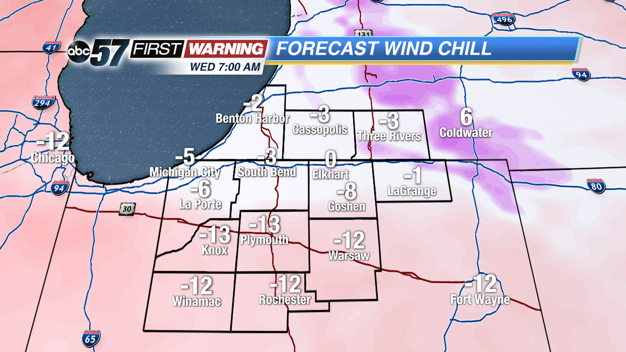
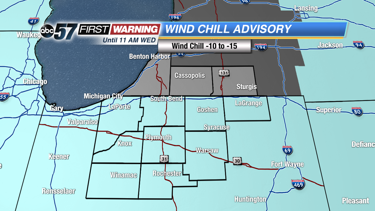
Lows will be next zero Tuesday and Wednesday night with a wind chill of -10 to -15 for most of Michiana. Dress warm and limit outdoor exposure, take extreme cold precautions.
Frigid forecast for the rest of 2017 and start of 2018. High temperatures won’t break 20 for at least the next week, some days struggling to break into the double digits. Lows will be in the single digits and at times near zero, with the wind chill even colder. Light snow and flurries will also be in the forecast, mostly lake effect that will only bring up to an inch or two each day from the state line north.
Tonight: Partly cloudy, flurries, low of 2.
Wednesday: Partly cloudy, flurries, high of 10.
Thursday: Partly cloudy, chance of snow late, high of 15.
Friday: Light snow showers, highs in the mid-teens.