
-
3:16

’It wasn’t safe for our community,’ Hispanic Heritage...
-
2:44

South Bend welcomes fans ahead of first home game
-
2:01

ABC57 Kickoff preview on the story of Bria Murphy
-
3:47

Kicking off the fall season with Oaktoberfest
-
1:21

Spotty storms Saturday, hotter Sunday
-
2:49

Dowagiac Football squad looks to tip 1-1 record heading into...
-
5:29

Sudden blindness, dealing with this rare hereditary disease
-
2:14

Elkhart update breakfast brings community together for answers...
-
3:02

New football coach at Benton Harbor looks to turn program around,...
-
1:58

Warming up and drying out, Isolated showers tomorrow
-
2:57

Supreme Court Justice Amy Coney Barrett set to speak at Notre...
-
1:20

Community gathers for 9/11 stair climb

Another foggy start for Michiana with areas of dense fog developing later this morning. Freezing fog and freezing drizzle are both possible early this morning, so watch out for areas of black ice. Fog sticks around through today with times of light rain and drizzle through tonight. Periods of heavier rain move in tomorrow with more fog in the forecast as snow melts. Highs reach into the middle 40s today and low 50s by tomorrow.
We are still watching a potential winter storm for Friday. Right now it looks like the heaviest snow will be to our east in Ohio but if the track of the storm shifts, it will greatly change the path of heaviest snow. Lake effect snow develops behind the system for Saturday.
Today: Fog and drizzle, high of 46. 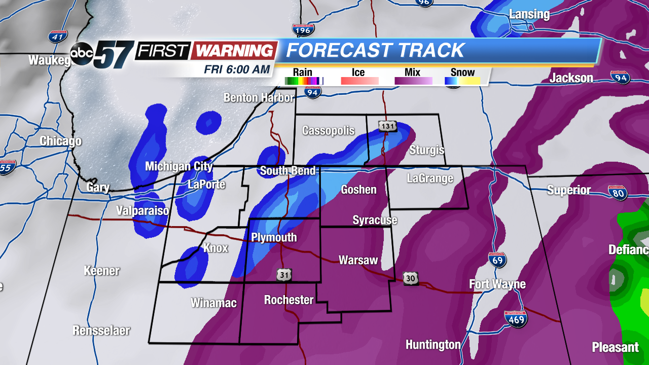 Wintry mix and snow Friday morning
Tonight: Fog and light rain, low 45.
Thursday: Rain and fog, highs near 50.
Friday: Snow showers, high of 30.