Flooding recap in SE Michiana

-
1:20

Rain doesn’t last all day, but warm and breezy conditions do
-
1:44

Michiana Jeep Club hosts their 18th annual Road Rally
-
0:51

4th annual South Bend Made Art Showcase held
-
2:15

Thunderstorms tonight, highs in the 80s tomorrow
-
2:18

Warm and breezy today; storms possible this evening
-
1:23

New Prairie Little League goes big for opening day
-
0:21

Police investigating shooting on Amhurst Avenue
-
2:42

South Bend Police Department recognized for completing crisis...
-
0:35

Local boxer brings home Golden Gloves Championship
-
1:01

5th annual Ivy Impact Gala held
-
0:50

13th annual Radiothon for Five Star Life takes place
-
1:52

German company Verbio buys new ethanol plant in South Bend

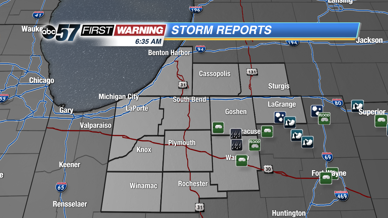 A few flash flood reports in Kosciusko and Elkhart counties but the worst of the weather was well to the south.
Yesterday, strong and severe thunderstorms ripped through portions of central and eastern Indiana and northwest Ohio. Here in Michiana, we were spared from the worst of the severe weather, but we still felt the effect of Sunday's storms.
We received a few reports of heavy rainfall as well as water moving across roadways in Kosciusko and even southern Elkhart counties yesterday afternoon. As much as 3" inches of rain fell in these areas in the span of a few hours, prompting a Flash Flood Warning for SE Michiana that lasted for about 3 hours.
Flood waters will be able to recede throughout this week, as a much drier trend is in store for Michiana.
Farther south, central and southern Indiana was hit much harder than us, as a few tornadoes did drop down in spots along with numerous severe thunderstorms packing heavy rain, large hail, and damaging winds yesterday afternoon. The National Weather Service sent down a survey team earlier this morning to take a look at the damage and make an official rating for the tornadoes that moved through in Central IN.