Flooding concerns and additional storms Wednesday

-
1:20

Local fans react to Irish victory over Indiana University
-
2:29

Warming trend begins Monday
-
2:03

Light AM snow, cold Saturday
-
4:33

Coach Freeman looks to the past to prepare for the future
-
6:40

EA Sports College Football 25 back for first time in over a...
-
7:01

’Voice of the Hoosiers’ Don Fischer sits down with the ABC57...
-
6:26

Notre Dame quarterback Riley Leonard’s inspiration for helping...
-
5:57

Former Notre Dame and NFL offensive lineman Alex Bars stops by...
-
3:04

ABC57 Kickoff’s LeVon Whittaker talks about how IU and ND...
-
6:10

Former Irish and NFL linebacker Jaylon Smith chats with the...
-
8:22

Former Notre Dame Receiver Golden Tate makes ABC57 Kickoff debut
-
4:28

IU vs. ND, history in the making at Notre Dame Stadium Friday...

It’s not a wash out for Wednesday, but expect some scattered showers and storms throughout today.
As you drive into work this morning, be cautious that there could be ponding or flooding in low-lying areas and across certain roads. Remember not to drive through standing water on roads. There is a flood watch across all of Michiana as we continue to add to rain totals for the week.
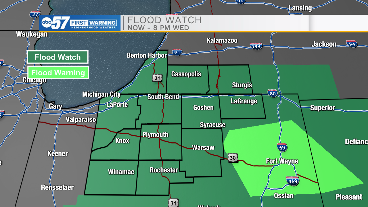
For anyone driving to the Fort Wayne area Wednesday, there is a flood warning in place, with several flood reports through the area. Be aware of this before you drive to that area.
There’s still a low severe risk for storms today, with flooding and heavy rain the biggest impacts, possibly some gusty winds.
Expect more rounds of storms and rain for Thursday and Friday.
We’ll finally dry out by the time we get to the weekend. It’ll be mostly sunny weather with highs in the lower 80s both Saturday and Sunday.
Today: Scattered showers and storms. High 85.
Tonight: Scattered storms. Low 68.
Thursday: Scattered storms. High 84.
Friday: Scattered showers. High 84.