
-
1:06

Marshall County Humane Society reschedules Dog Egg Hunt
-
2:01

Martin Luther King Dream Center hosts MLK March in South Bend
-
1:54

South Bend Cubs opener postponed by weather, but fans still find...
-
2:01

Sights and sounds from South Bend Cubs Opening Day
-
1:32

NIPSCO ’flatly rejected’ further negotiations, USW workers...
-
3:36

The art of groundskeeping at Four Winds Field
-
3:32

The history behind America’s only ballpark synagogue turned...
-
1:59

South Bend opens season against Quad Cities in familiar Midwest...
-
4:21

South Bend Cubs owner discusses $48M stadium expansion, changes...
-
3:19

A look into the new South Bend Cubs 2026 roster
-
5:17

Expansion goes beyond Four Winds Field, new restaurants, bars,...
-
6:18

What’s new this season? South Bend Cubs unveil major improvements...

Messy winter weather to end the week. Widespread system snow starts early Friday morning. The first flakes are likely to melt due to the warm ground and air temperature just above freezing. Grassy areas are likely the first to accumulate but most of Friday is wet / slushy.
Cold air surges across the lake Friday night, after midnight accumulation of more than three inches is possible across southwest Michigan, less than three inches near the state line. Snow ends Saturday morning, the rest of the day will be bitterly cold for November.
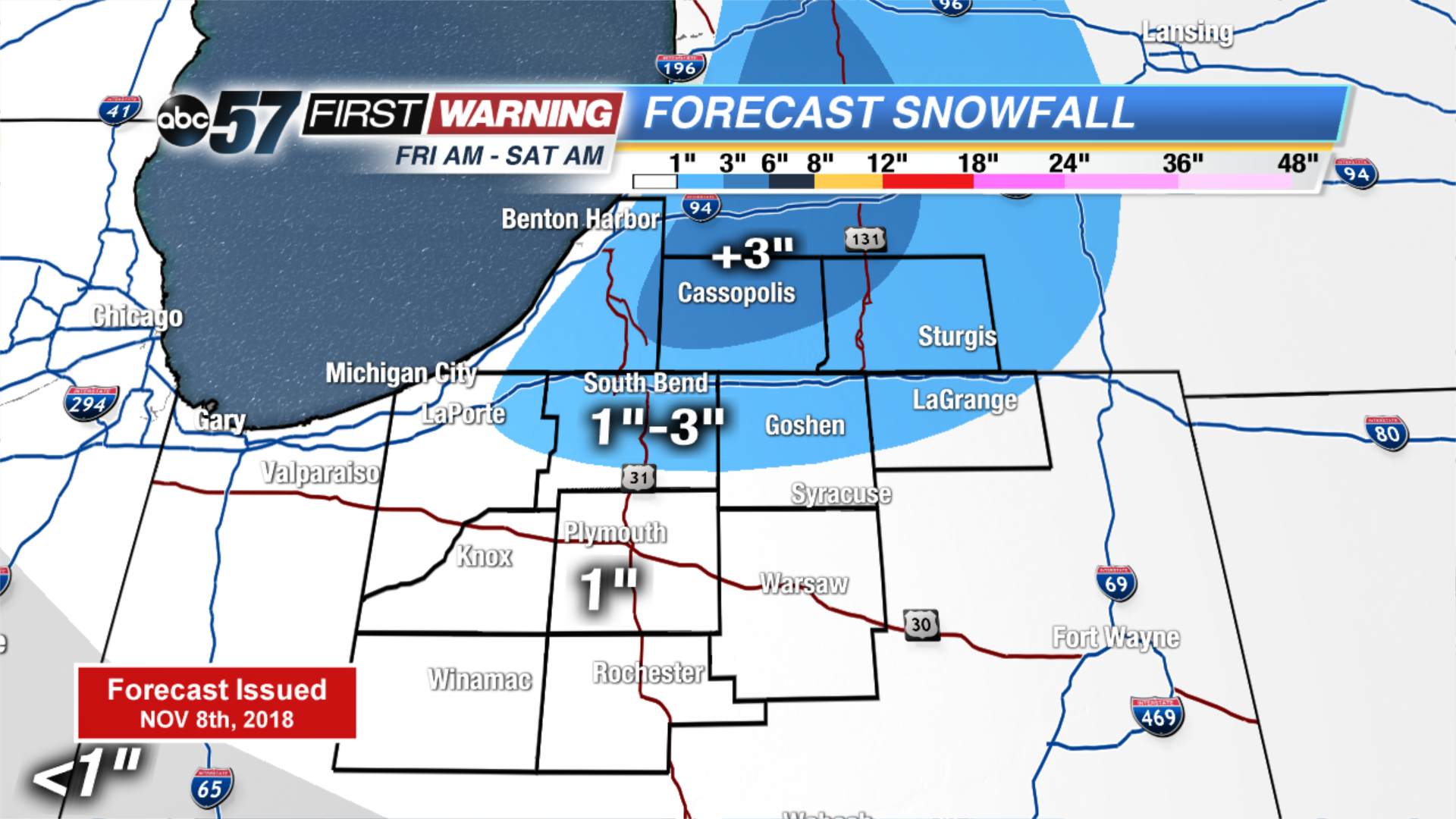
Tonight: Early AM snow/mix, low of 32.
Friday: Mix/snow showers then lake effect snow, high of 38.
Saturday: Morning lake effect snow, high of 34.
Sunday: Mostly cloudy, high of 38.
Sign up for the ABC 57 Newsletter