
-
1:06

Marshall County Humane Society reschedules Dog Egg Hunt
-
2:01

Martin Luther King Dream Center hosts MLK March in South Bend
-
1:54

South Bend Cubs opener postponed by weather, but fans still find...
-
2:01

Sights and sounds from South Bend Cubs Opening Day
-
1:32

NIPSCO ’flatly rejected’ further negotiations, USW workers...
-
3:36

The art of groundskeeping at Four Winds Field
-
3:32

The history behind America’s only ballpark synagogue turned...
-
1:59

South Bend opens season against Quad Cities in familiar Midwest...
-
4:21

South Bend Cubs owner discusses $48M stadium expansion, changes...
-
3:19

A look into the new South Bend Cubs 2026 roster
-
5:17

Expansion goes beyond Four Winds Field, new restaurants, bars,...
-
6:18

What’s new this season? South Bend Cubs unveil major improvements...

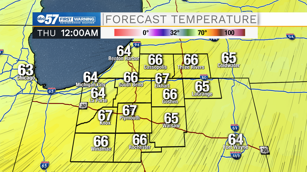
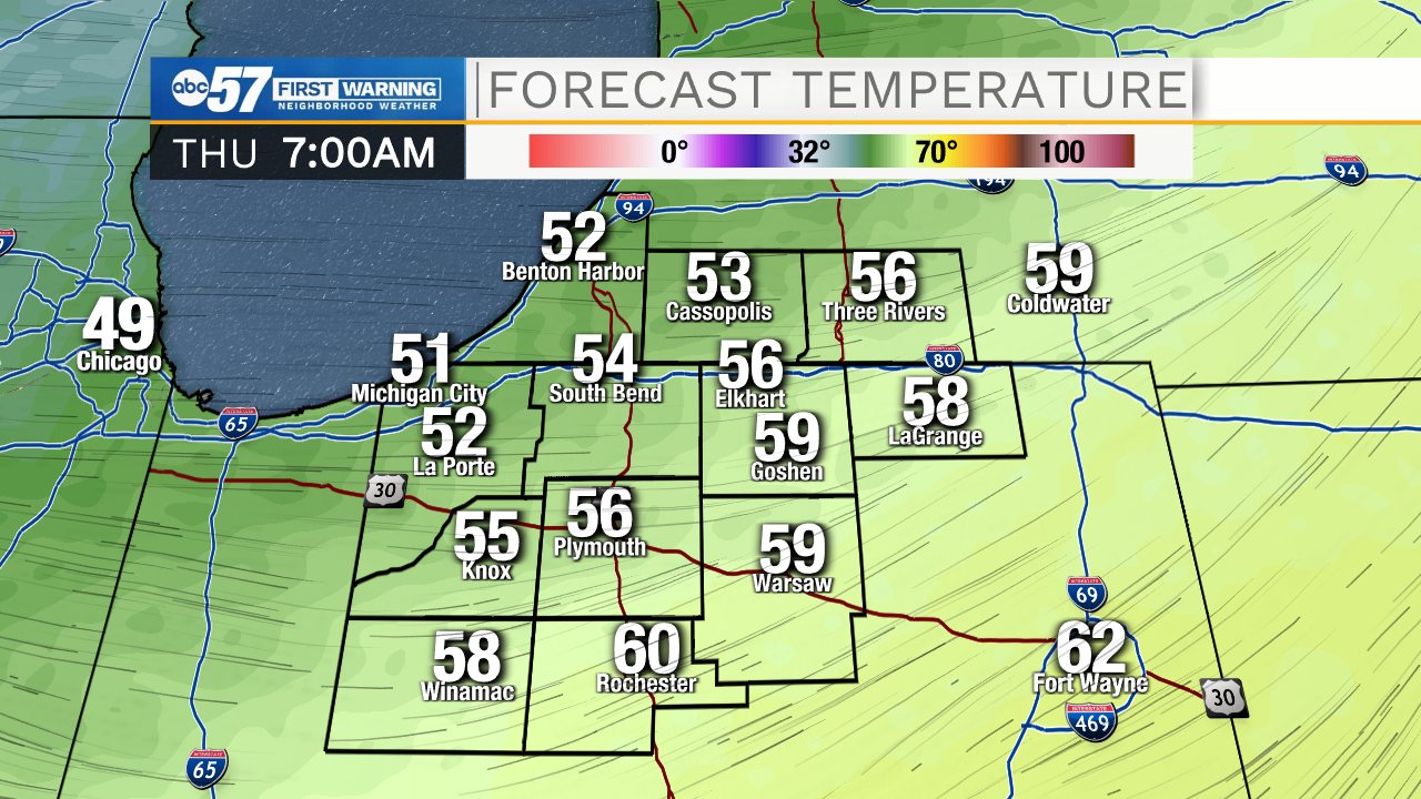
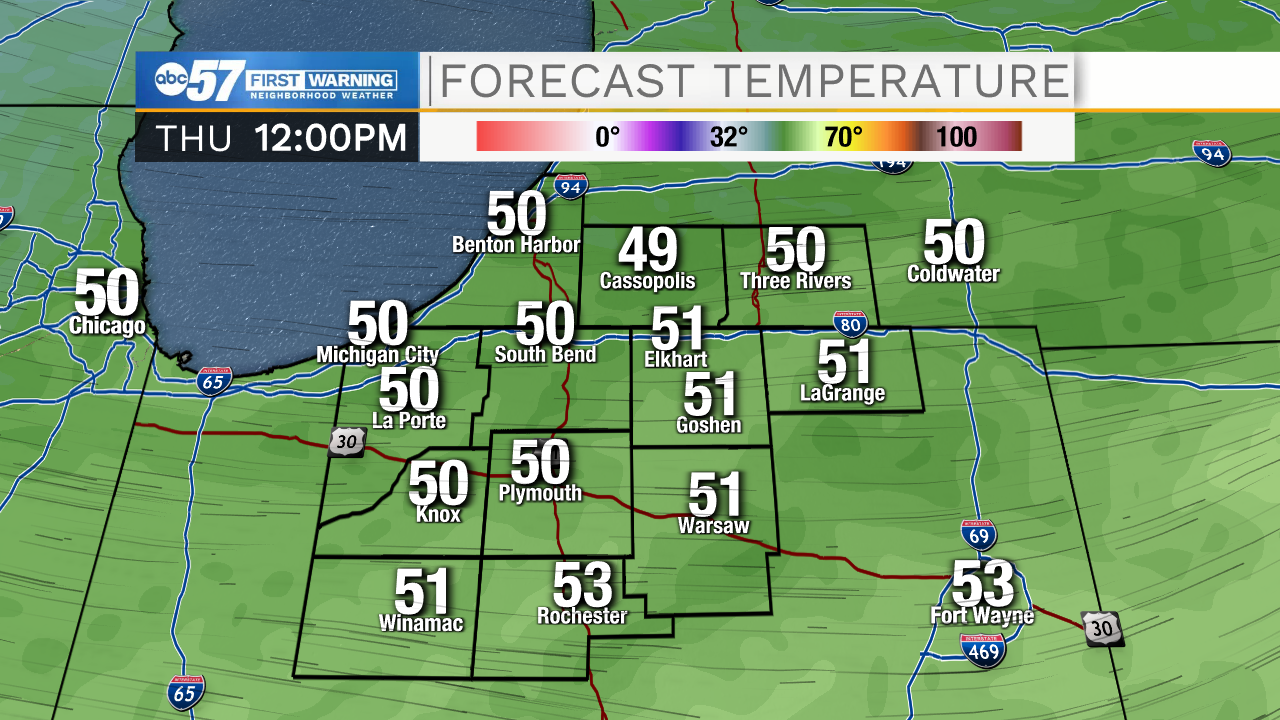
The cold air surges early Thursday morning. The earlier arrival will still drop temperatures but they will no longer fall through the day Thursday. Instead temperature range between 50 and 55 before dropping into the mid-30s early Friday. Frost is possible Friday morning. The weekend is cooler but near normal for mid-October with highs in the upper 50s. Next week’s forecast is sketchy at best with a lot of turbulence in the models. Plan for rain early next week.
Tonight: Mostly cloudy, chance of showers. Breezy. Low 50.
Thursday: A chance of showers. Breezy. Temps range 50 to 55.
Friday: Mostly sunny. High 56.
Saturday: Partly cloudy. 58
Sign up for the ABC 57 Newsletter