Falling temperatures and lake effect snow

-
2:42

Active weather arrives Sunday
-
3:22

Calm today, storms return Sunday
-
2:58

Thousands of people across Michiana experienced power outages...
-
1:13

Earl Wigfall holds Detective Trivia Night for Sheriff campaign
-
1:50

Preparations underway for South Bend’s annual St. Patrick’s...
-
0:24

CAVA set to open in Mishawaka
-
1:16

Groundbreaking project underway for housing development
-
0:52

Jefferson Boulevard renamed to kickoff St. Patrick’s Day festivities
-
0:35

Congressman Rudy Yakym on Iran conflict
-
3:22

A look at some of the big concerts coming to St. Joseph County...
-
1:50

Mild Sunday, snow Monday
-
4:37

Morris Performing Arts Center show season starts tonight

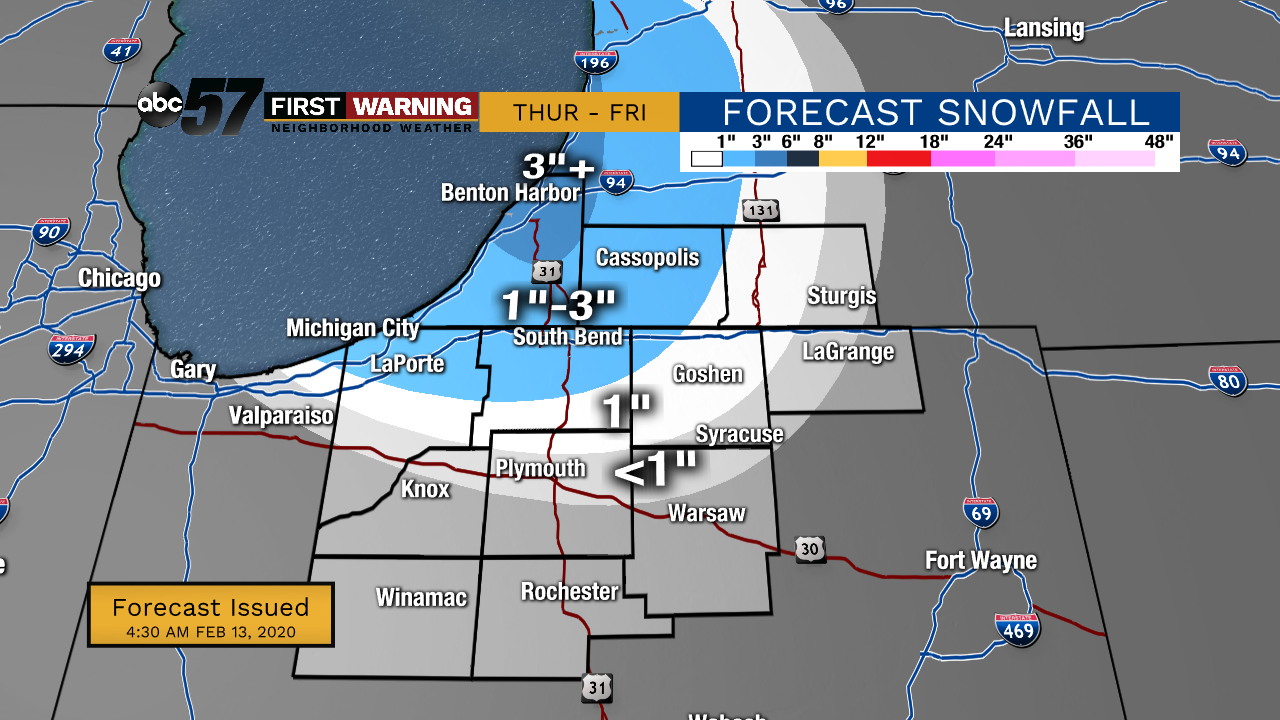
Thursday, February 13th, 2020
Light snow showers from the system continues early this morning. The system moves out before noon with lake effect snow developing around that time. Lake effect snow will add up for our NW counties this afternoon into early Friday morning. Temperatures drop today along with it, falling from 30 degrees. Overnight temperatures will fall into the single digits and the wind will make it feel even colder! After a frigid Friday, temperatures rise again over the weekend with a chance of rain to start the new work week.
Today: Snow showers early, then afternoon lake effect snow. Temperatures drop from 30.
Tonight: Lake effect snow, mostly cloudy. Low of 8.
Friday: A few flurries early, then partly cloudy. High 18.
Saturday: Increasing clouds then evening wintry mix. High 33.