
-
3:19

Mishawaka apartment resident raises concerns over algae-filled...
-
2:55

USA World Cup watch party at Manny’s Sports Bar
-
3:15

RedBud Nationals brings 4th of July motocross tradition back...
-
1:49

RedBud organizers prepare for high temps at this weekend’s...
-
2:10

Indiana FSSA breaks down report on SNAP error rates
-
2:53

Street camping now illegal across Hoosier state
-
2:37

Preview the possibilities at the St. Joseph County 4H Fair
-
1:17

Local reactions to the Supreme Court’s ruling on transgender...
-
2:32

Local experts and politicians weigh-in on the Supreme Court’s...
-
8:00

250 years of Indiana sports history, a legacy built across generations
-
7:19

Savoring Michiana
-
3:16

Dowagiac residents seek class action over noise from hyperscale...

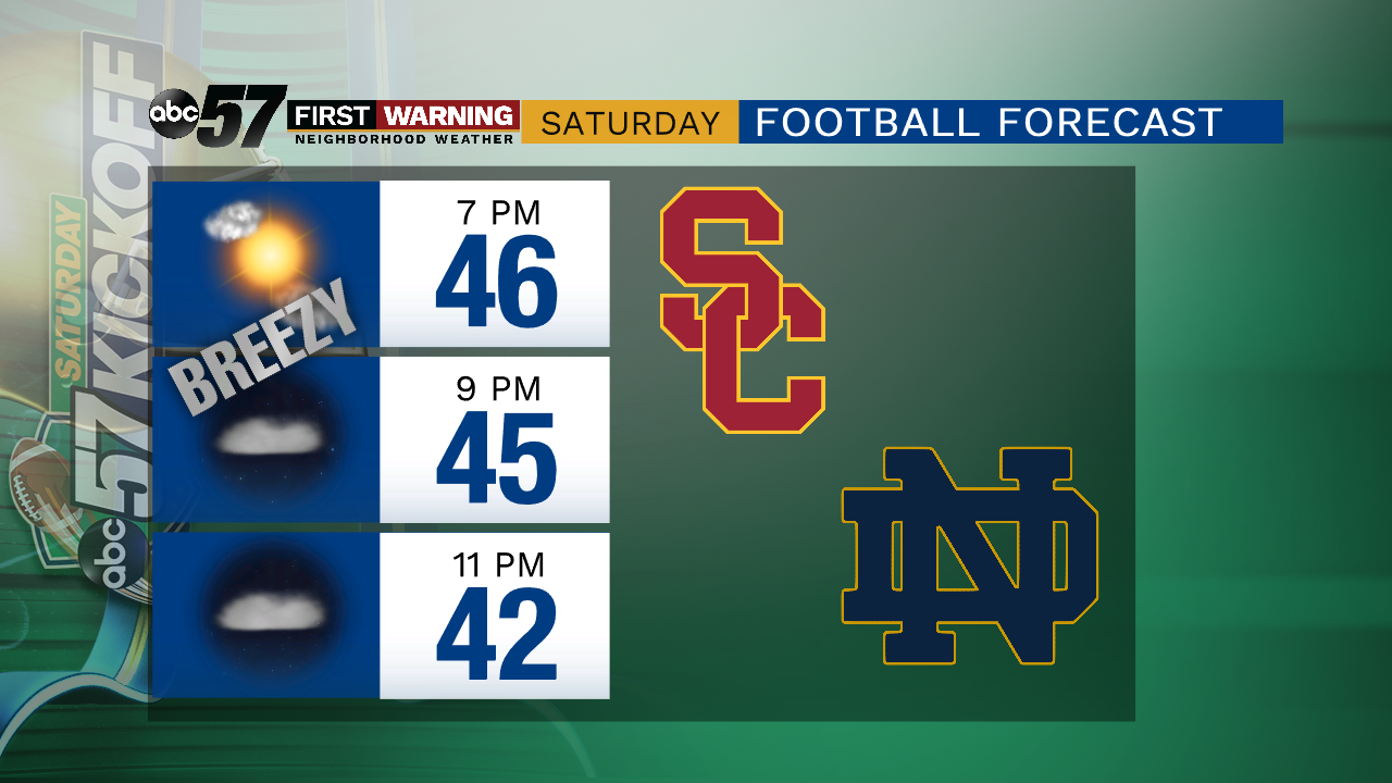
The first effects of the fall storm begin early Friday with rain showers and rain is likely much of the day. Temperatures peak near 70 at noon and fall steadily after the cold front passes around 2:00 p.m. dropping to the 40s by the evening. Wind gusts range 25 to 30 mph and it stays breezy through much of Saturday. Skies clear for the weekend but temperatures remain cool, highs only in the low to mid 50s.
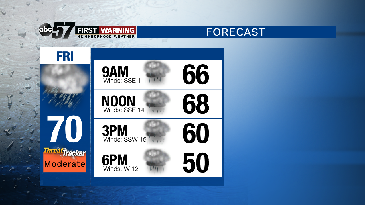
Tonight: Shower by morning. Low of 63.
Friday: Rainy and breezy. High of 70.
Saturday: Fair and breezy. High of 50.
Sunday: Sunny. High of 56.
Monday: Sunny. High 56.
Sign up for the ABC 57 Newsletter