Dry and mild weekend
By: Alex Countee
Posted: Jun 24, 2017 8:03 AM EDT

-
1:48

Preparations underway as Indiana University football trophies...
-
3:09

Indiana Utility Regulatory Commission collecting consumer data...
-
1:18

St. Joseph County officials host Election 101 Workshop on voting...
-
5:36

Hannah Hidalgo wins Naismith Defensive Player of the Year
-
2:50

New South Bend Cubs manager Daniel Wasinger ready for opening...
-
2:24

South Bend Cubs pitcher Kenten Egbert looks to build on strong...
-
1:52

Hoosiers face a gas tax increase as gas prices continue to rise
-
1:45

Iranian cybercrime group claims to have hacked St. Joseph County’s...
-
1:17

Cold and soaking rain today, another severe risk tomorrow
-
0:44

South Bend High School Music Festival highlights student talent
-
1:55

South Bend house fire possibly caused by lightning
-
2:26

Flooding remains a threat into Wednesday

We’ll be much cooler, and drier, for the duration of the weekend. Saturday will be mostly sunny with a high in the middle 70s. Sunday looks very similar, except for the slight chance of an afternoon shower or storm. Highs will continue to fall off into the upper 60s for Monday before rebounding back into the lower 80s by midweek. Our next system should bring rain back to Michiana as early as Wednesday evening, and continuing to affect us for Thursday and Friday.
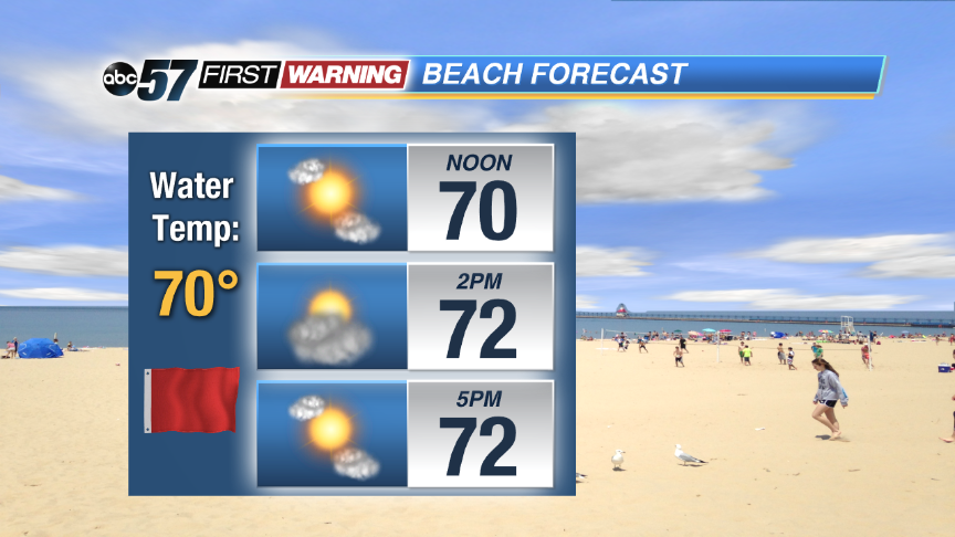 Red flags are up today as the rip current threat increases.
Saturday: Mostly sunny, high 74.
Tonight: Partly cloudy, low of 54.
Sunday: Mostly sunny, high 72.
Monday: Mostly sunny, highs near 70.
Sign up for the ABC 57 Newsletter