
-
3:19

Mishawaka apartment resident raises concerns over algae-filled...
-
2:55

USA World Cup watch party at Manny’s Sports Bar
-
3:15

RedBud Nationals brings 4th of July motocross tradition back...
-
1:49

RedBud organizers prepare for high temps at this weekend’s...
-
2:10

Indiana FSSA breaks down report on SNAP error rates
-
2:53

Street camping now illegal across Hoosier state
-
2:37

Preview the possibilities at the St. Joseph County 4H Fair
-
1:17

Local reactions to the Supreme Court’s ruling on transgender...
-
2:32

Local experts and politicians weigh-in on the Supreme Court’s...
-
8:00

250 years of Indiana sports history, a legacy built across generations
-
7:19

Savoring Michiana
-
3:16

Dowagiac residents seek class action over noise from hyperscale...

Rain continues tonight and could turn into more of a wintry mix overnight. The wintry mix continues early Saturday morning, then rain most of the late morning and afternoon. By Saturday evening, we could see snow instead. Light snow continues into Sunday morning. Little accumulation is expected. Roads will remain above freezing, so there should be little impact for travel. Temperatures this weekend and next week will remain in the mid to upper 30s each day with overnight lows in the upper 20s.
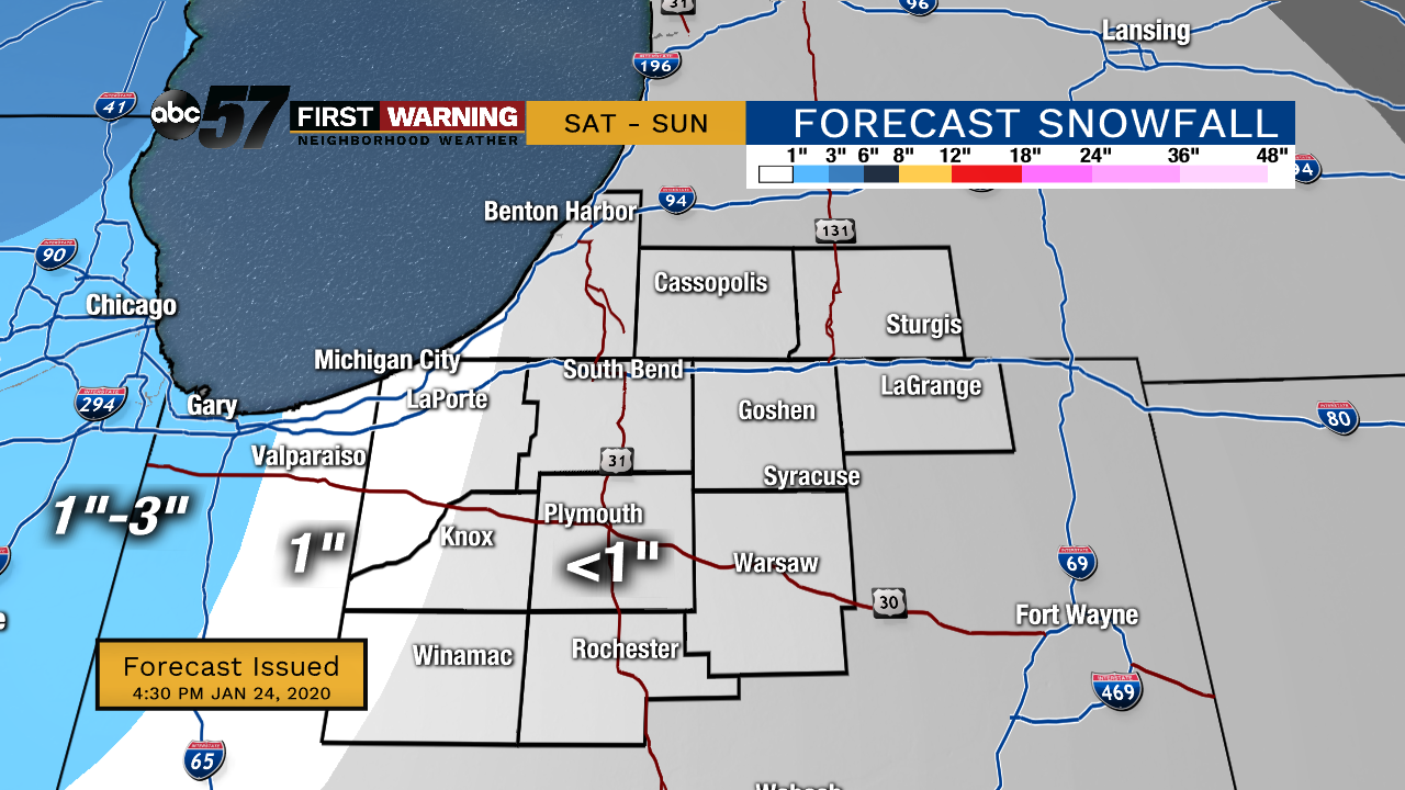
Tonight: Rain turns late to a wintry mix. Low 30.
Saturday: Wintry mix early, then mostly rain. Snow possible by evening. High 36.
Sunday: Snow in the morning, then cloudy. High 34.
Monday: Cloudy but dry. High 34.
Sign up for the ABC 57 Newsletter