Cold front arrives before midnight Friday, showers and storms follow
Posted: May 20, 2022 8:04 PM EDT

-
0:37

13th annual Radiothon for Five Star Life takes place
-
1:05

Amazon investing $11 billion into New Carlisle data center
-
1:52

German company Verbio buys new ethanol plant in South Bend
-
0:54

61st annual Salvation Army Pancake Day held
-
5:26

Rep. Rudy Yakym calling for the protection of Jewish students...
-
1:26

Wet, warm & windy this weekend
-
4:24

Michiana Crime Stoppers shredding event
-
1:16

’IvyCares’ program setting students up for success in and...
-
1:45

Windy and wet this weekend, but unseasonable warmth as well
-
3:13

Local players react to $3 million investment in Byer Softball...
-
0:32

Layoffs at Whirlpool could affect workers in Benton Harbor
-
1:03

Annual District Sisterhood Conference at Ivy Tech empowers students

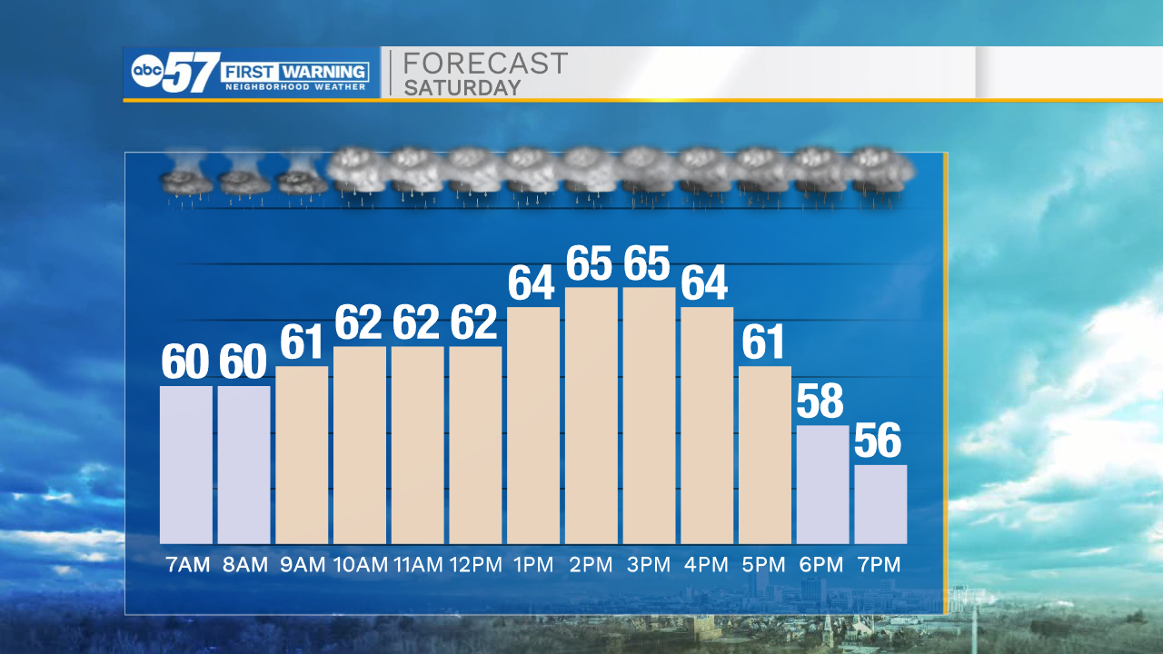
The cold front moves through Michiana early Saturday, bringing with it showers and thunderstorms. The front likely stalls between Plymouth and Ft. Wayne Saturday, keeping the area under rounds of rain, but the storm threat is to the southeast. Severe weather is unlikely. Temperatures will be cool to mild through most of next week.

Tonight: Rain and thunderstorms. Low 60.
Saturday: Rounds of rain. High 66.
Sunday: Mostly cloudy and cooler. High 60
Monday: Mostly sunny. High 66
Sign up for the ABC 57Newsletter