
-
1:28

Waiting for the end of week warm up
-
2:59

Nipsco hosts Community Care Centers
-
3:04

Granger mom and daughter stuck in Puerto Vallarta resort amid...
-
2:54

Officials urge road safety in snowy conditions
-
2:48

“It’s crazy!” Niles resident reacts to Michiana weather...
-
1:45

The snow melts again this week
-
2:06

Another burst of winter today, warmer tomorrow
-
2:22

’Ladder Up’ program offers free tax assistance for low-income...
-
3:10

Attorney breaks down ongoing Benton Harbor water crisis litigation...
-
1:05

Final day of 2026 Home and Outdoor Expo takes place Sunday
-
2:12

Wintry weather continues overnight
-
2:41

Widespread snow through Sunday

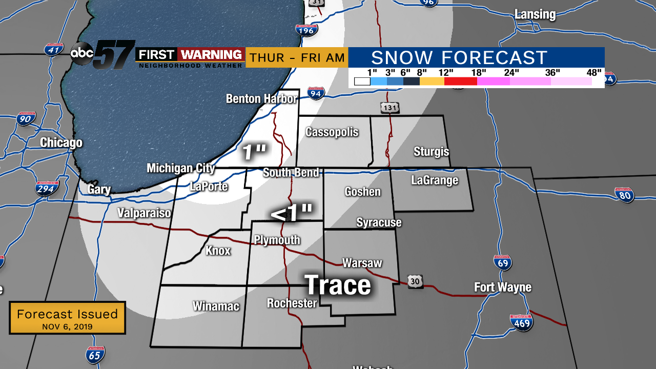
Highs will struggle to break the freezing mark Thursday and Friday. Lake effect snow showers will be mostly confined to Berrien and La Porte counties, even then most will see less than an inch. There’s a short reprieve from the cold this weekend, then another cold blast next week. Round two could flirt with record cold and bring more significant lake effect snow.
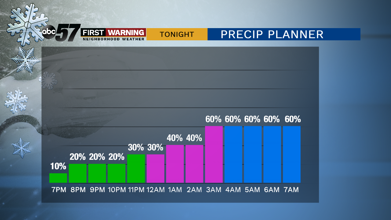
Tonight: Mostly cloudy with rain/snow showers. Low of 30.
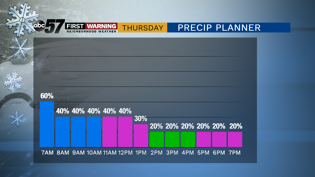
Thursday: Mostly cloudy lake effect snow showers. High of 34.
Friday: Partly to mostly sunny. High of 34.
Saturday: Partly cloudy High of 42.
Sunday: Mostly cloudy, PM showers. High of 44.
Sign up for the ABC 57 Newsletter