
-
2:56

The partial government shutdown is impacting travel across the...
-
1:33

Cool out the door, Mild by afternoon
-
1:50

Top Ten Snow Year 2025-26
-
1:17

South Bend Cubs unveil fan-focused upgrades ahead of Opening...
-
2:21

Notre Dame Fighting Irish ready for spring football
-
2:06

Fighting Irish using time off to refocus ahead of spring practice
-
2:35

What are the privacy implications of SBPD’s ’Drone as First...
-
1:22

Expert discusses Wednesday’s Fed decision
-
3:19

New legislation could make Michigan the 30th constitutional carry...
-
2:15

SBPD using drones to help improve response time
-
1:20

The March roller coaster ride continues
-
1:52

Snow today, rain tomorrow, and warm this weekend

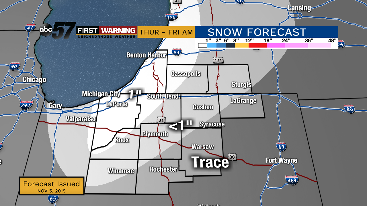
Clouds increase Wednesday, the warm side of the system may bring some drizzle along with highs nearing 50. The cold side brings a wintry mix as temperatures fall to the 30s Thursday. Lake effect snow could bring light accumulation to the grass and raised surfaces through early Friday. There will be an even colder blast of air early next week.
Tonight: Partly cloudy. Low of 30.
Wednesday: Mostly Cloudy. High of 48.
Thursday: Mix/snow showers. High of 36.
Friday: Partly cloudy. High of 34.
Saturday: Mostly sunny. High of 42.
Sign up for the ABC 57 Newsletter