Cold and active start to February
Posted: Jan 31, 2018 4:18 PM EDT

-
1:36

Beautiful start to the weekend despite morning fog
-
1:03

’Pedals and Petals’ in downtown South Bend
-
3:18

Owners urged to vaccinate dogs after puppy left for dead outside...
-
1:54

Threat of drought, even with rainy spring in Michiana
-
3:43

Protestors arrested on campus of Notre Dame
-
1:17

A fair weekend, minus a few showers Saturday night
-
4:50

“Matilda The Musical“ at the Lerner Theatre
-
2:12

More rain this morning, but overall drier weather going into...
-
2:34

Pro-life group files lawsuit against IDOH for access to abortion...
-
1:01

South Bend students gain hands-on experience at first ’GEAR...
-
1:48

Temperatures swing with rounds of rain
-
2:56

Senior citizens feeling taxed out of their neighborhoods

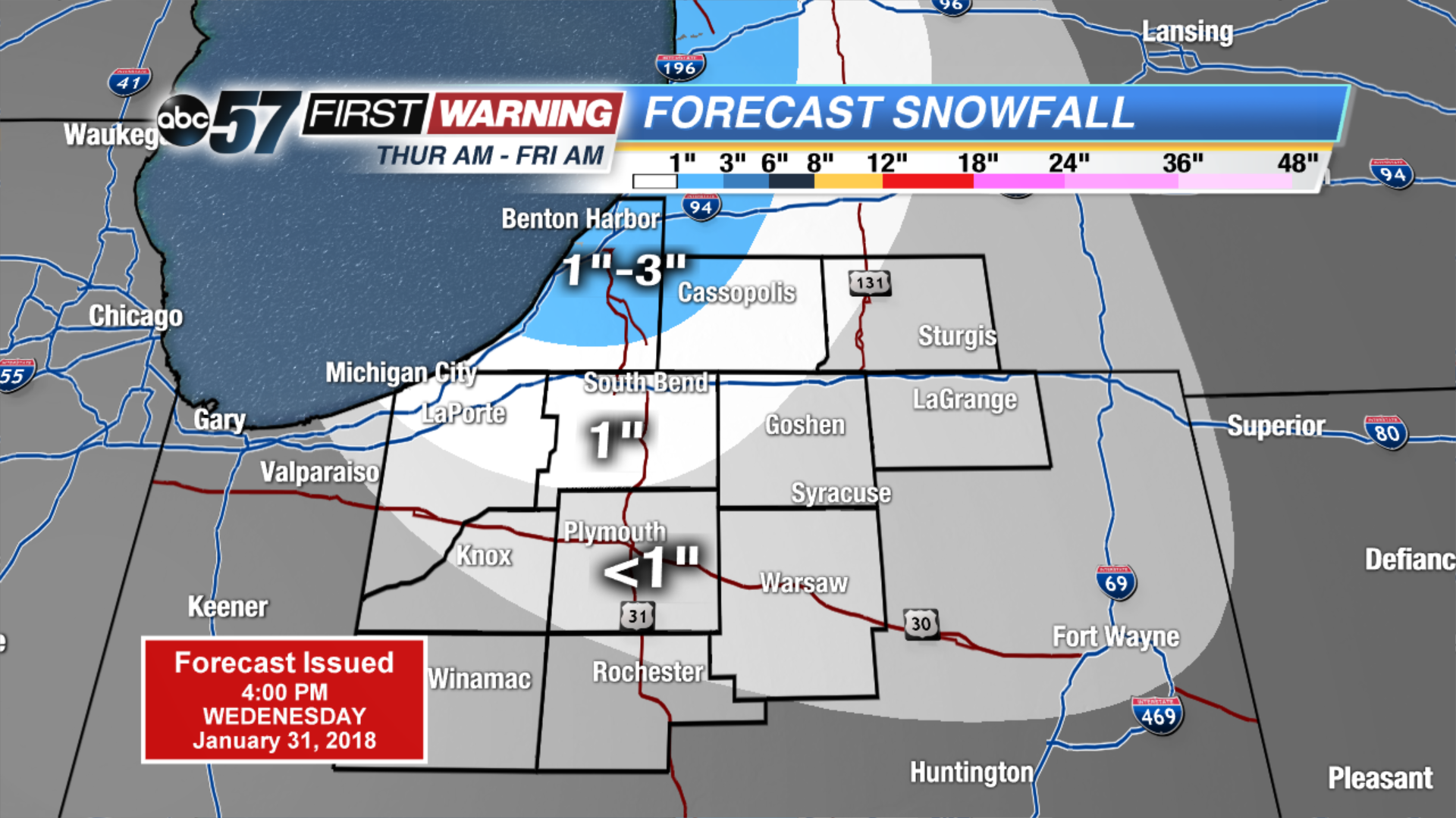
Temperatures fall through Friday, as bitter cold returns to start February. Highs are unlikely to break the freezing mark for at least the next week. An active pattern will bring a chance of snow about every other day. The quick moving systems may not bring a lot of snow individually but will add to the snowfall as a whole. The best chance for widespread accumulation is Friday.
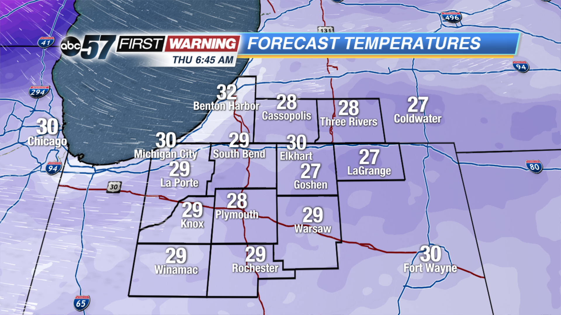 Temperatures Thursday Morning
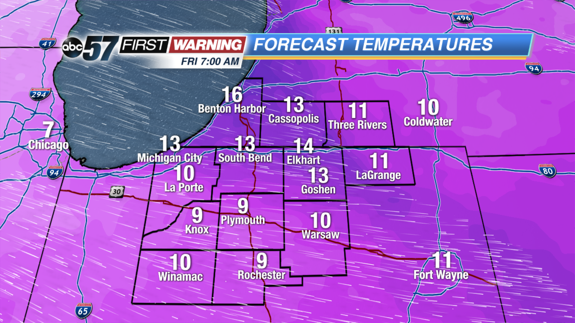 Temperatures Friday Morning
Tonight: Mostly cloudy, low of 30.
Thursday: Mostly cloudy with lake effect snow developing, temperatures fall from 32.
Friday: Partly cloudy, chance of snow early, highs in the teens.
Saturday: Snow by the afternoon, highs near 30.
Sign up for the ABC 57Newsletter