
-
2:12

Quiet today, storm threat tomorrow and Wednesday
-
3:50

Plymouth community hosts 5K in the fight against ALS
-
2:10

Sunny Monday ahead, but showers and thunderstorms later this...
-
2:10

Plymouth High School hosts ’Steps for Stegs’
-
2:05

Drier but cooler to wrap up the weekend
-
6:23

ABC57’s Arts and Acts: Local dance stars shine at A&A Ballet...
-
2:49

St. Adalbert Church celebrates Cinco De Mayo, announces fundraising...
-
0:40

Congressman Rudy Yakym awards local high school artists
-
2:06

Thundershowers tonight, a cooldown tomorrow following cold front
-
0:52

Bethel University celebrates 77th commencement
-
1:36

Beautiful start to the weekend despite morning fog
-
1:03

’Pedals and Petals’ in downtown South Bend

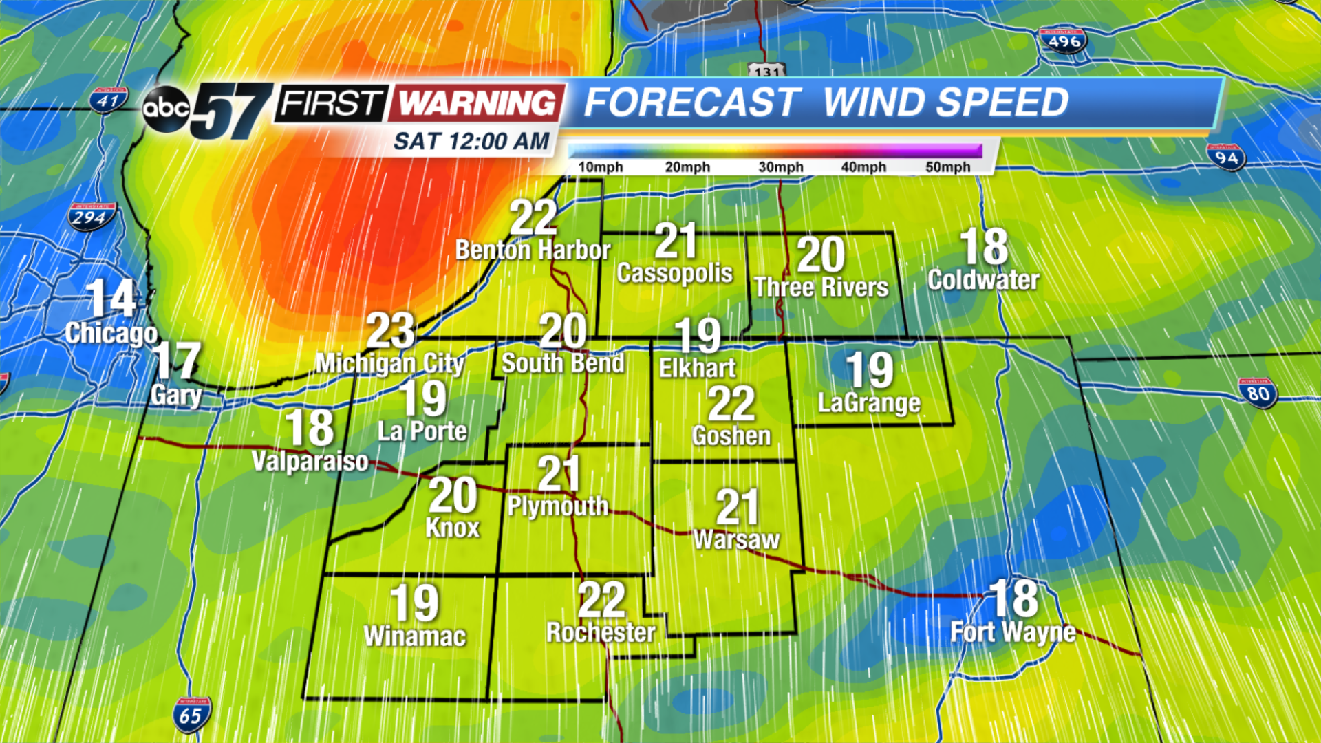 Wind speed at midnight Saturday morning
A brief calm before the weekend storm. Some sunshine is possible through the first half of Friday, clouds fill-in, wind increases and rain returns Friday night into Saturday. Wind gusts may top 40 mph Saturday, there’s a brief lull when the wind changes direction from the south to the northwest Saturday. Temperatures will fall sharply into Sunday, this could lead to some black ice and lake effect snow showers.
Tonight: Mostly cloudy. Low of 30. 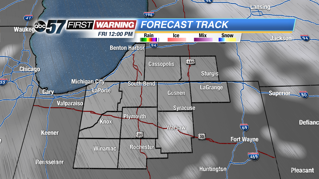 Break in the clouds early Friday
Friday: Partly to mostly cloudy, becoming windy and rainy late. High of 48.
Saturday: Rainy and windy, highs near 52 but falling through the afternoon.
Sunday: Cold, chance of lake effect snow showers, high of 34.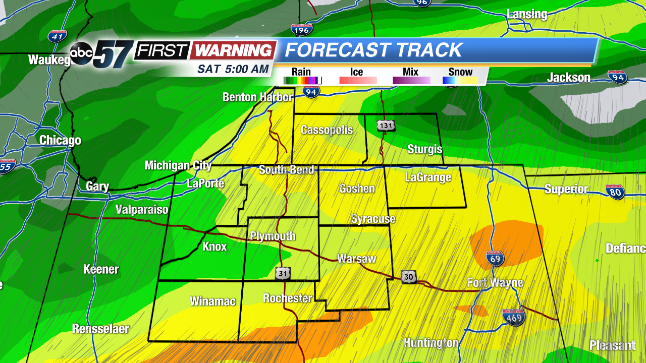 Heaviest rainfall likely early Saturday
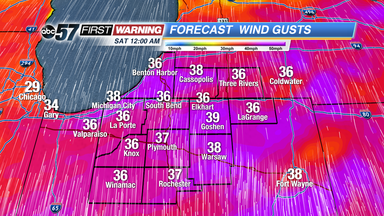 Wind gusts at midnight Saturday morning