
-
3:02

Less haze, more humidity
-
6:37

Phoenix Performing Arts puts on ’Footloose’
-
4:11

Confusion follows proposal to pay fee for copies of police recordings
-
1:46

IT Department of St. Joseph County asks for new hires, despite...
-
6:07

President of Michiana PBS talks potential budget cuts to public...
-
3:33

Trash and code enforcement concerns continue on South Bend’s...
-
1:22

Car meet in Granger leads to discovery of two people stabbed
-
1:03

More heat, less smoke on Tuesday
-
0:26

FDA recalls mislabeled bread sold in Indiana, Michigan
-
2:00

Humidity stays away, heat returns
-
1:29

Coloma Schools offers a virtual alternative program for students
-
0:57

Summer Concert Series brings tunes to Potawatomi Park

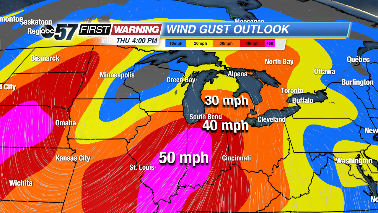
Fair weather continues through Tuesday before our next spring storm brings more wind and rain. Wednesday will see an increasing chance of rain, the most widespread and heavy arriving Wednesday night into Thursday. Thursday the strongest wind will gust, topping 50 mph. Temperatures will also spike, reaching the 50s Wednesday and 60s Thursday.The warm-up doesn’t last as temperatures return to the 30s and 40s this weekend.
Tonight: Mostly clear, low of 24.
Tuesday: Sunny, high of 48.
Wednesday: Scattered showers, becoming breezy, high of 55.
Thursday: Windy, gusts topping 50 mph, rain showers, high of 66.
Sign up for the ABC 57 Newsletter