


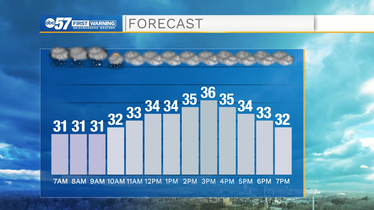
It’s a snowy start to Sunday. Parts of Michiana will see just a dusting this morning, but the southeast portion of the viewing area could pick up 1-2+” of snow. Most snow showers wrap up by 10 a.m., then it will be quiet and cloudy the rest of the day.
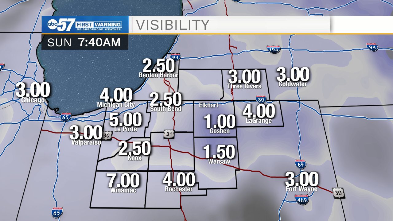
This morning it might be best to stay off the roads again, as they are slippery and snow covered. Overnight, a few more tree branches snapped, so be aware there could be limbs down in the streets again. Additionally, areas of patchy fog have started to develop, so visibility is low this morning. If you need to travel this morning, give yourself plenty of time to drive slowly.
This afternoon, any snow on the ground should get slushy again. Temperatures are around 30 degrees early this morning, and we’ll reach a high around 36 today.
Overnight will stay quiet and mostly cloudy. There is a possibility of more patchy fog developing overnight and early Monday morning. The low tonight is around 24 degrees, so bundle up as you head out the door Monday.
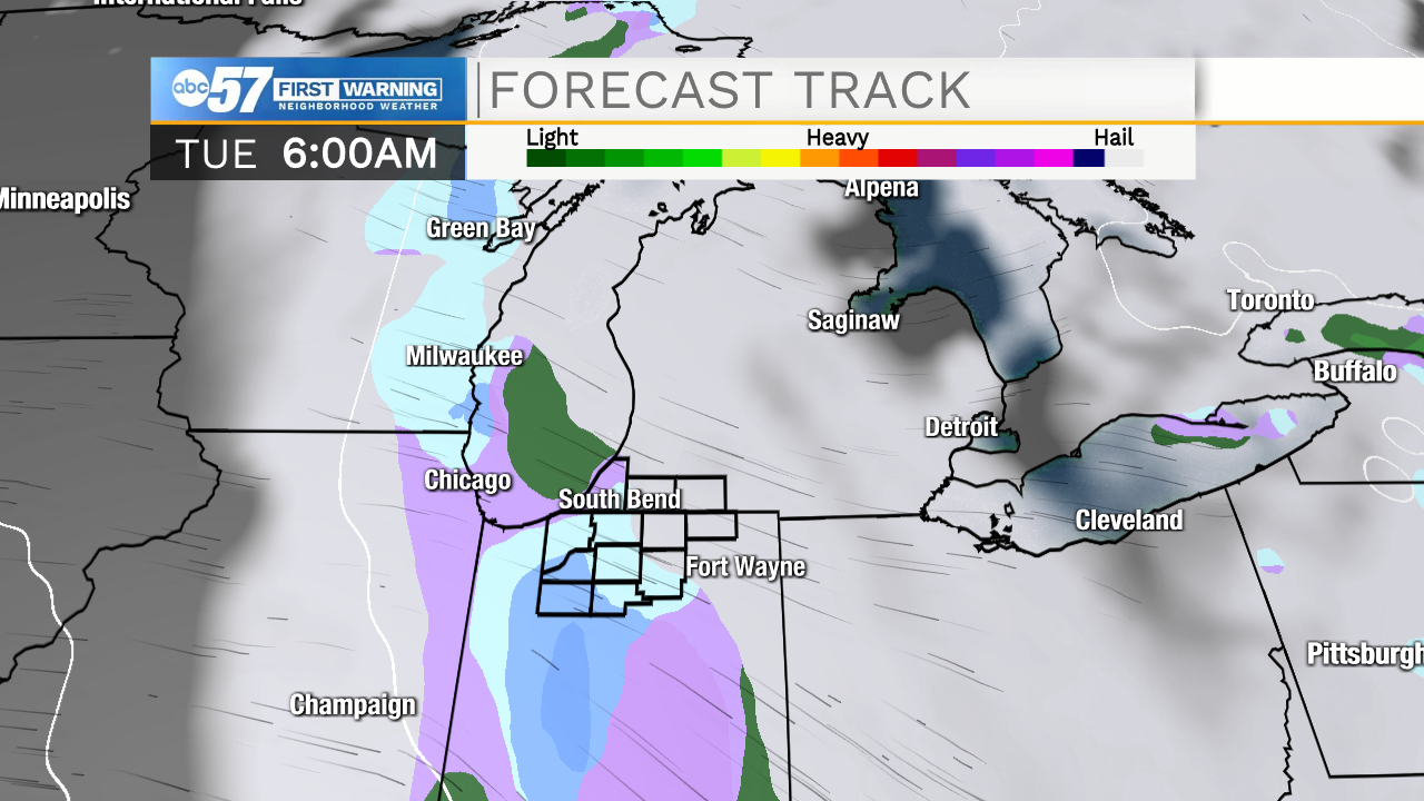
Monday stays quiet. There is a chance for snow showers or freezing drizzle to develop overnight Monday into early Tuesday morning. If more of the precipitation is freezing drizzle (instead of snow), the Tuesday morning commute could be slick.
The rest of the work week stays pretty quiet, with highs in the mid to upper 30s each day. There is a chance for showers just south of Michiana Wednesday night, but a few showers could slide into Michiana overnight into early Thursday morning.
Today: AM snow. Cloudy afternoon. High 36.
Tonight: Mostly cloudy. Patchy fog possible. Low 24.
Monday: AM fog possible. Mostly to partly cloudy. Chance snow overnight. High 36.
Tuesday: Mostly to partly cloudy. High 36.