Another round of storms tonight, heat breaks this weekend
By:
Tom Coomes
Posted: Aug 28, 2020 4:24 PM EDT

-
1:14

Widespread showers and downpours this morning ahead of warm front
-
1:48

Preparations underway as Indiana University football trophies...
-
3:09

Indiana Utility Regulatory Commission collecting consumer data...
-
1:18

St. Joseph County officials host Election 101 Workshop on voting...
-
5:36

Hannah Hidalgo wins Naismith Defensive Player of the Year
-
2:50

New South Bend Cubs manager Daniel Wasinger ready for opening...
-
2:24

South Bend Cubs pitcher Kenten Egbert looks to build on strong...
-
1:52

Hoosiers face a gas tax increase as gas prices continue to rise
-
1:45

Iranian cybercrime group claims to have hacked St. Joseph County’s...
-
1:17

Cold and soaking rain today, another severe risk tomorrow
-
0:44

South Bend High School Music Festival highlights student talent
-
1:55

South Bend house fire possibly caused by lightning

The best chance for widespread rain is Friday night. A lull in thunderstorm activity will re-fire by late evening as the cold front approaches. A line or broken line of showers / storms is possible around midnight. The severe threat remains relatively low.
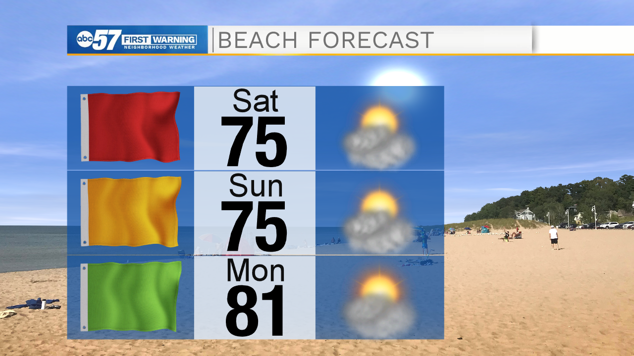
The heat and humidity break this weekend. Saturday is breezy, the northwest wind will cause rough surf on Lake Michigan, this is not the safest weekend for swimmers. The forecast stays fair through the weekend and the chance of rain remains low through next week. A weak system may bring some showers by Wednesday.
Tonight: Scattered thunderstorms, possibly severe. Low 66.
Saturday: Mostly sunny. Breezy. High 76.
Sunday: Sunny. High 76.
Monday: Partly cloudy. High 80
Sign up for the ABC 57 Newsletter