


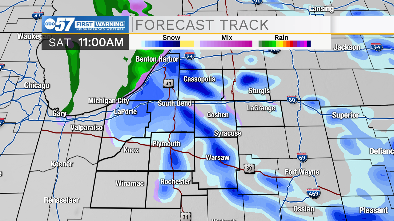
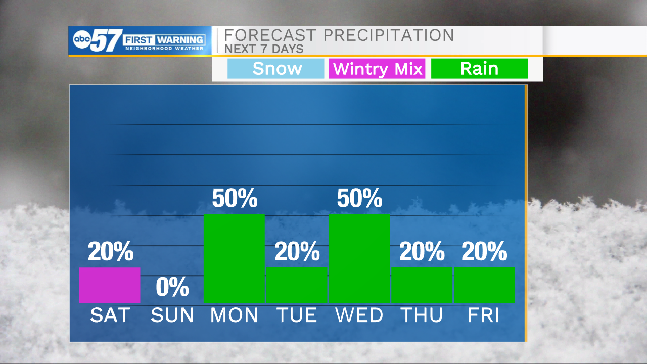
Isolated rain showers will impact portions of Michiana as we head into the evening hours. Some of this rain could turn over to a wintry mix by late evening as temperatures begin to drop into the mid 30s. Lake effect snow will impact portions of Michiana through Saturday morning. A dusting of snow accumulation is possible for portions of southwest Michigan. Temperatures will slowly warm back above freezing tomorrow morning, then snow will turn back to rain. Isolated showers are possible into the early afternoon. Dry weather will then settle in for the rest of the weekend. Sunday looks mostly sunny to partly cloudy with highs in the upper 50s. Rain chances return late Sunday night into early Monday morning. Once the rain arrives it will stick around through most of next week. Highs next week will make a run for the 70s on Tuesday and Wednesday, but then another cool down arrives dropping highs back into the 50s and 60s for Thursday and Friday.
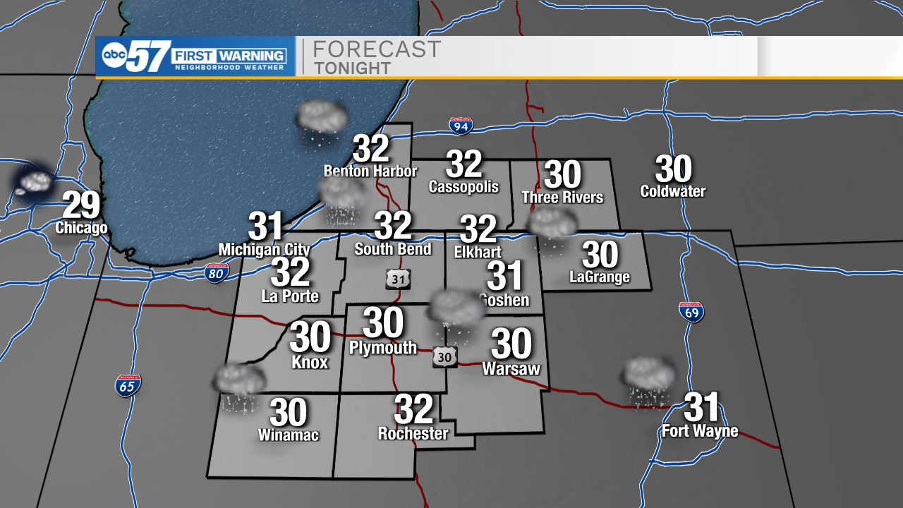
Tonight: Wintry mix. Low 32.
Tomorrow: AM wintry mix. High 40.
Sunday: Mostly sunny/partly cloudy. High 57.
Monday: Scattered rain showers. High 66.