What are our White Christmas chances?


With Christmas only one week away, it's about time to talk more about this year's White Christmas chances! Historically, cities around the lake shore have the best shot of seeing at least one inch of snow on the ground Christmas morning. South Bend, itself, has a 50% chance of seeing a White Christmas with areas along and south of Hwy 30 getting a 30 to 40% chance.
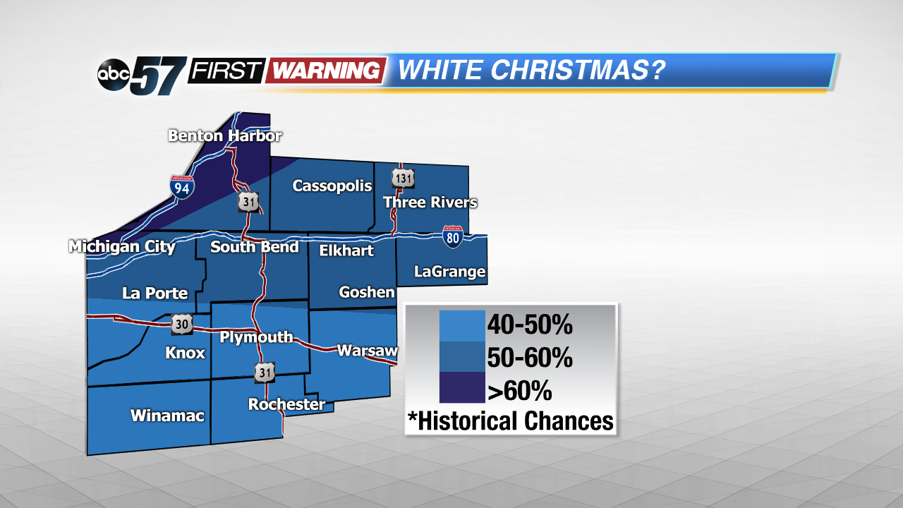 Historically, Berrien and northern LaPorte counties have the best chance of seeing a White Christmas.
But, this weekend, we'll have our next, stronger storm system moving through the area. Rain and very mild temperatures are expected for Friday, but lake effect snow looks possible both Saturday and Sunday! Areas around the lake shore have a good chance of picking up 1" in spots, with odds decreasing for SE Michiana.
That means travel could be difficult at times over the weekend. Reduced visibilities and pockets of heavy snowfall are possible under those intense lake effect bands. But, if you're planning on flying to your destination, be prepared for delays if you're heading east.
The system moving through Michiana on Friday will be bringing rain and colder temperatures to the eastern seaboard, causing delays for airports around New York, Boston, and Philadelphia. The I-95 corridor will also be on the slow side, due to the poor weather conditions.