
-
1:07

Easter Bunny stops at Tako Loco and Tokyo for Easter fun
-
0:49

Annual Easter Egg Hunt brings families together in Elkhart
-
1:06

Marshall County Humane Society reschedules Dog Egg Hunt
-
2:01

Martin Luther King Dream Center hosts MLK March in South Bend
-
1:54

South Bend Cubs opener postponed by weather, but fans still find...
-
2:01

Sights and sounds from South Bend Cubs Opening Day
-
1:32

NIPSCO ’flatly rejected’ further negotiations, USW workers...
-
3:36

The art of groundskeeping at Four Winds Field
-
3:32

The history behind America’s only ballpark synagogue turned...
-
1:59

South Bend opens season against Quad Cities in familiar Midwest...
-
4:21

South Bend Cubs owner discusses $48M stadium expansion, changes...
-
3:19

A look into the new South Bend Cubs 2026 roster

A line of storms dives out of Wisconsin early Thursday morning and moves across Lake Michigan. The questions for Michiana are, will this be a direct hit or a glancing blow? Hot much will storms weaken, arriving most likely after 3:00 a.m. Every should prepare for the possibility of losing power Thursday morning.
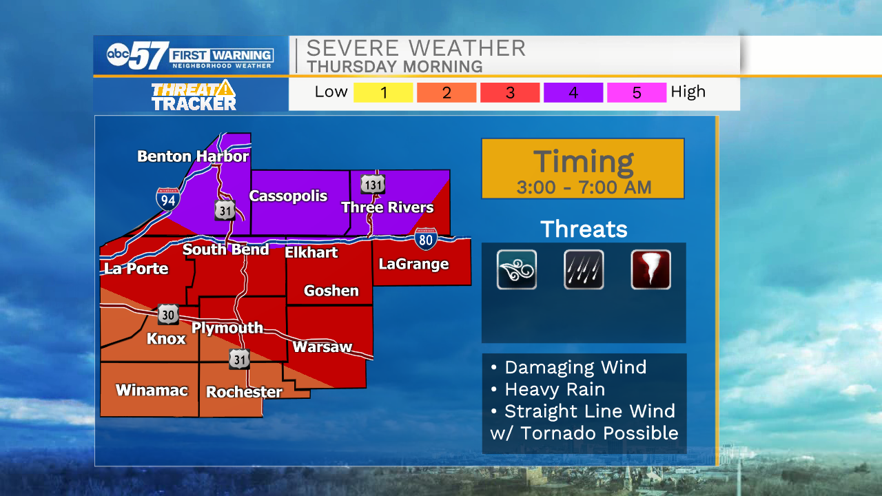
The line of storms clears quickly Thursday morning, the rest of the day will be dry, with lower humidity. The forecast for Friday and through the weekend is fair and mild for the end of July / beginning of August.
Tonight: Storms after midnight could be strong to severe. Low 72.
Thursday: AM showers/storms. High 82.
Friday: Partly cloudy. High 76.
Saturday: Mostly sunny. High 80.
Sign up for the ABC 57 Newsletter