Snow showers will develop late tonight

-
1:49

Back home in downtown South Bend, YMCA to open new location
-
2:16

This week’s ABC57 Cub Reporter is Nicholas Zentz
-
3:05

Amazon Web Services invests $11 billion to build data center...
-
4:05

Riley High School student center stage at the NFL Draft
-
1:35

Rain, wind, and milder temperatures forecast this weekend
-
2:49

Joe Alt expected to be drafted in the first round of NFL Draft
-
2:11

Students gearing up for local careers in Manufacturing
-
2:13

Sunny today, but expect a wetter and warmer weekend
-
0:54

Goodwill ’Little Black Dress’ event raises funds for community...
-
1:45

Cheers Bar and Grill liquor license renewed following controversy
-
2:40

Kyle Rudolph weighs in on fellow Irish, Joe Alt, ahead of NFL...
-
0:58

Contractors prepare bids for multi-million-dollar Four Winds...

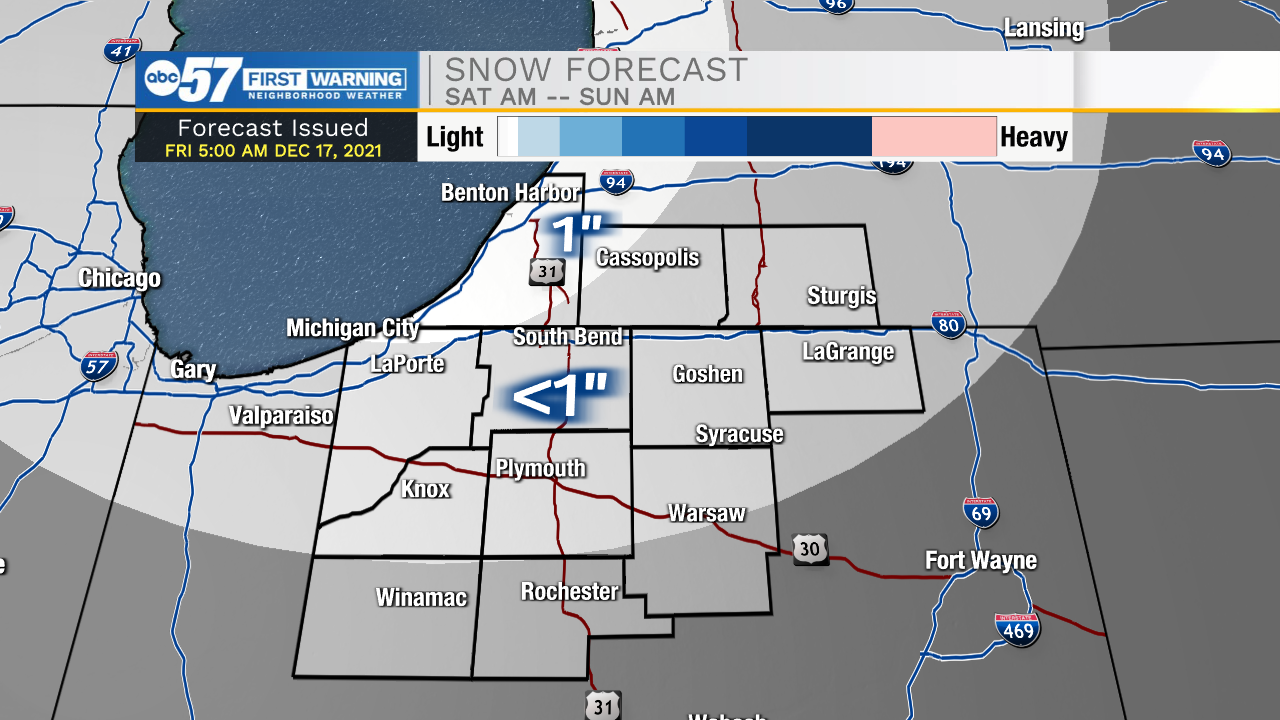
Friday will start with clear and quiet conditions, but then cloud cover will slowly build throughout the day. High temperatures this afternoon will top out in the lower 40s. Rain showers will move in out of the southwest late this evening into early tomorrow morning. Scattered light showers and drizzle are likely for most places throughout Michiana. As temperatures drop to freezing tomorrow morning, mixed wintry precip and snow showers will develop. Lake effect snow showers will stick with us throughout most of Saturday. A dusting of snow is likely for most places in northwest Michiana, with a few isolated areas seeing closer to an inch. Ground temperatures will remain too warm throughout the rest of Michiana to allow any accumulations. High temperatures this weekend will only top out in the mid to upper 30s.
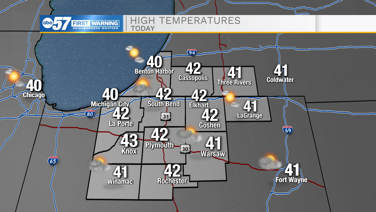
Today: Mostly sunny/partly cloudy. High 42.
Tonight: Scattered showers/snow showers. Low 32.
Tomorrow: Snow/mixed wintry precip. High 38.
Sunday: Mostly sunny. High 36.