Showers and storms overnight but severe threat has lowered
Posted: May 16, 2019 4:43 PM EDT

-
4:24

Michiana Crime Stoppers shredding event
-
1:16

’IvyCares’ program setting students up for success in and...
-
1:45

Windy and wet this weekend, but unseasonable warmth as well
-
3:13

Local players react to $3 million investment in Byer Softball...
-
0:32

Layoffs at Whirlpool could affect workers in Benton Harbor
-
1:03

Annual District Sisterhood Conference at Ivy Tech empowers students
-
1:49

Back home in downtown South Bend, YMCA to open new location
-
2:16

This week’s ABC57 Cub Reporter is Nicholas Zentz
-
3:05

Amazon Web Services invests $11 billion to build data center...
-
4:05

Riley High School student center stage at the NFL Draft
-
1:35

Rain, wind, and milder temperatures forecast this weekend
-
2:49

Joe Alt expected to be drafted in the first round of NFL Draft

The mid-afternoon showers reduced our severe thereat for the area as storm energy dropped. There will still be showers and storms overnight, the main thereat would be heavy rain.
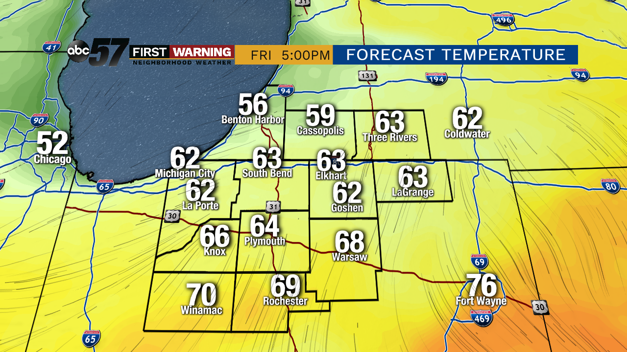
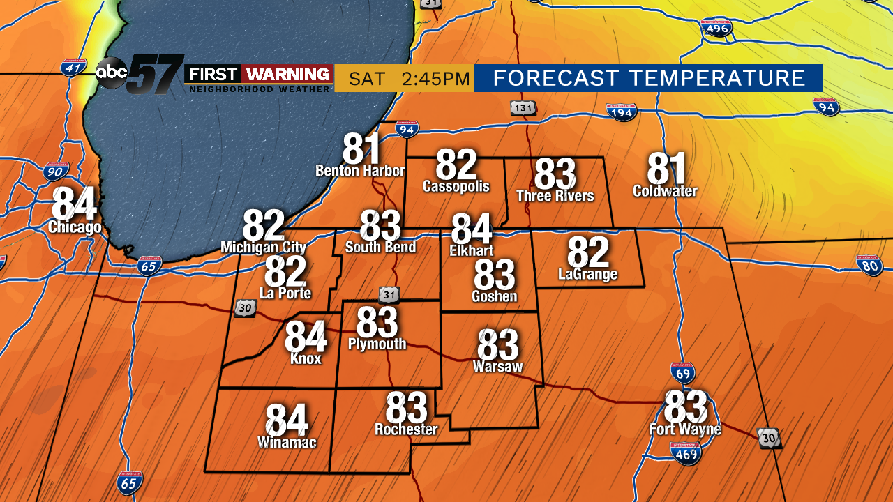
The front dips south Friday leaving Michiana in the cooler air, highs will be in the 60s with a chance of showers or a stray thunderstorm. The front surges north again Saturday and temperatures look to hit 80 for the first time in 2019. The building heat and humidity will fuel another round of showers and storms Sunday.
Tonight: Scattered storms, heavy rain possible, low of 58.
Friday: Morning showers, mostly cloudy, high of 66.
Saturday: Partly cloudy, high of 82.
Sunday: Afternoon thunderstorms, high of 78.
Sign up for the ABC 57Newsletter