
-
1:06

Marshall County Humane Society reschedules Dog Egg Hunt
-
2:01

Martin Luther King Dream Center hosts MLK March in South Bend
-
1:54

South Bend Cubs opener postponed by weather, but fans still find...
-
2:01

Sights and sounds from South Bend Cubs Opening Day
-
1:32

NIPSCO ’flatly rejected’ further negotiations, USW workers...
-
3:36

The art of groundskeeping at Four Winds Field
-
3:32

The history behind America’s only ballpark synagogue turned...
-
1:59

South Bend opens season against Quad Cities in familiar Midwest...
-
4:21

South Bend Cubs owner discusses $48M stadium expansion, changes...
-
3:19

A look into the new South Bend Cubs 2026 roster
-
5:17

Expansion goes beyond Four Winds Field, new restaurants, bars,...
-
6:18

What’s new this season? South Bend Cubs unveil major improvements...

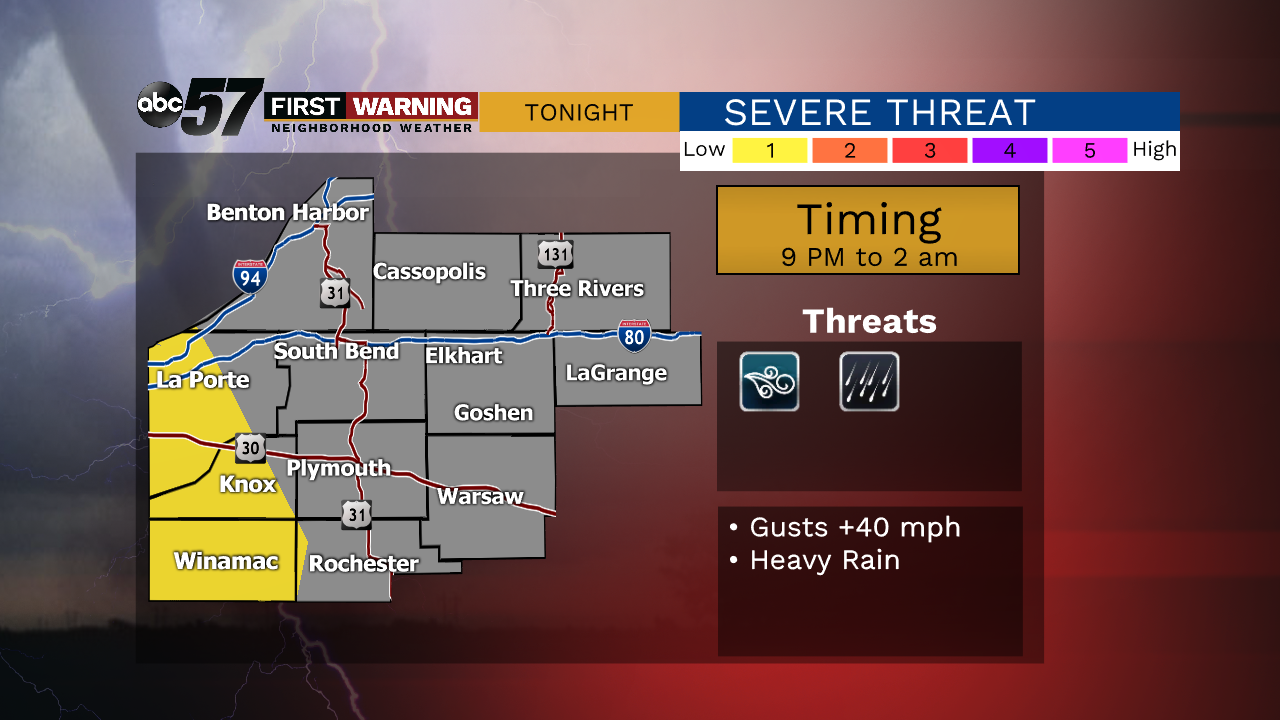
A few spotty evening showers then widespread rain with some rumbles of thunder late evening that continues into Wednesday morning. Severe weather is unlikely but some wind gusts +40 mph and heavy rain are possible.
Wet weather will last through midweek, Wednesday is wet, with a few lulls it what will be a day of steady rain and showers continues Thursday. Temperatures fall through Thursday too, in what will be a damp and breezy day. The forecast turns fair again to end the week and temperatures warm to 70 on Saturday. Mild temperatures won't last however, highs in the 50s last for much of next week.
Tonight: Scattered showers and thunderstorms. Low of 56.
Wednesday: Rainy. High of 60.
Thursday: Scattered showers, breezy. High of 50.
Friday: Mostly sunny. High of 57.