


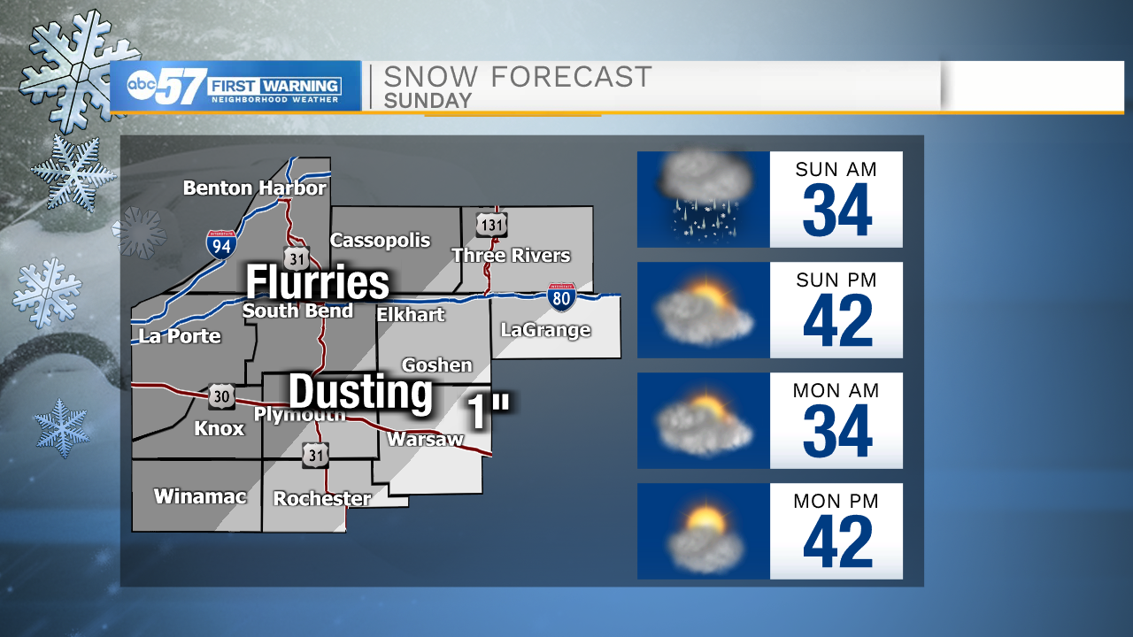
Cloud cover will continue to increase this evening and tonight as our next system moves in out of the southwest. Light rain showers are possible around midnight. Rain showers will turn scattered during the early morning tomorrow. Temperatures tomorrow morning will drop into the low to mid 30s. Rain showers will then turn to a rain snow mix for counties in central Michiana. A light dusting of snow is possible in southeastern St. Joseph county Michigan, southeastern Elkart, southeastern Marshall, and Fulton counties. Snow accumulation up to 1 inch is possible for Kosciuske and southeastern LaGrange counties. Wintry mix and light snow showers will move out around 10am, and then light rain will remain possible into the mid-afternoon.

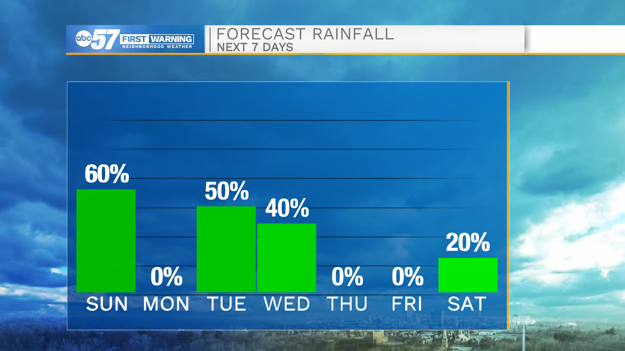
Next week more rain showers and some wintry mix will be possible Tuesday and Wednesday. Thanksgiving looks to stay dry with temperatures toping out in the upper 40s to lower 50s.
Tonight: Rain/Wintry mix. Low 34.
Tomorrow: Light rain. High 42.
Monday: Mostly cloudy. High 42.
Tuesday: Rain showers. High 44.