
-
1:06

Marshall County Humane Society reschedules Dog Egg Hunt
-
2:01

Martin Luther King Dream Center hosts MLK March in South Bend
-
1:54

South Bend Cubs opener postponed by weather, but fans still find...
-
2:01

Sights and sounds from South Bend Cubs Opening Day
-
1:32

NIPSCO ’flatly rejected’ further negotiations, USW workers...
-
3:36

The art of groundskeeping at Four Winds Field
-
3:32

The history behind America’s only ballpark synagogue turned...
-
1:59

South Bend opens season against Quad Cities in familiar Midwest...
-
4:21

South Bend Cubs owner discusses $48M stadium expansion, changes...
-
3:19

A look into the new South Bend Cubs 2026 roster
-
5:17

Expansion goes beyond Four Winds Field, new restaurants, bars,...
-
6:18

What’s new this season? South Bend Cubs unveil major improvements...

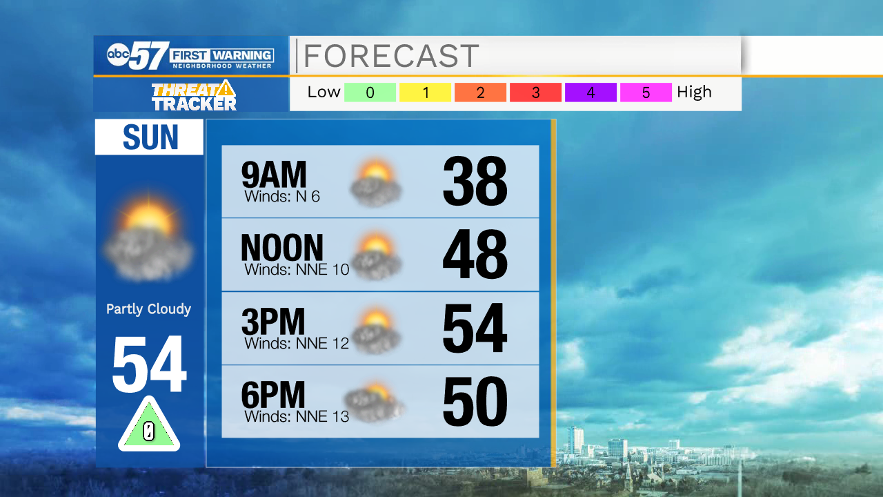
Temperatures tomorrow afternoon will top out in the mid 50s under partly cloudy skies. Our next system will move into Michiana during the late morning Monday. This system will bring a rain, snow, and freezing rain mixture. A few areas here in Michiana could see some ice accumulation, so prepare for a few slick spots on the roadways Monday around lunchtime. Once we get into the early to mid afternoon temperatures will jump back above freezing and turn the precip over to all rain. A few isolated showers and snow flurries could linger into Tuesday morning. The next chance for rain after that will be Wednesday and Thursday. High temperatures this week will mostly hold in the 40s.
Tonight: Partly cloudy. Low 34.
Tomorrow: Partly cloudy. High 54.
Monday: Rain/freezing rain. High 40.
Tuesday Partly cloudy to mostly sunny. High 50.