
-
1:41

Remembering Pastor Emeritus Reverend Lefate Owens Sr.
-
0:44

South Bend takes part in ’Kids to Park Day’
-
2:53

Feeling summer-like in the short-term, but tracking severe threat
-
2:16

Girls on the Run Michiana hosts 5k run in South Bend today!
-
1:35

Surging into the 80s with abundant sunshine this weekend
-
0:29

South Bend Police Department holds annual memorial for fallen...
-
1:59

Plymouth Elementary school ‘walks for warriors’ in honor...
-
2:51

South Bend police tapes scandal goes to trial
-
1:59

Concord schools launch weather balloon
-
1:14

Warm and dry weekend
-
2:47

Petition to add more security cameras throughout the University...
-
1:07

Fog exits, but storms could enter Friday evening

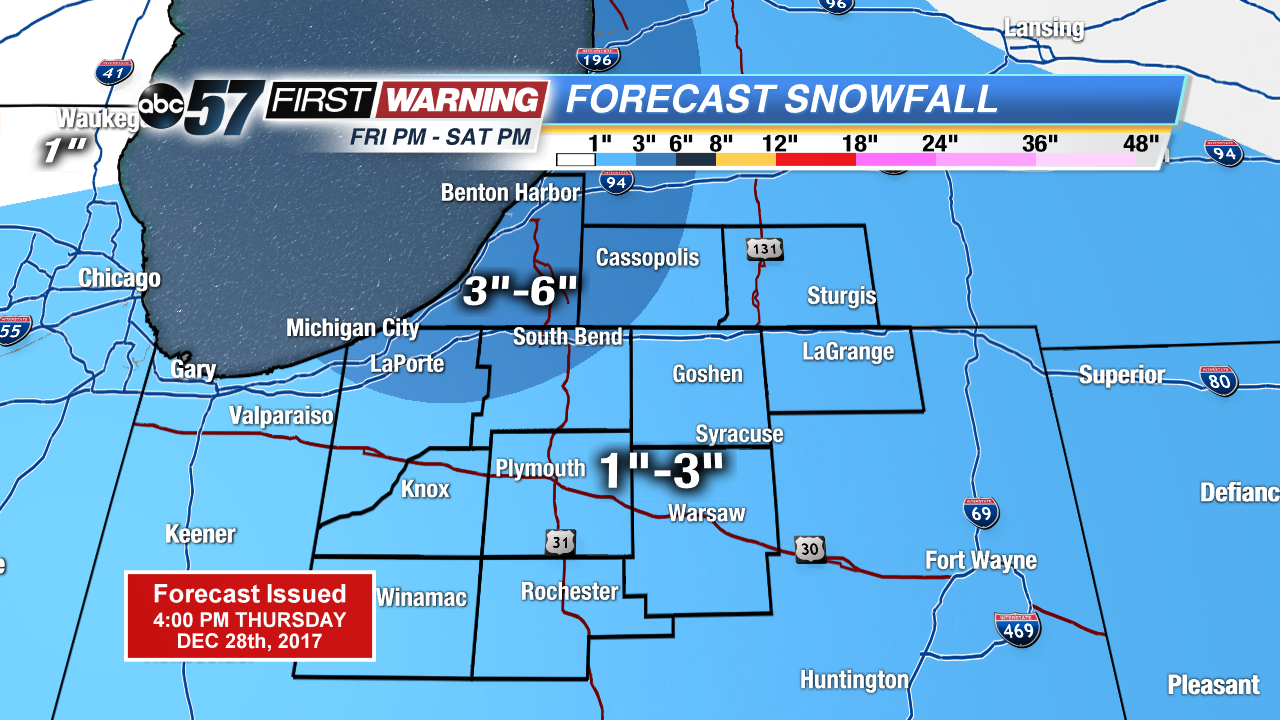
Not as cold tonight, temperatures will stay above zero but snow returns to the forecast. Light snow, less than an inch for most the area Thursday night into Friday morning.
The big question will be if we break 20 on Friday, it’s the only day that it could happen in the next week. The warm-up will precede a clipper system that will bring area-wide significant snowfall Friday night and Saturday. A widespread one to three inches is likely Friday night with lake effect adding at least another one to three Saturday, for some. Bitter cold returns for New Year’s with lows falling back below zero early next week.
Tonight: Light snow showers, low of 8.
Friday: Mostly cloudy, snow starting by the evening, high of 18.
Saturday: Lake effect snow, high of 14.
Sunday: Mostly cloudy, highs in the low teens.