Minor winter weather impacts before significant weekend storm

-
0:21

Police investigating shooting on Amhurst Avenue
-
2:42

South Bend Police Department recognized for completing crisis...
-
0:35

Local boxer brings home Golden Gloves Championship
-
1:01

5th annual Ivy Impact Gala held
-
0:50

13th annual Radiothon for Five Star Life takes place
-
1:05

Amazon investing $11 billion into New Carlisle data center
-
1:52

German company Verbio buys new ethanol plant in South Bend
-
0:54

61st annual Salvation Army Pancake Day held
-
5:26

Rep. Rudy Yakym calling for the protection of Jewish students...
-
1:26

Wet, warm & windy this weekend
-
4:24

Michiana Crime Stoppers shredding event
-
1:16

’IvyCares’ program setting students up for success in and...

The concern for freezing drizzle and fog continues Tuesday night into Wednesday morning. Slick spots are possible as black ice could form on roads.
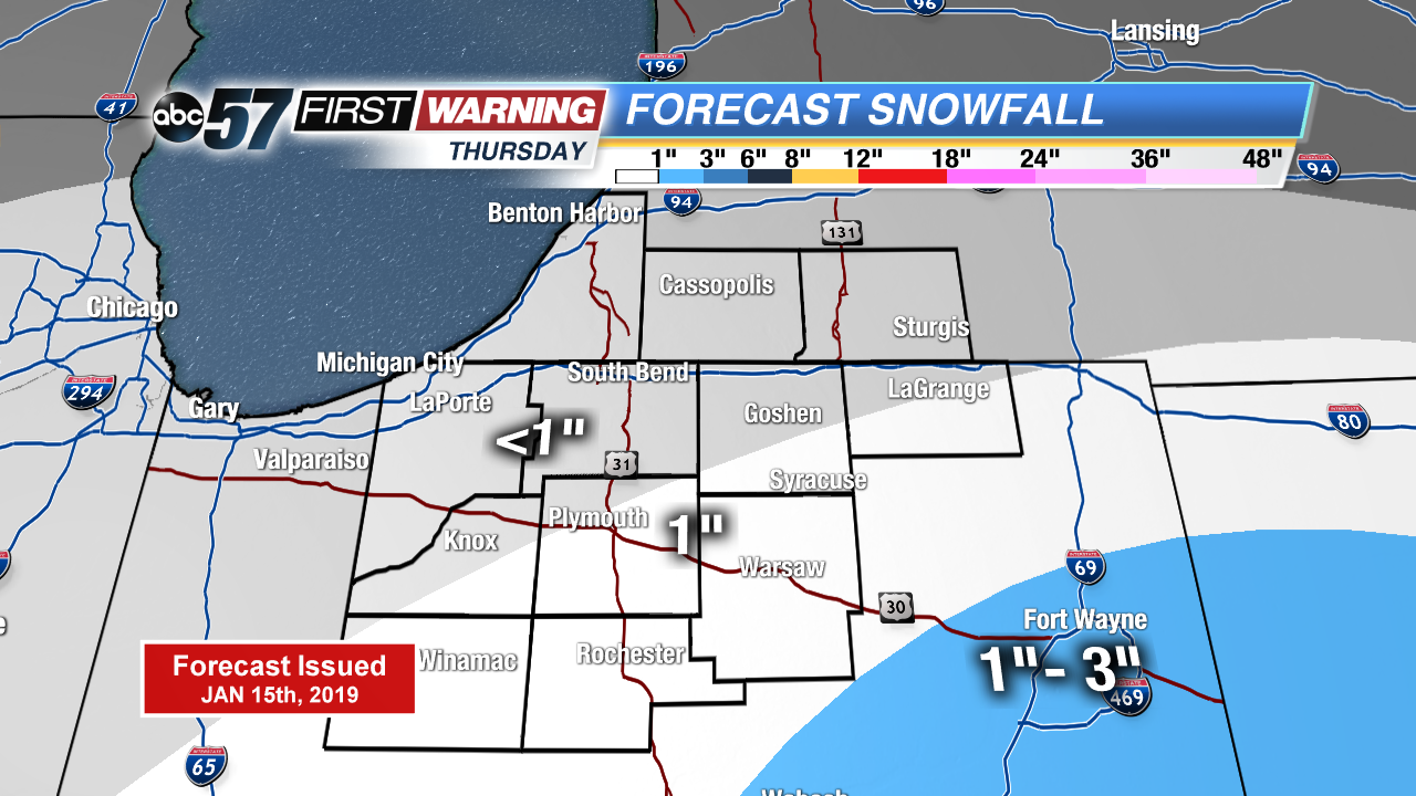
There’s little change in the weather Wednesday, cloudy with highs just peaking above freezing. A weak system brings light snow Thursday, with up to an inch possible. Friday is the lull before the storm. Widespread snow Saturday looks likely, significant snowfall through the Saturday evening. Temperatures fall into the single digits Saturday night and lake effect snow is possible Sunday. The coldest air of the season lasts through early next week.
Tonight: Freezing fog/drizzle possible, cloudy, low of 28.
Wednesday: Cloudy, high of 34.
Thursday: Light snow showers, mostly cloudy, high of 32.
Friday: Mostly cloudy, high of 30.