Massive waves churn in the Great Lakes

-
2:23

PGA & Whirlpool prepare for one last KitchenAid Senior Championship...
-
1:49

Two people killed in plane crash near Bristol
-
2:44

The new plan to transform much of Potawatomi Park in South Bend
-
2:49

Parts of Michiana to be pestered soon
-
6:56

The realities of rapidly rising rent
-
1:20

Mild midweek, rain likely Friday
-
1:10

Local dance company promotes healthy social media habits to students
-
1:51

Rain is gone, mild and fair Tuesday ahead
-
0:49

One wounded in shooting near Prosper Apartments
-
0:32

Annual Racial Justice Awards honor social service
-
0:33

Rum Village Adventure Aerial Park closed for season, possibly...
-
1:04

New maintenance facility up and running in Goshen

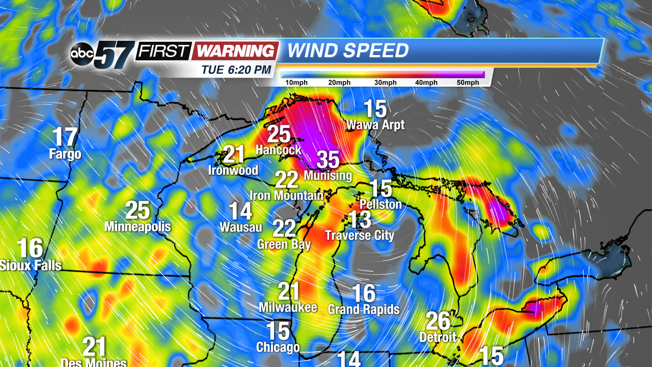
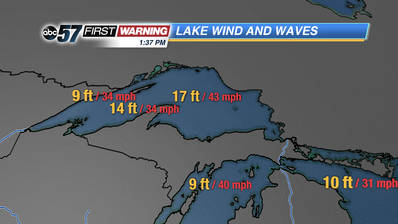
The low pressure system that has been bringing Michiana rain and wind for Monday and Tuesday is creating chaos on the Great Lakes. On Tuesday, storm warnings for Lake Superior and the northern half of Lake Michigan, urged people to stay off of the water, and commercial vessels to brace themselves.
Winds over Lake Superior gusted over 60 MPH this morning, downing trees and power lines, and also causing flooding. The wave heights at a buoy observation spot in the largest part of the lake peaked at seventeen feet.
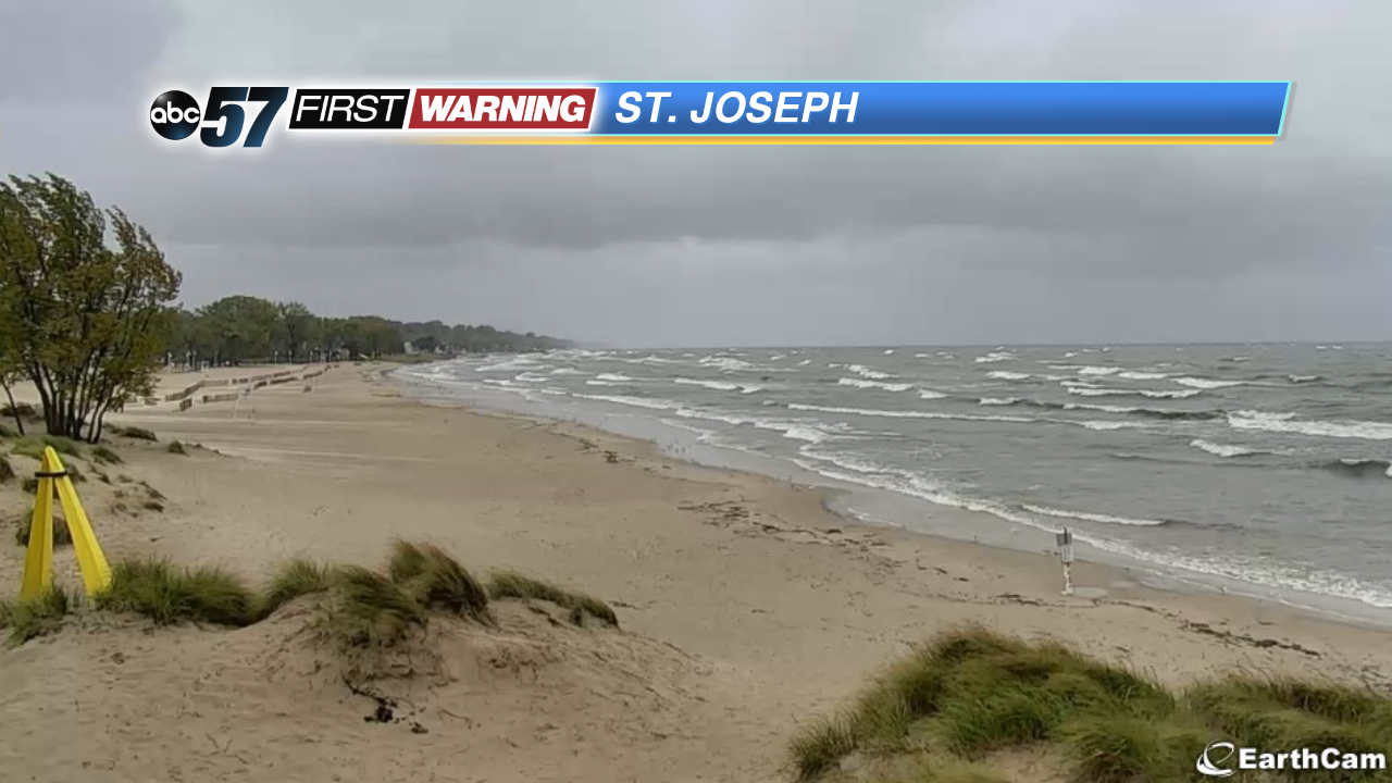
Closer to home, the water has been churning as well. The wave heights in Lake Michigan increased steadily throughout the day. At 5 PM Tuesday, the waves peaked at ten feet at St. Joseph.
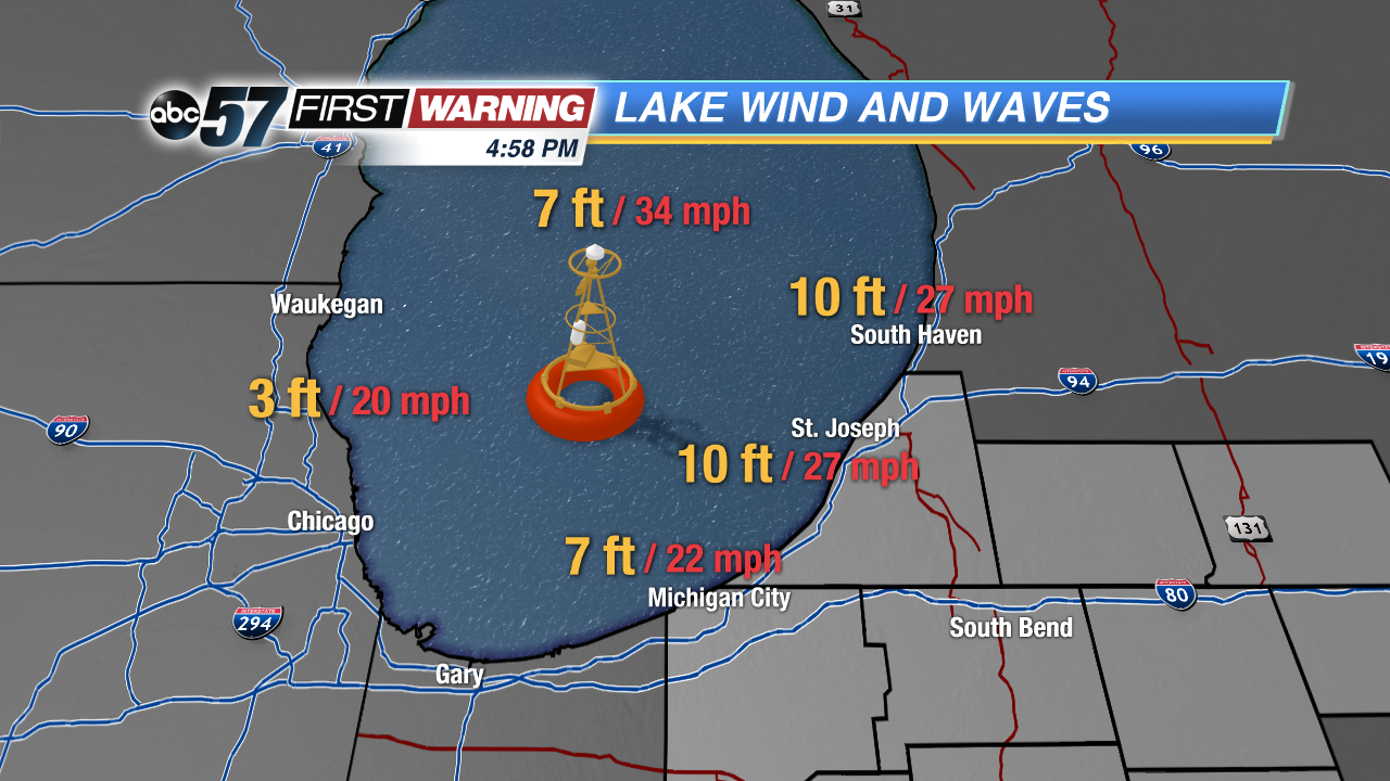
These massive waves in both Lake Superior and Lake Michigan are due to the northwesterly winds on the left side of the strong low pressure center. While winds at many coastal locations topped out in the 30s, the wind speeds over the open water were even higher because there is no friction, causing the large waves.