
-
1:06

Marshall County Humane Society reschedules Dog Egg Hunt
-
2:01

Martin Luther King Dream Center hosts MLK March in South Bend
-
1:54

South Bend Cubs opener postponed by weather, but fans still find...
-
2:01

Sights and sounds from South Bend Cubs Opening Day
-
1:32

NIPSCO ’flatly rejected’ further negotiations, USW workers...
-
3:36

The art of groundskeeping at Four Winds Field
-
3:32

The history behind America’s only ballpark synagogue turned...
-
1:59

South Bend opens season against Quad Cities in familiar Midwest...
-
4:21

South Bend Cubs owner discusses $48M stadium expansion, changes...
-
3:19

A look into the new South Bend Cubs 2026 roster
-
5:17

Expansion goes beyond Four Winds Field, new restaurants, bars,...
-
6:18

What’s new this season? South Bend Cubs unveil major improvements...

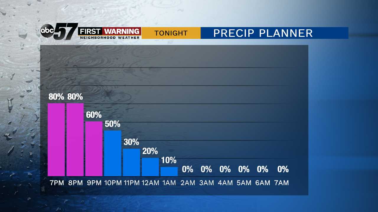
The worst weather lasts through Thursday evening; rain, snow, gusty wind and a wind chill in the 20s. Precipitation ends and the wind starts to calm after midnight.
A chilly Friday, after the first freeze of the season temperatures slowly warm into the mid-40s but there will be sunshine. A weak system could bring a few flurries early Saturday otherwise the weekend is dry. Clouds break to end the weekend and temperatures reach their warmest point on Monday with highs near 50.
Tonight: Blustery with rain and snow early. Low of 28.
Friday: Mostly sunny, breezy. High of 44.
Saturday: Early morning flurries, mostly cloudy. High of 40.
Sunday: Partly cloudy. High of 45.
Monday: Partly cloudy. High of 50.
Sign up for the ABC 57 Newsletter