Extremely cold morning then slow warming

-
4:24

Michiana Crime Stoppers shredding event
-
1:16

’IvyCares’ program setting students up for success in and...
-
1:45

Windy and wet this weekend, but unseasonable warmth as well
-
3:13

Local players react to $3 million investment in Byer Softball...
-
0:32

Layoffs at Whirlpool could affect workers in Benton Harbor
-
1:03

Annual District Sisterhood Conference at Ivy Tech empowers students
-
1:49

Back home in downtown South Bend, YMCA to open new location
-
2:16

This week’s ABC57 Cub Reporter is Nicholas Zentz
-
3:05

Amazon Web Services invests $11 billion to build data center...
-
4:05

Riley High School student center stage at the NFL Draft
-
1:35

Rain, wind, and milder temperatures forecast this weekend
-
2:49

Joe Alt expected to be drafted in the first round of NFL Draft

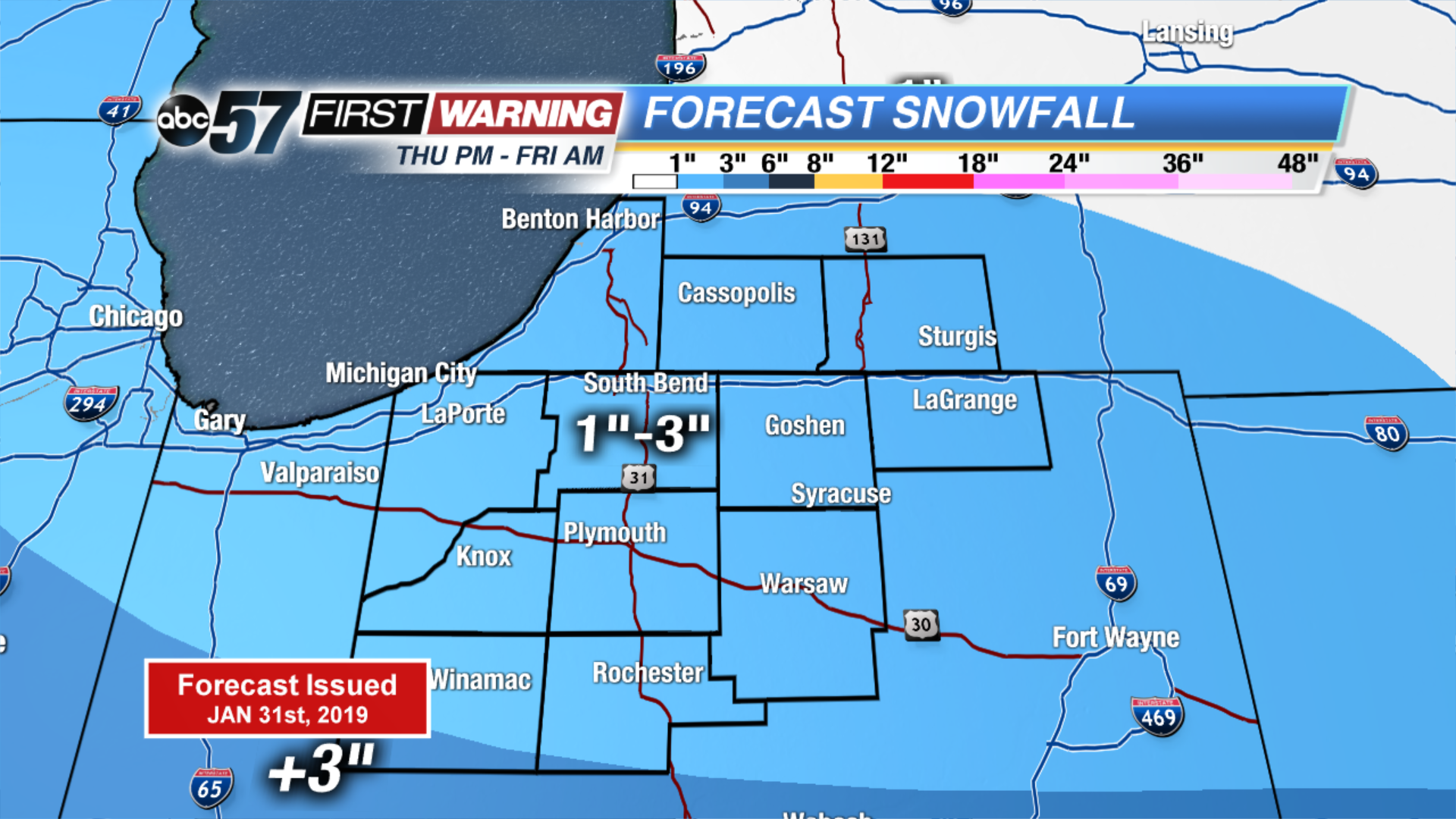
Incredibly COLD this morning with temperatures near -20 F. Temperatures slowly warm through the day, reaching near zero by midnight and continuing to warm through the night. A quick system will bring us 1-3” of snow starting late this evening lasting through Friday morning. Roads will likely be slick in spots. Daytime highs finally reach near 20F (above zero!) Friday and only continues to warm up over the weekend. Part of the Saturday will be partly cloudy but with the melting snow, fog will be possible through Monday. Scattered rain showers continues to melt the snow on Sunday and Monday. Minor flooding is likely.
Today: Extreme Cold. Mostly sunny, warming towards zero by midnight.
Tonight: Scattered light snow, temperatures warming from -2.
Friday: AM snow showers, high of 20.
Saturday: Partly cloudy, fog possible, high of 40.