
-
2:15

The ingredients for severe weather
-
2:14

Why summer travel prices may spike due to the ongoing war in...
-
1:49

Heavy rain, high winds, and hail are main severe concerns today
-
1:26

Amidst several rounds of storms, some could be severe today
-
0:34

South Bend Community Review Board hosts open discussion on youth...
-
2:19

INDOT walks through a proposed diverging diamond intersection...
-
1:08

Notre Dame’s Leonard Moore highlights student success and raises...
-
1:05

Mayflower Bridge set to close beginning April 6
-
0:21

Colfax Avenue eastbound lane closed for water and sewer work
-
0:46

Madison Street closed for lifestyle district project
-
4:11

Non-profit organization provides deep dive into Blackstone, a...
-
1:52

Storms possible overnight, strong storms by Tuesday evening

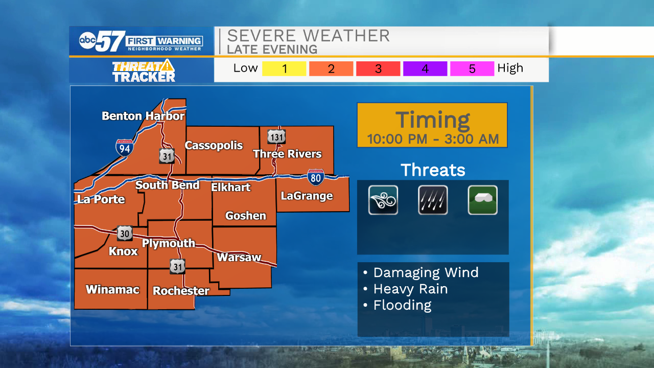
Tonight: Overnight storm threat, the severe window is 10:00 PM to 3:00 AM, scattered damaging wind and flooding possible.
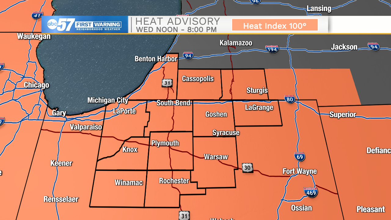
Extreme heat, humidity and storms remain in the forecast through Thursday. These are the hottest days of 2021, with a heat index of +100 degrees each afternoon. Storms develop each evening; some storms could be strong to severe with heavy rain and flooding possible as well. The heat and humidity break Friday and the weekend is pleasant.
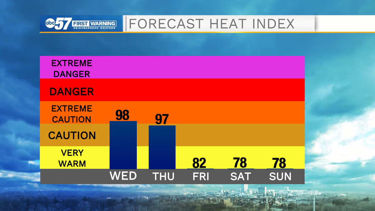
Wednesday: Extreme heat, Scattered PM thunderstorms. High 90.
Thursday: Extreme heat, Scattered PM thunderstorms. High 90.
Friday: Partly cloudy. High 82.
Sign up for the ABC 57 Newsletter