Cool start to the week with frost possible at night
By: Emily Kennedy
Posted: May 10, 2021 2:46 AM EDT

-
1:06

Marshall County Humane Society reschedules Dog Egg Hunt
-
2:01

Martin Luther King Dream Center hosts MLK March in South Bend
-
1:54

South Bend Cubs opener postponed by weather, but fans still find...
-
2:01

Sights and sounds from South Bend Cubs Opening Day
-
1:32

NIPSCO ’flatly rejected’ further negotiations, USW workers...
-
3:36

The art of groundskeeping at Four Winds Field
-
3:32

The history behind America’s only ballpark synagogue turned...
-
1:59

South Bend opens season against Quad Cities in familiar Midwest...
-
4:21

South Bend Cubs owner discusses $48M stadium expansion, changes...
-
3:19

A look into the new South Bend Cubs 2026 roster
-
5:17

Expansion goes beyond Four Winds Field, new restaurants, bars,...
-
6:18

What’s new this season? South Bend Cubs unveil major improvements...

ABC57 First Warning Neighborhood Weather Forecast
Monday, May 10th, 2021
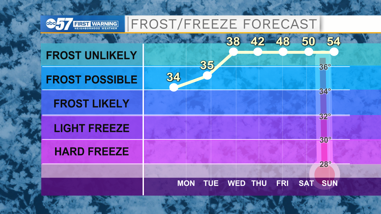
A mix of sun and clouds today with an isolated shower possible this afternoon. Under clear skies, temperatures drop into the low to mid 30s tonight leading to possible frost. Bring in or cover any sensitive vegetation. Sunshine and cool for Tuesday but we finally make it back into the 60s on Wednesday! Temperatures gradually warm into the 70s by Friday with sunshine and warmth lasting through the weekend.
Today: Mix of sun and clouds. High 54.
Tonight: Mostly clear, frost possible. Low 34.
Tuesday: Mostly sunny. High 56.
Wednesday: Mostly sunny. High 64.
Sign up for the ABC 57 Newsletter