
-
2:34

Pro-life group files lawsuit against IDOH for access to abortion...
-
1:01

South Bend students gain hands-on experience at first ’GEAR...
-
1:48

Temperatures swing with rounds of rain
-
2:56

Senior citizens feeling taxed out of their neighborhoods
-
0:26

Monterey adds around-the-clock cameras to combat crime
-
5:06

The NALC is looking for volunteers to ’Stamp Out Hunger’...
-
2:19

Dry and mild start to Thursday, but rain arrives this evening
-
2:56

Pro-Palestinian protesters fill intersection of Walnut and Western...
-
1:55

’Water shut off notices’ return in Benton Harbor
-
0:57

Indiana Lt. Gov. Suzanne Crouch makes local campaign stop
-
3:55

Deliberation about changes to Indiana’s high school graduation...
-
1:44

Temperatures rise and fall to end the week, rain Friday

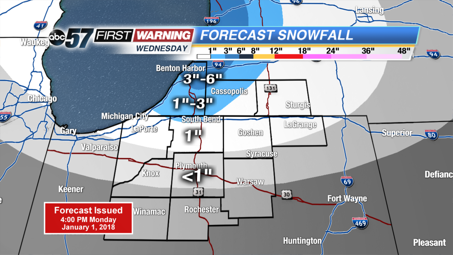
Tuesday may be the coldest day so far in the Frigid holiday season, temps start well below zero and highs will not break into the double digits. The wind chill will also be a factor staying mostly subzero. There is a short break from snow with mostly sunny skies. The next round of snow will be Wednesday – Thursday with another clipper, plus lake effect. Amounts will not be extreme but some areas could see another three to six by Friday morning.
Tonight: Partly to mostly clear, low of -8.
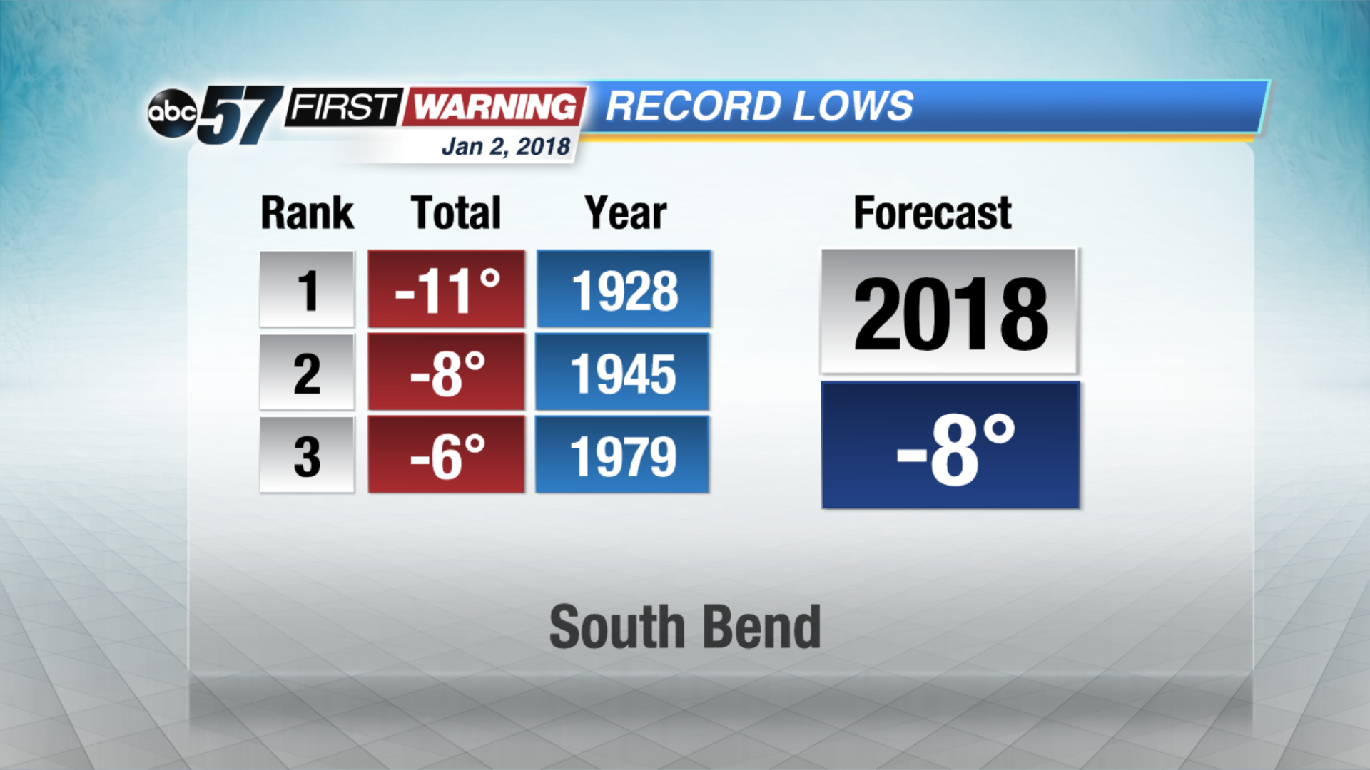 Forecast nearing record lows Tuesday morning
Tuesday: Mostly sunny. Highs near 6.
Wednesday: Mostly cloudy, afternoon and evening snow showers, high of 14.
Thursday: Lake effect snow showers, highs in the lower teens.
Sign up for the ABC 57Newsletter