


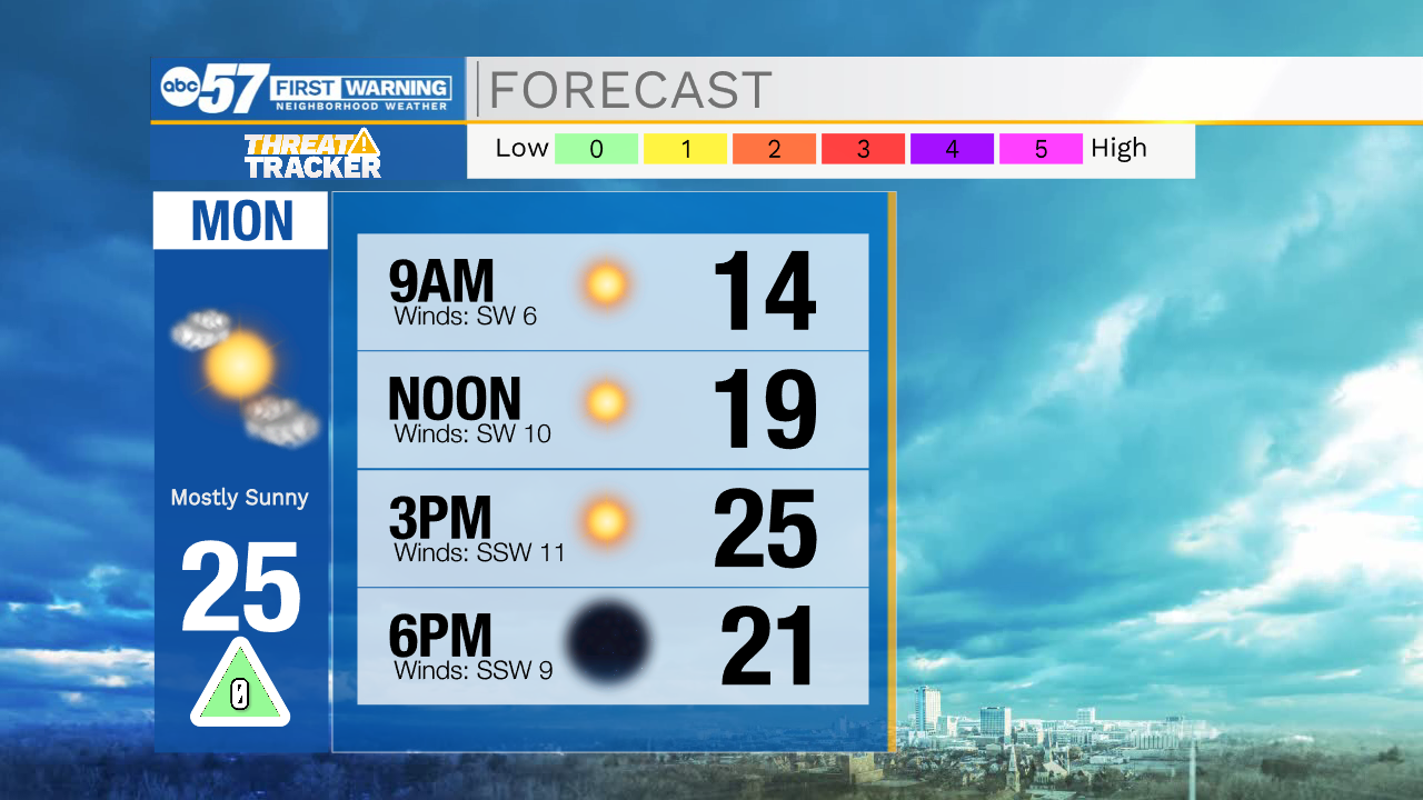
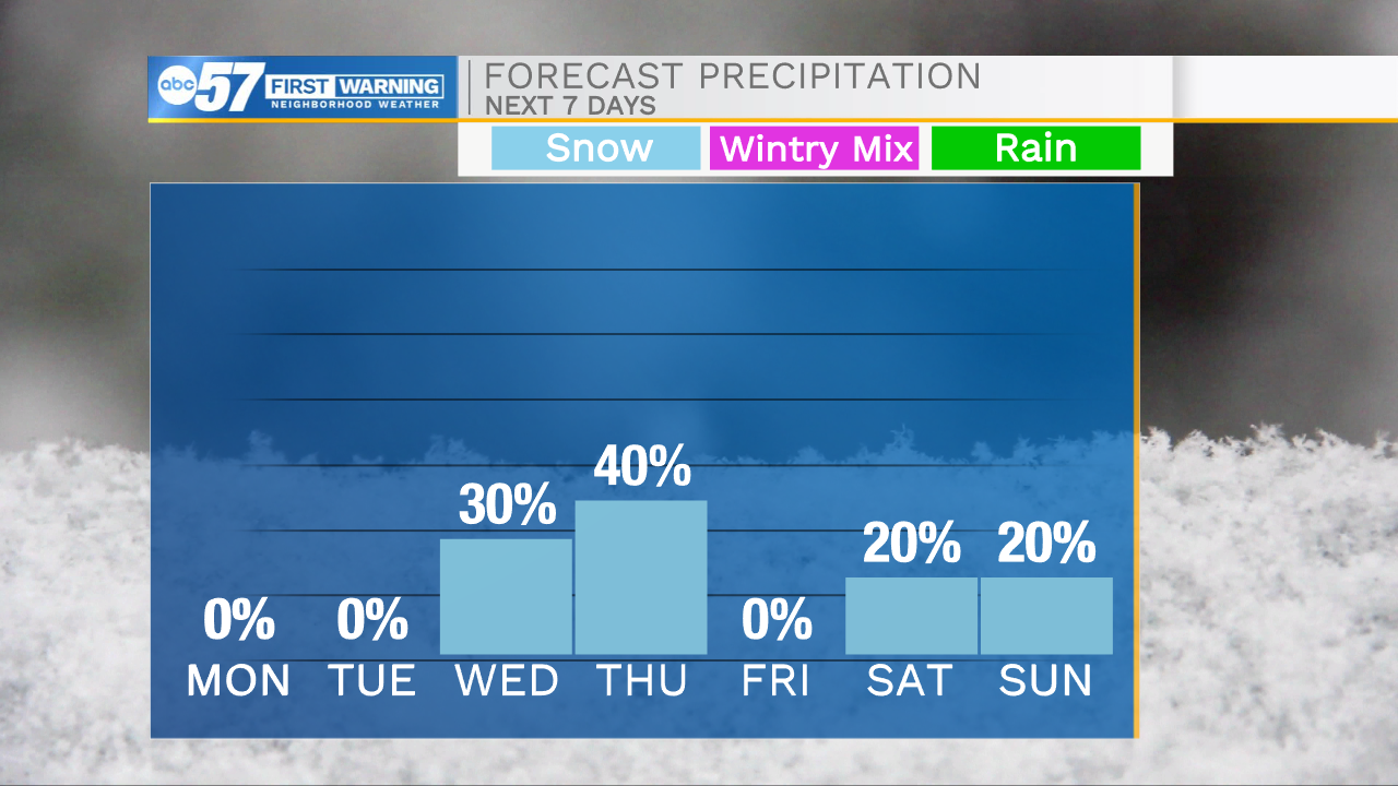
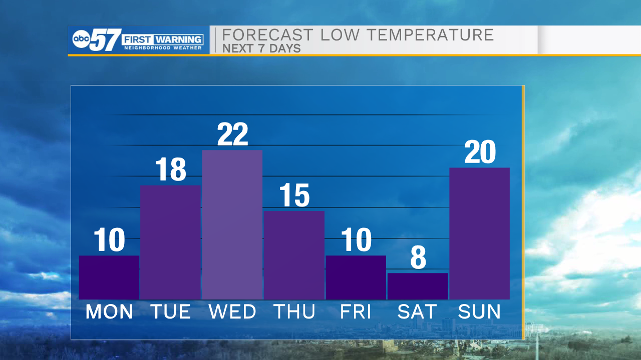
Our weather looks to stay mostly quiet heading through the overnight hours. A few isolated lake effect snow showers are possible later tonight in LaPorte and Berrien counties, little to no impacts are expected. Temperatures will plummet tonight as lows drop into the single digits for some tomorrow morning. Wind chills will be closer to 0 as a persistent light breeze remains with us heading into tomorrow. Make sure to bundle up with multiple layers and limit time outside. Highs tomorrow afternoon will only warm into the mid 20s. Tuesday and Wednesday highs rebound back into the 30s. Wednesday afternoon a few lake effect snow showers are possible, and will linger into Thursday. Right now impacts look low, but a few inches of snow are possible in southwest Michigan. Highs for later in the week will drop into the upper teens by Friday.
Tonight: Partly cloudy. Low 10.
Tomorrow: Mostly sunny. High 25.
Tuesday: Partly cloudy. High 36.
Wednesday: Isolated snow showers. High 32.