
-
2:10

Sunny Monday ahead, but showers and thunderstorms later this...
-
2:10

Plymouth High School hosts ’Steps for Stegs’
-
2:05

Drier but cooler to wrap up the weekend
-
6:23

ABC57’s Arts and Acts: Local dance stars shine at A&A Ballet...
-
2:49

St. Adalbert Church celebrates Cinco De Mayo, announces fundraising...
-
0:40

Congressman Rudy Yakym awards local high school artists
-
2:06

Thundershowers tonight, a cooldown tomorrow following cold front
-
0:52

Bethel University celebrates 77th commencement
-
1:36

Beautiful start to the weekend despite morning fog
-
1:03

’Pedals and Petals’ in downtown South Bend
-
3:18

Owners urged to vaccinate dogs after puppy left for dead outside...
-
1:54

Threat of drought, even with rainy spring in Michiana

Light lake effect snow showers Thursday night into Friday morning, accumulation up to one inch possible.
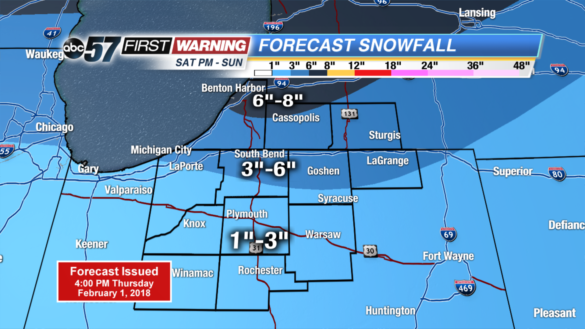
The cold and snowy pattern returns. Light snow and flurries end Friday morning, but temperatures will struggle to break 20. The next round of snow arrives Saturday afternoon and lasts through Sunday. Accumulation of at least three inches is likely for most. The pattern shows no changes for next week with a chance of snow every other day.
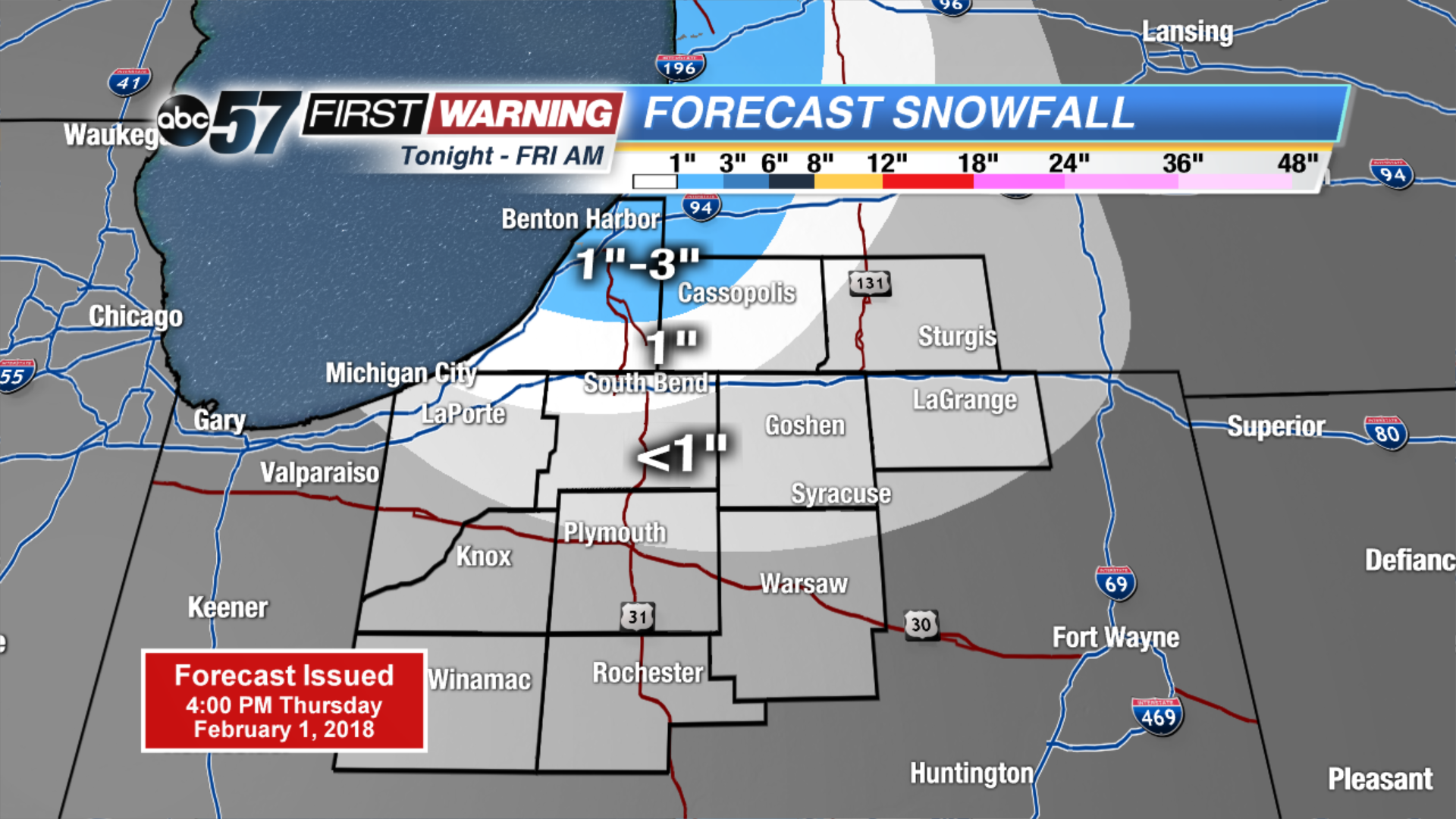
Tonight: Mostly cloudy, lake effect snow, low of 10.
Friday: Partly cloudy, chance of snow early, high of 18.
Saturday: Snow by the afternoon, high of 32.
Sunday: Snow showers through midday, highs in the upper 20s.
Sign up for the ABC 57Newsletter