
-
0:21

Police investigating shooting on Amhurst Avenue
-
2:42

South Bend Police Department recognized for completing crisis...
-
0:35

Local boxer brings home Golden Gloves Championship
-
1:01

5th annual Ivy Impact Gala held
-
0:50

13th annual Radiothon for Five Star Life takes place
-
1:05

Amazon investing $11 billion into New Carlisle data center
-
1:52

German company Verbio buys new ethanol plant in South Bend
-
0:54

61st annual Salvation Army Pancake Day held
-
5:26

Rep. Rudy Yakym calling for the protection of Jewish students...
-
1:26

Wet, warm & windy this weekend
-
4:24

Michiana Crime Stoppers shredding event
-
1:16

’IvyCares’ program setting students up for success in and...

Winter weather returns, snow showers are likely through Wednesday. The cold northwesterly flow will set up lake effect snow showers during the early morning, when temperatures fall into the 20s. Snow showers wane each afternoon as temperature warm above freezing. Total accumulation of one to three inches is possible over the next three days, the brunt of which is likely Tuesday. Skies clear and temperatures warm to end the week, 50s possible by the weekend.
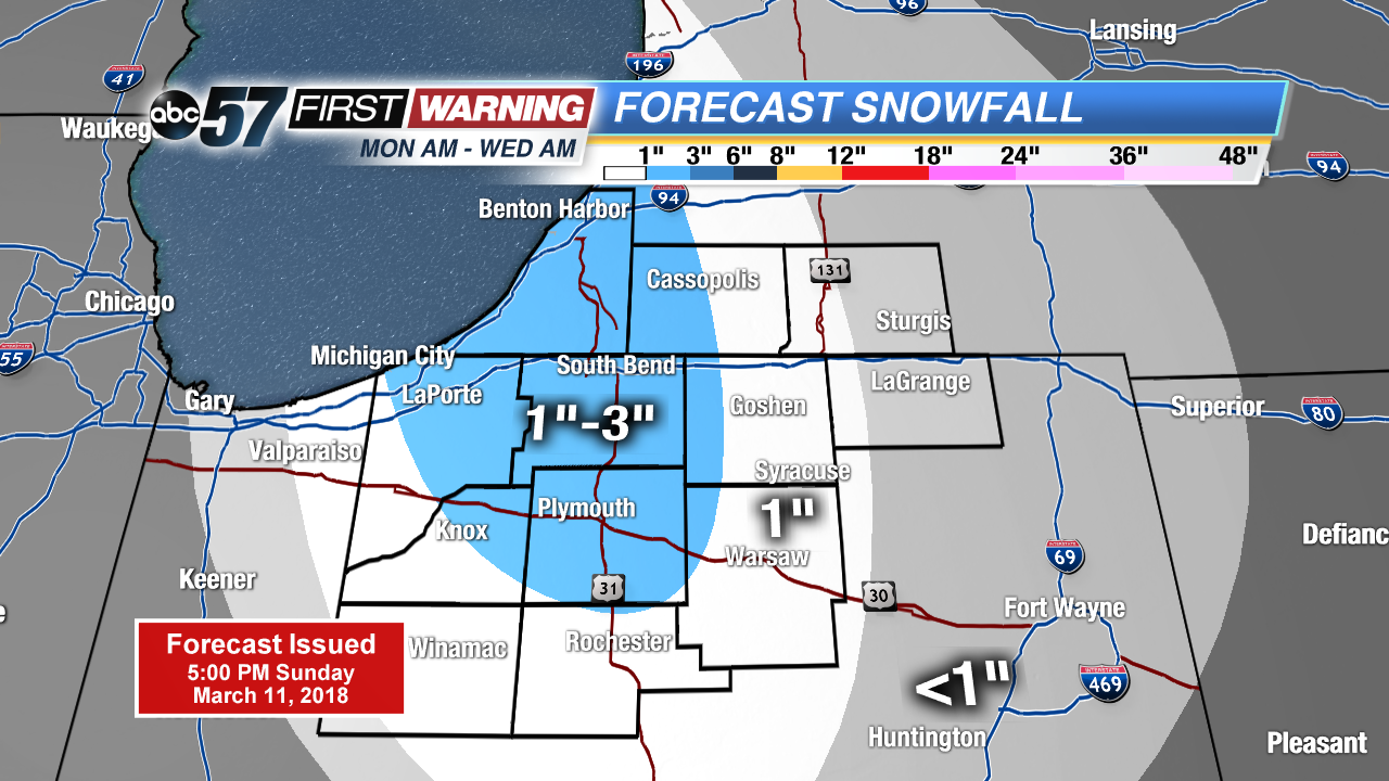
Tonight: Mostly clear, snow by morning, low of 24.
Monday: Mostly cloudy with a chance of scattered snow showers, breezy, high of 36.
Tuesday: Lake effect snow showers, high of 32.
Wednesday: Morning snow showers, highs in the mid-30s.
Sign up for the ABC 57Newsletter