
-
0:28

Mishawaka police officers rescue man from apartment fire
-
0:45

South Bend Schools fires teacher arrested for grooming and enticing...
-
1:08

Drier week expected for Michiana
-
0:43

Freeze Warning active
-
0:42

NIA participates in road cleanup volunteer day
-
1:55

Community concert brings generations together through music at...
-
2:06

South Bend Cubs take series from Beloit despite no-hit loss in...
-
1:54

St. Joseph River rises into minor flood stage after weeks of...
-
1:05

Freeze warning begins tonight
-
1:30

Gunman identified in mass shooting in Shreveport, Louisiana
-
1:14

After afternoon showers, drier week ahead
-
0:57

Calm and cool now, showers later

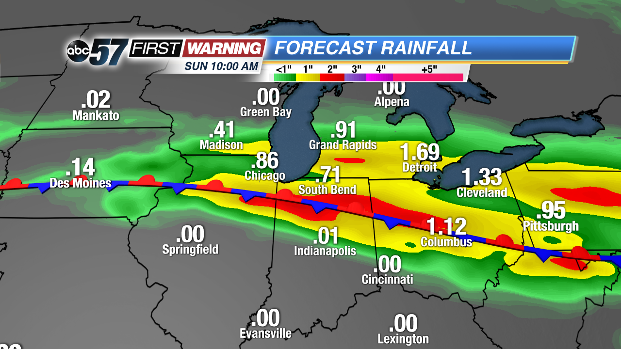
Cool and rainy start to the weekend. Round of showers and thunderstorms are likely Saturday, with the heaviest rain threat Saturday night into early Sunday, storms may also have large hail. Minor flooding is a concern as some areas could see more than two inches or rain through Sunday morning. Mother’s day will be a bit milder and drier and clouds break in the afternoon. The pattern is warmer but still stormy next week.
Tonight: Few showers and storms possible, low of 48.
Saturday: Scattered thunderstorms, high of 62.
Sunday: AM showers then becoming partly cloudy, high of 68.
Monday: Partly cloudy, chance of showers, highs near 80.
Sign up for the ABC 57 Newsletter