

-
0:53

Storms, heavy rain start after sunrise
-
1:47

Warsaw celebrates local flavor at Taste of Kosciusko
-
0:41

Magistrate talks to Discovery Middle School students about Constitution
-
2:34

Nic Stanley’s defense attorney gives exclusive interview days...
-
2:04

Twin City Players Costume sale
-
2:28

Shamrocks beat Bucks 30-20, stay unbeaten in 2026
-
3:00

Buchanan’s Sweet Shop faces foreclosure over $6,000 debt as...
-
2:24

50 Years of Nappanee’s Apple Festival, What You Can Expect
-
2:17

Indiana State Police Trooper Fired Upon; One Suspect in Custody,...
-
1:21

Sweater Weather coming soon
-
2:34

Plan for rain for Saturday Night Football
-
1:50

IN AI Roadshow teaching how to apply A.I. in the workplace

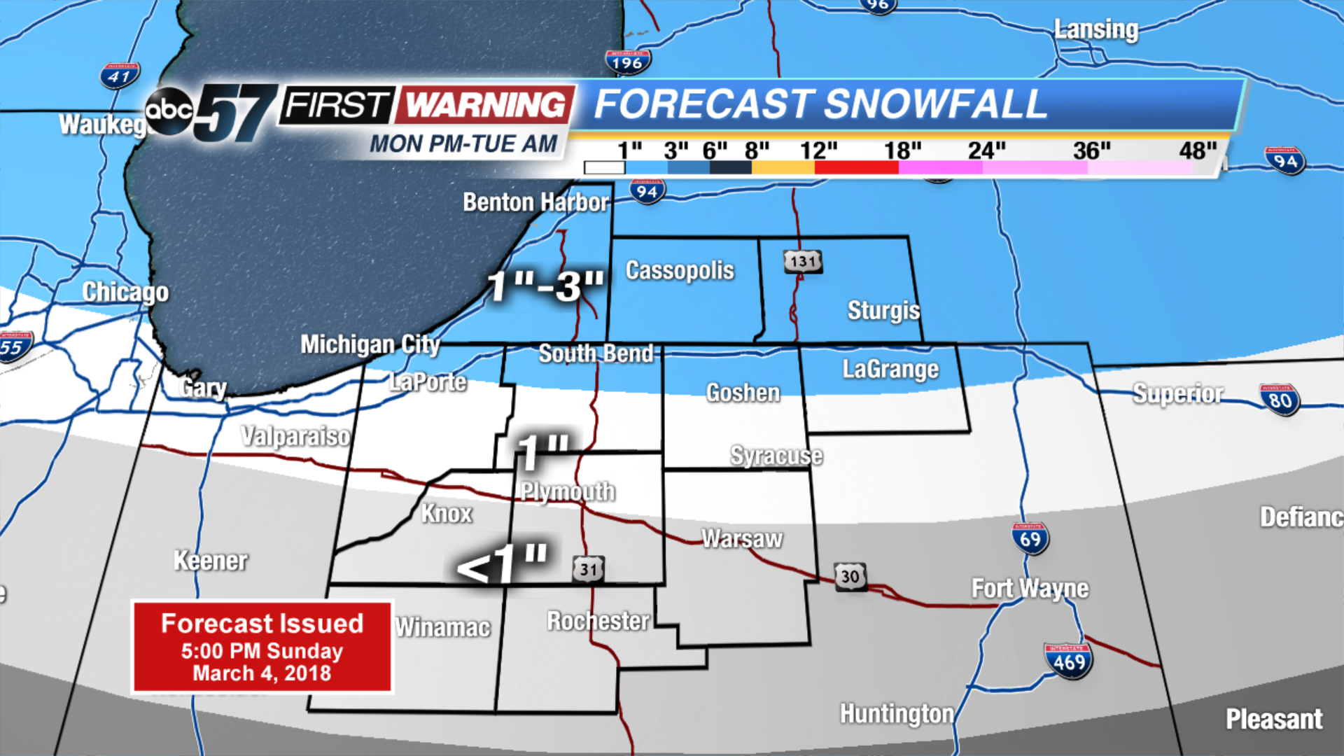
A big change to start the first full week of March. Monday will start fair but increasing clouds foretell the return of wintry weather. Rain changing to snow Monday night will make for sloppy roads Tuesday morning. Accumulation of one to three inches is possible through early Wednesday but not all of that snow may stick, as temperatures waver just above freezing.
Tonight: Mostly clear to partly cloudy. Low of 26.
Monday: Mostly sunny to mostly cloudy with a chance of late PM rain showers. High of 42.
Tuesday: Mostly cloudy with snow in the early morning, then a rain/snow mix in the afternoon/evening. High of 40.
Wednesday: Chance of snow showers, highs in the mid-30s.
Sign up for the ABC 57 Newsletter