Winter Storm moves in tonight

-
1:45

Windy and wet this weekend, but unseasonable warmth as well
-
3:13

Local players react to $3 million investment in Byer Softball...
-
0:32

Layoffs at Whirlpool could affect workers in Benton Harbor
-
1:03

Annual District Sisterhood Conference at Ivy Tech empowers students
-
1:49

Back home in downtown South Bend, YMCA to open new location
-
2:16

This week’s ABC57 Cub Reporter is Nicholas Zentz
-
3:05

Amazon Web Services invests $11 billion to build data center...
-
4:05

Riley High School student center stage at the NFL Draft
-
1:35

Rain, wind, and milder temperatures forecast this weekend
-
2:49

Joe Alt expected to be drafted in the first round of NFL Draft
-
2:11

Students gearing up for local careers in Manufacturing
-
2:13

Sunny today, but expect a wetter and warmer weekend

We are off to a cold but quiet start this morning. Most of the roads are much clearer and it remains calm for today. There is just a chance for a flurry or two but most won’t have to deal with any snow. The winter storm moves in Thursday night lasting throughout Friday, into Friday night. Winter Storm Watch is already posted for most of Michiana. Heavy snow, low visibility and rough travel conditions are expected. Well over 6” of snow is likely for northern Michiana. Exactly who gets the most snow will depend on the track the storm makes. Snow chances continue into the weekend but next week is much quieter.
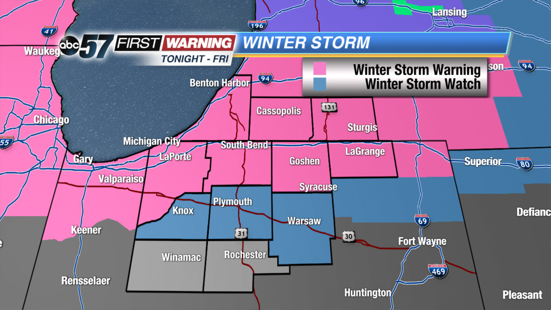 Winter Storm Warnings and Watches posted for tonight through Friday night
Thursday: Mostly to partly cloudy, chance of snow, high of 20.
Tonight: Heavy snow begins, low of 18.
Friday: Heavy snow, highs near 30.
Saturday: Mostly cloudy, chance of PM snow, highs in the upper 20s.
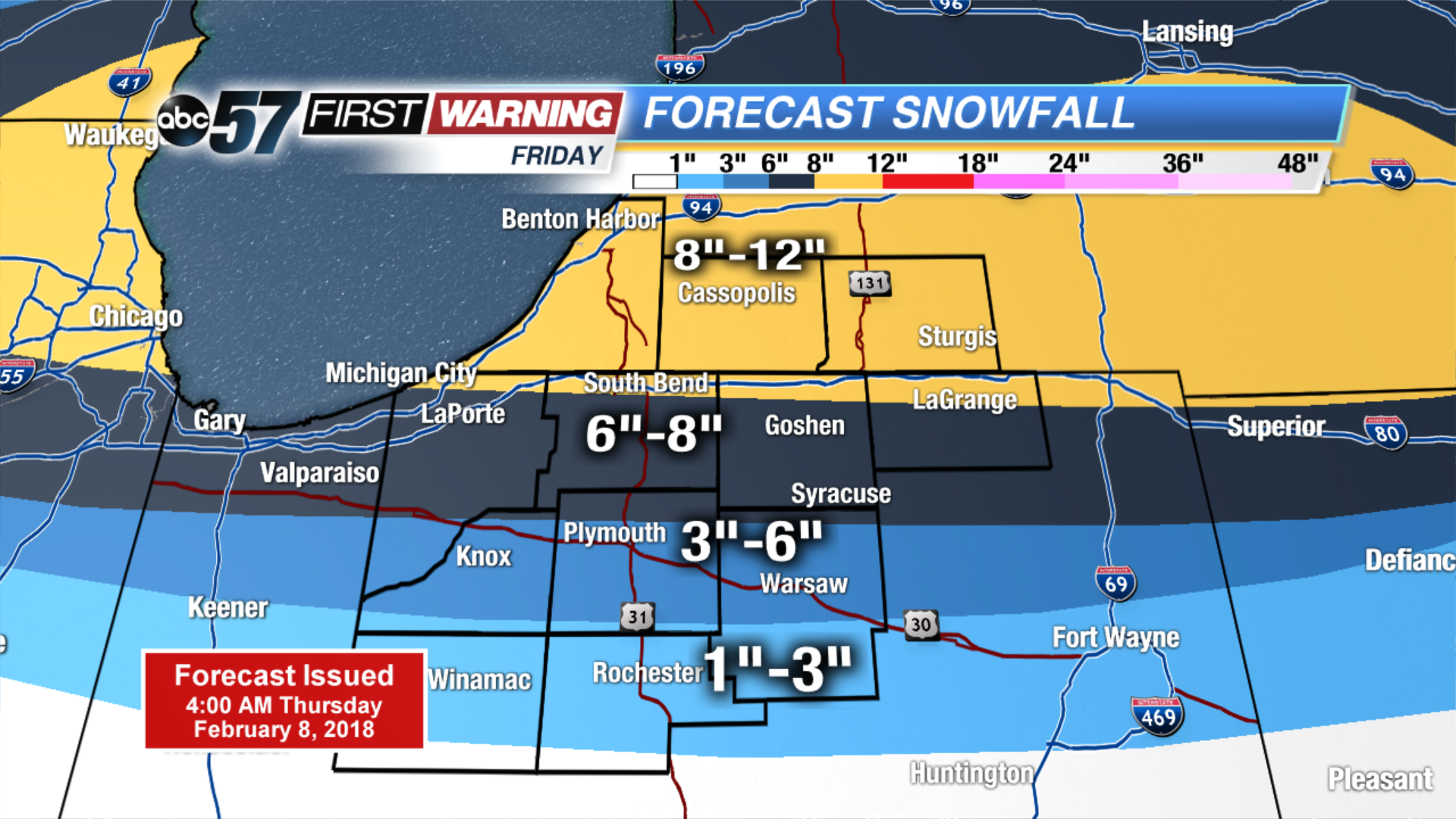 Forecast snowfall totals for Friday.