
-
0:30

Prayer vigil held for domestic violence victim in South Bend
-
1:10

Bristol Town Council voting in favor tonight for the annexation...
-
0:52

Official ribbon cutting for The Delta neighborhood in Elkhart
-
1:08

Traveling or booking a trip soon? Here’s what to know
-
0:27

Elkhart Police Department investigating a hit and run on Cassopolis...
-
2:40

Recovery efforts continue after EF-1 tornado devastated Edwardsburg
-
1:22

The March rollercoaster continues
-
0:55

Mishawaka High School Theatre presents ’Chicago! Teen’
-
19:10

How public records requests increase government transparency
-
2:25

Local chef showcasing her food at Pacers game
-
3:46

Local farmers concerned war with Iran will impact fertilizer
-
2:56

The partial government shutdown is impacting travel across the...

Windy and rainy Saturday. Wind gusts could top 40 mph and rain amounts may be over an inch. There will be a brief lull in the wind Saturday morning, before it turns northwesterly and gusts through the afternoon. Temperatures will crash form near 50 mid-morning, to the low 40s by evening and 30s by early Sunday. Lake effect snow showers are also possible Sunday morning but accumulation is unlikely.
Tonight: Windy and rainy, temperatures hold or rise through the 40s. 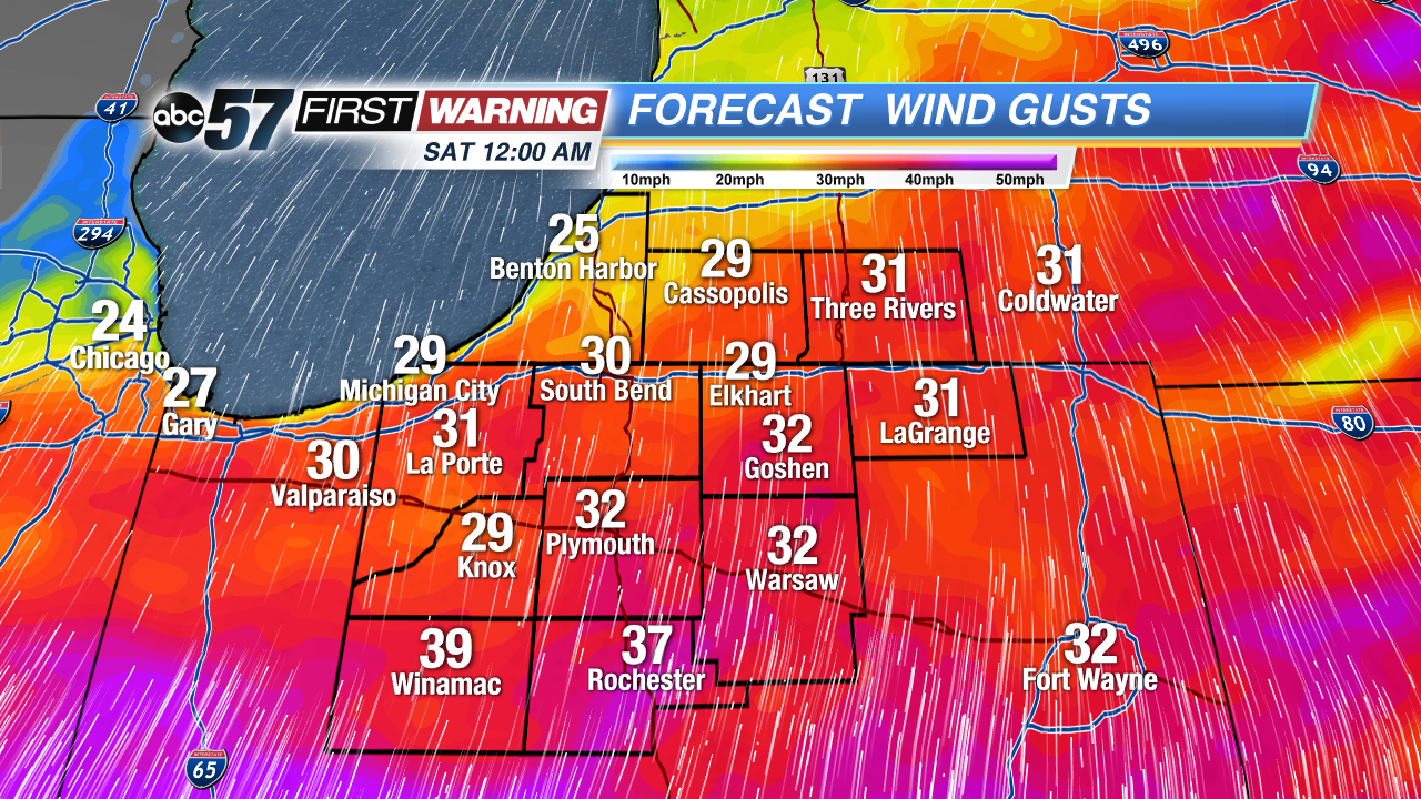 Wind gust forecast early Saturday
Saturday: Wind and rainy, highs near 52 but falling through the afternoon.
Sunday: Mostly cloudy with chance of lake effect snow showers early. High of 34.
Monday: Mostly sunny, highs in the mid-40s.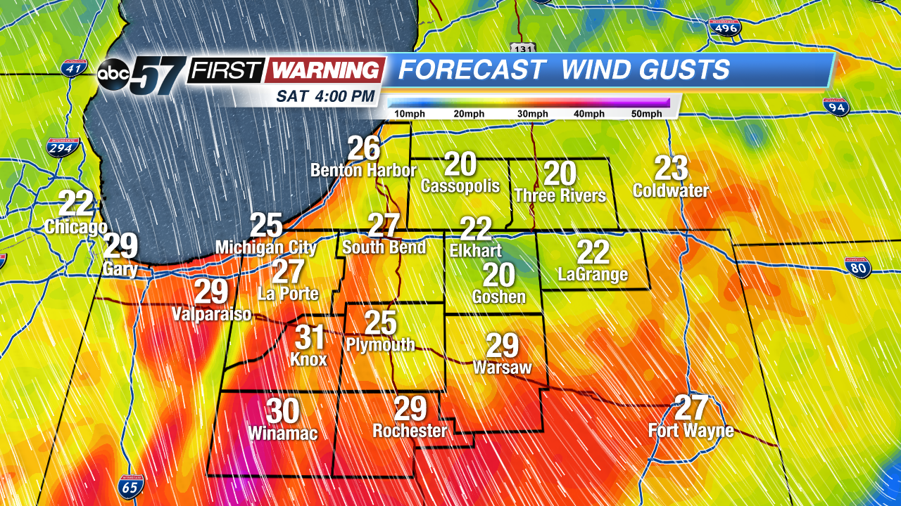 Wind gust forecast Saturday afternoon