
-
0:52

Indiana Michigan Power plan for 100 percent clean energy
-
3:24

Teen’s organ donation gives stranger a second chance at life
-
1:37

City of South Haven introduces new lifeguard chief
-
3:36

The confusion surrounding childhood vaccines
-
3:01

Southwest Michigan dispensaries welcome thousands for first 4/20...
-
3:25

Emergency funding and disaster recovery in Michigan explained...
-
1:40

American importers owed billions in refunds for tariffs
-
1:44

Suspect flees after shooting female in downtown Goshen
-
0:28

Mishawaka police officers rescue man from apartment fire
-
0:45

South Bend Schools fires teacher arrested for grooming and enticing...
-
1:08

Drier week expected for Michiana
-
2:33

ISP investigating death of 82-year-old inmate at Miami Correctional...

Active weather through the weekend, the forecast is not a complete washout but rain will be in the forecast through Saturday and into early Sunday. Scattered showers and storms during the day Saturday, then a widespread line of rain Saturday night into early Sunday. Sunday, temperatures fall with a blustery northwest wind, gusting up to 30 mph. Next week starts cool and sunny.
Tonight: Increasing clouds, low 58.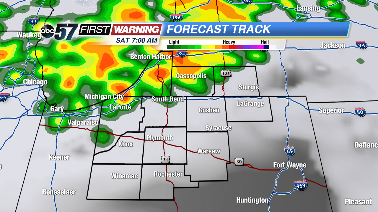 Scattered storms mostly across our north Saturday.
Saturday: Scattered showers and storms, high 74.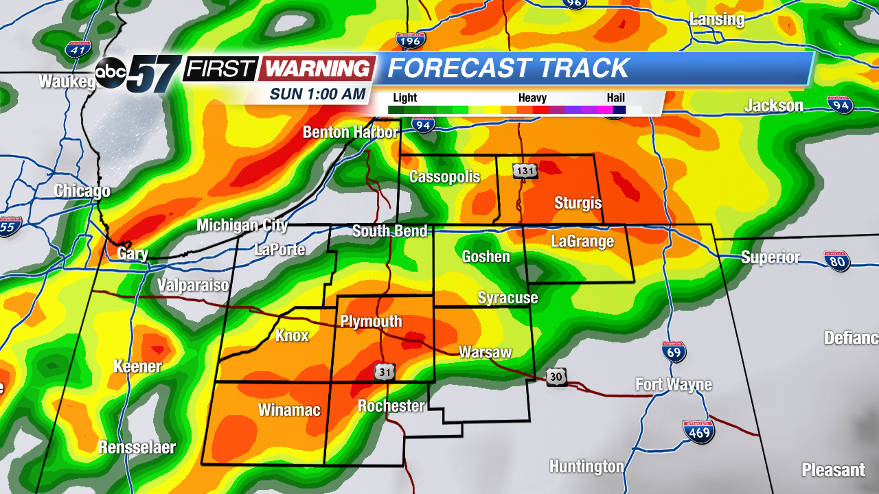 Widespread rain Saturday night
Sunday: Morning showers, temperatures fall from 60 and breezy.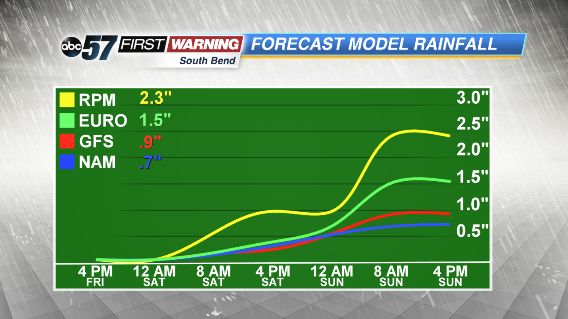 Rainfall estimates of over an inch likely through Sunday AM
Monday: Sunny, highs near 60.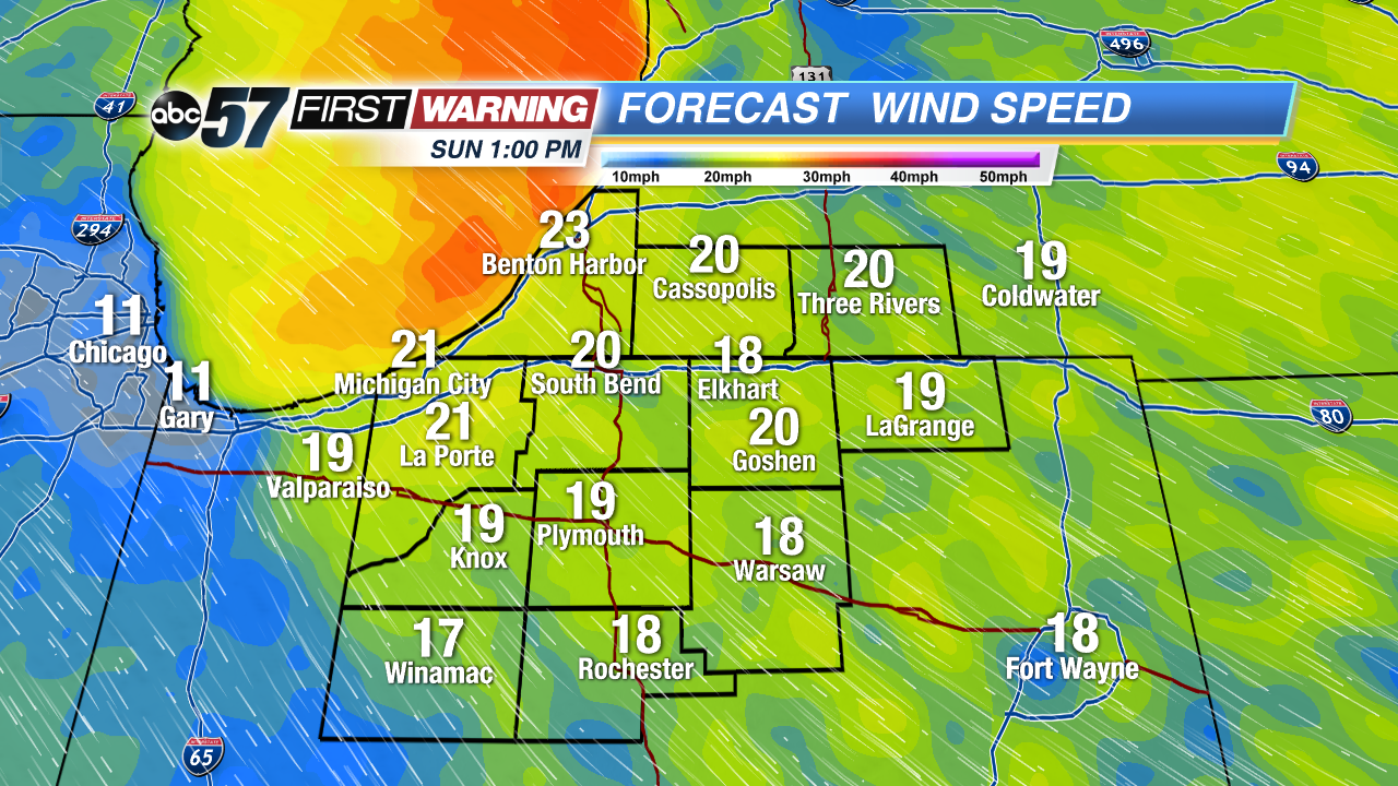 Blustery Sunday, gusts topping 30 mph.