Watching for risk of severe weather on Tuesday, February 25
SOUTH BEND, Ind. -- The ABC57 First Warning Neighborhood Weather Team is continuing to watch for severe weather conditions forecasted to develop Tuesday evening.
Currently, southerly winds are triggering an influx of warm, moist air from the Gulf of Mexico into Michiana.
As a result, our highs are expected to climb past 60F tomorrow and close to 70 by Tuesday.
With the warmer air at our doorstep, our area will become moisture-laden over the next two to three days, increasing our regional dewpoints as well.
An ample moisture supply, warming temperatures, and sunshine, all of which are expected heading into both Monday and Tuesday, will help drive CAPE (Convective Available Potential Energy) values up, acting as a source of fuel for potential severe thunderstorm development.
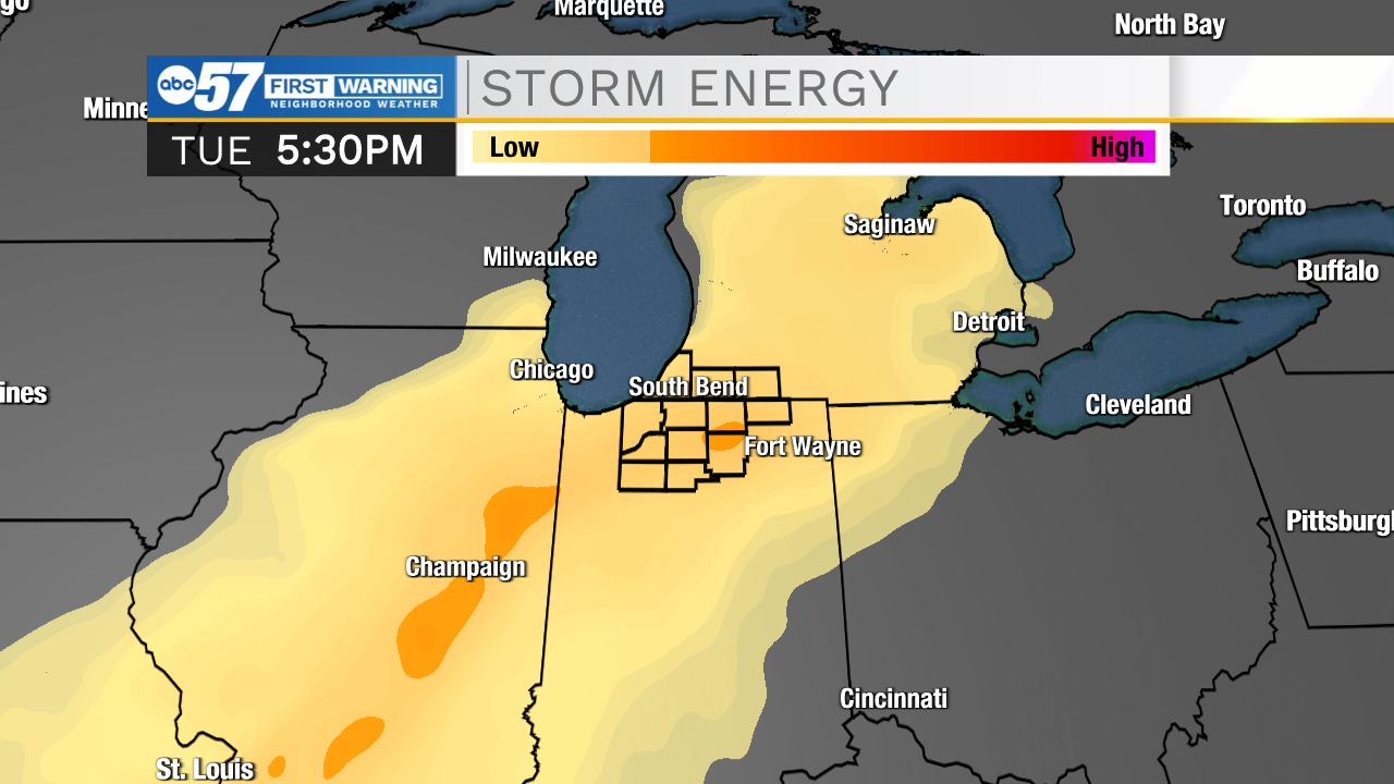 GFS initialization of CAPE values on Tuesday evening
In the upper levels of the atmosphere within the jet stream, a jet streak is primed to develop Tuesday morning.
The jet streak's placement relative to Michiana also boosts our area's chances of seeing thunderstorms Tuesday evening, some of which may be severe.
Over the past two days, models have come to a general consensus about the timing and placement of the aforementioned jet streak, putting Michiana in the left exit region.
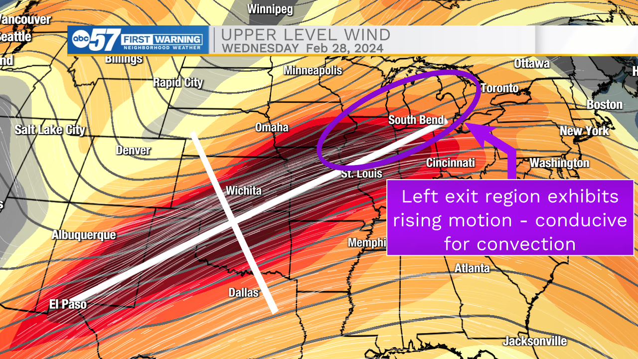 Model analysis from 02/24 18z GFS
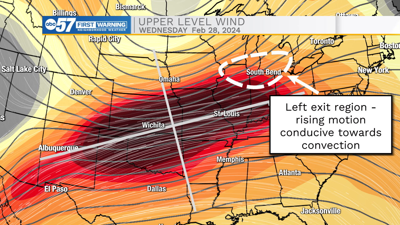 Model analysis from 02/25 18z GFS
However, there is still much uncertainty about timing of thunderstorms and potential impacts.
If the first round of rain showers Tuesday morning fails to dissipate, or abundant cloud cover is present through Tuesday afternoon, diurnal heating drops, and the severe risk Tuesday night diminishes.
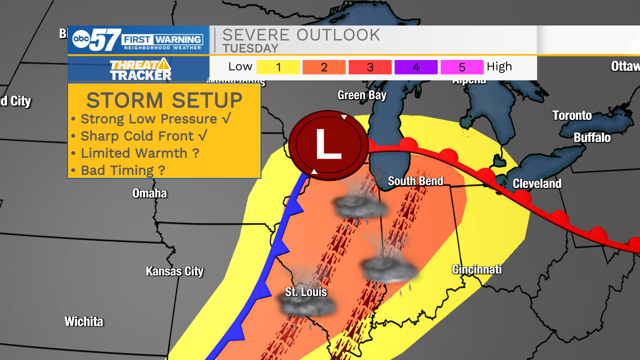 Severe weather outlook for Tuesday
Keep following the ABC57 First Warning Neighborhood Weather Team for more updates about Tuesday's severe weather risk.
