
-
1:43

Pleasant to start the weekend
-
3:06

Pulaski County weighs stricter solar rules amid resident concerns
-
0:40

Marian High School hosts World Down Syndrome Awareness Walk
-
2:33

South Bend leaders call for an end to gun violence
-
2:01

Tae Johnson, Notre Dame secondary stands out as Irish open spring...
-
2:21

Backup quarterback competition, position battles highlight Notre...
-
2:25

A new Pathway to the Golden Dome
-
2:33

Howard Park aims to install bandshell
-
1:37

March Madness and gambling responsibly
-
1:19

There are two big temperatures drops next week
-
1:48

Longer days for the first day of Spring
-
1:30

Country music star Jake Owen to play at Blue Gate Performing...

Temperatures rise along with the humidity Wednesday, before our next chance of storms Thursday. The forecast turns steamy Wednesday night as showers and storms move in for the first half of Thursday. The greatest threat looks to be heavy rain and possibly gusty wind. The rainy weather exits Thursday and is replaced by mild and sunny weather for the weekend.
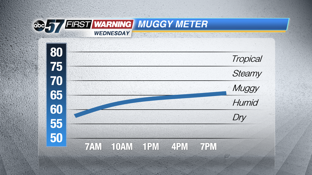 Humidity will noticeably rise through Wednesday
Tonight: Clear, low 60.
Wednesday: Mostly sunny, high 86, chance of storms late.
Thursday: Thunderstorms likely, high 80.
Friday: Mostly sunny, highs in the upper 70s.
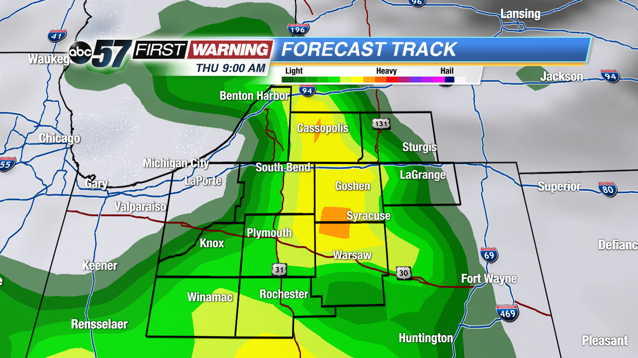 Next chance of rain/storms still expected Thursday morning.
Sign up for the ABC 57 Newsletter