
-
2:25

Lake effect snow through this morning
-
0:25

City commission approves new downtown paid parking plan
-
3:41

Community shares concerns at board meeting over offensive language...
-
2:03

Staying safe around downed power lines
-
3:10

Former players share stories of Lou Holtz before his burial
-
3:02

Trust, Love, and Commitment: Lou’s Life Lessons
-
1:32

Notre Dame ready for funeral traffic
-
3:23

Notre Dame community says their final farewell to Coach Lou Holtz
-
5:58

Remembering Lou Holtz: Broadcasters reflect on Holtz’ role...
-
16:25

ESPN’s Rece Davis remembers the life and legacy of Lou Holtz
-
1:17

Cold, snowy and breezy overnight
-
2:15

’Political vengeance,’ Drake, GOP leaders respond to swatting...

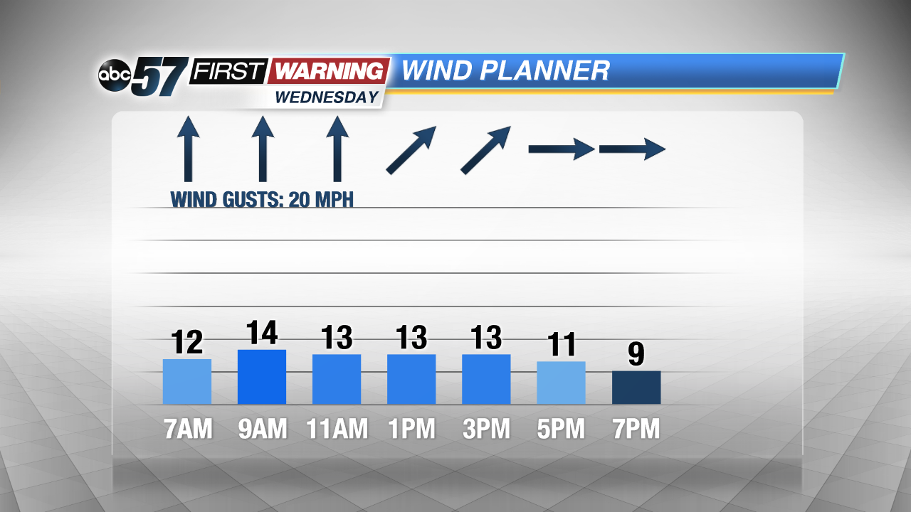
Active weather pattern the rest of the week with two storm systems. Storm number one will roll through Michiana quickly Wednesday, bringing moderate to heavy rain through midday. There’s a short break Thursday and most of Friday, before storm number two Saturday. The weekend storm will be the stronger of the two, bringing rain and gusty wind that could top 40 mph. Temperatures drop into Sunday and lake effect snow showers will develop.
Tonight: Mostly cloudy, low of 40.
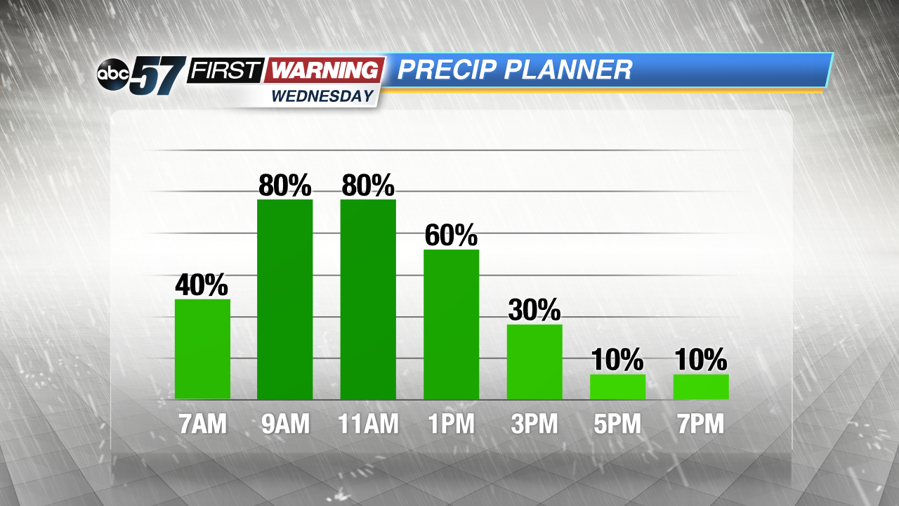
Wednesday: Morning showers, rainy and breezy midday then ending by midafternoon, high 50
Thursday: Partly cloudy to mostly sunny, high 42.
Friday: Increasing clouds, chance of rain late, highs near 50.
Sign up for the ABC 57 Newsletter