Turning colder Thursday, lake effect snow

-
0:32

Layoffs at Whirlpool could affect workers in Benton Harbor
-
1:03

Annual District Sisterhood Conference at Ivy Tech empowers students
-
1:49

Back home in downtown South Bend, YMCA to open new location
-
2:16

This week’s ABC57 Cub Reporter is Nicholas Zentz
-
3:05

Amazon Web Services invests $11 billion to build data center...
-
4:05

Riley High School student center stage at the NFL Draft
-
1:35

Rain, wind, and milder temperatures forecast this weekend
-
2:49

Joe Alt expected to be drafted in the first round of NFL Draft
-
2:11

Students gearing up for local careers in Manufacturing
-
2:13

Sunny today, but expect a wetter and warmer weekend
-
0:54

Goodwill ’Little Black Dress’ event raises funds for community...
-
1:45

Cheers Bar and Grill liquor license renewed following controversy

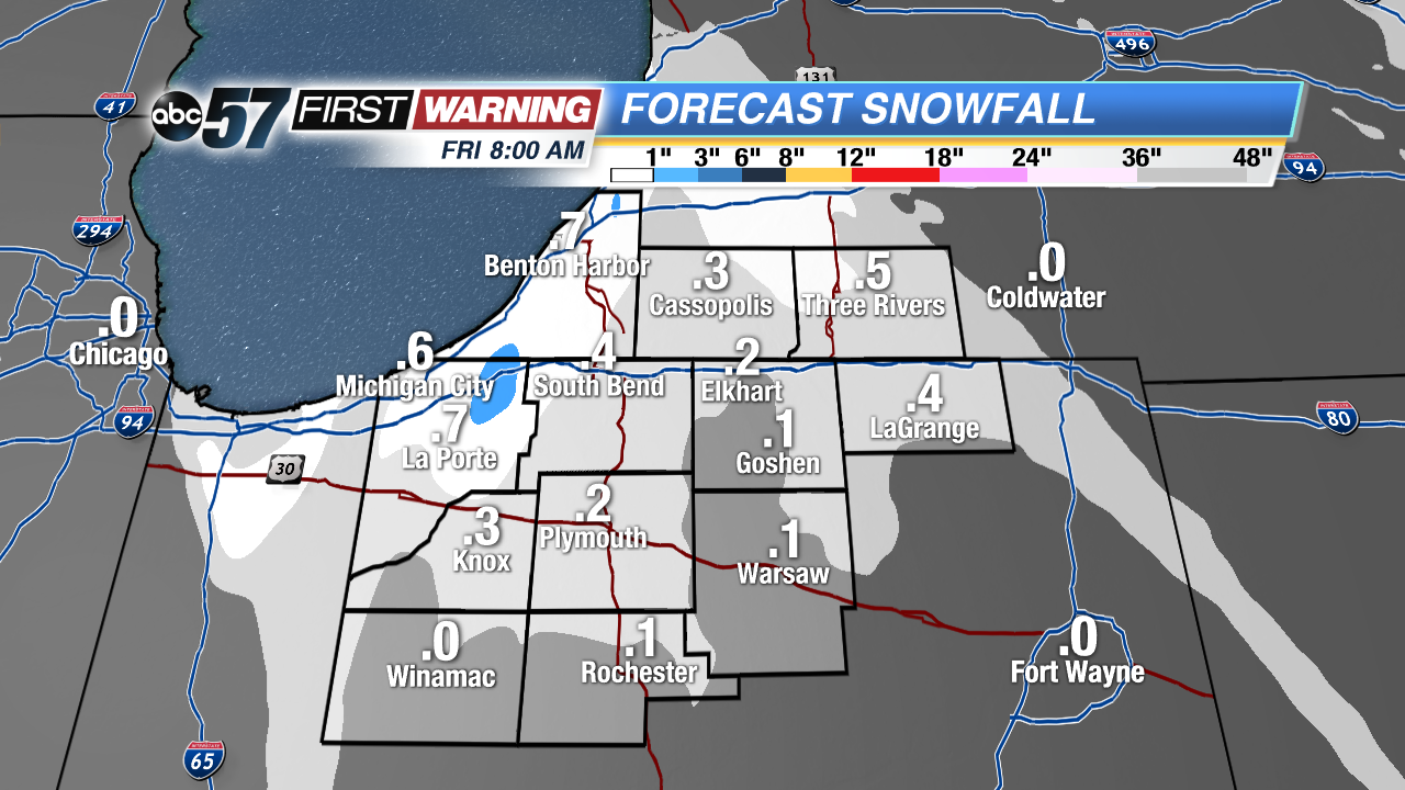
Much colder weather is on the way. Thursday, temperatures warm into the low 40s, before a clipper system drops temperatures quickly in the afternoon and turns the wind to the northwest. Breezy and colder Thursday evening and that will turn on the lake effect snow machine, as temps fall into the lower 20s. Heavy snow is not expected but a few grassy areas may turn white by Friday morning.
Friday will be a cold day, highs will struggle to break the freezing mark. High temperatures warm this weekend into the 40s. there’s another chance of snow early Sunday before precipitation turns to all rain by the afternoon.
Tonight: Mostly clear, low 30.
Thursday: Partly cloudy, becoming breezy and colder with lake effect snow late, high 42.
Friday: Morning flurries, high of 32.
Saturday: Partly cloudy, highs in the low 40s.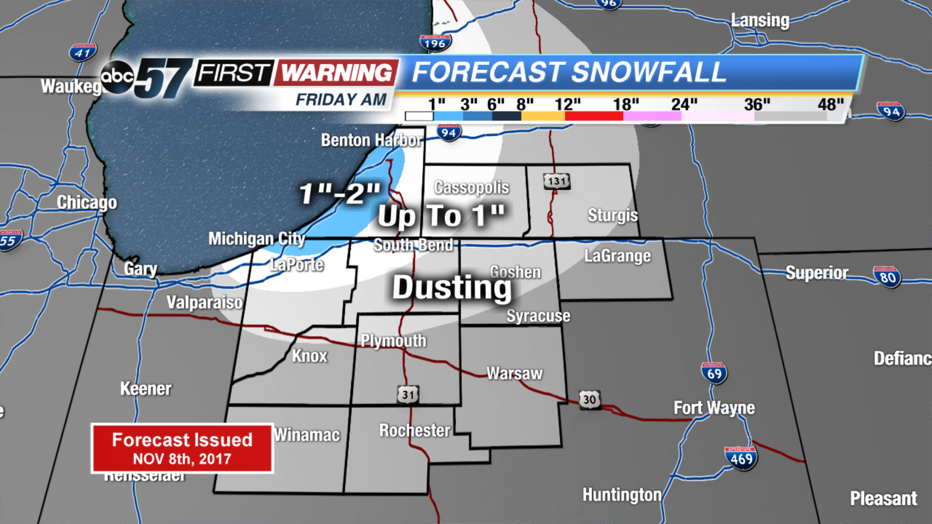 Higher totals likely closer to lake Michigan.
 Early estimates could mean up to 1/2
Early estimates could mean up to 1/2
Early estimates could mean up to 1/2
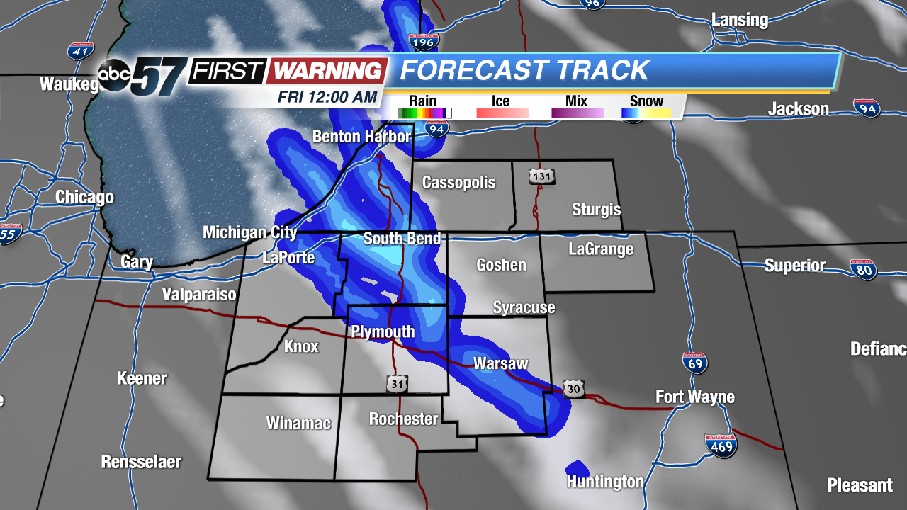 Lake effect snow bands set-up Thursday night into Friday