
-
1:43

Pleasant to start the weekend
-
3:06

Pulaski County weighs stricter solar rules amid resident concerns
-
0:40

Marian High School hosts World Down Syndrome Awareness Walk
-
2:33

South Bend leaders call for an end to gun violence
-
2:01

Tae Johnson, Notre Dame secondary stands out as Irish open spring...
-
2:21

Backup quarterback competition, position battles highlight Notre...
-
2:25

A new Pathway to the Golden Dome
-
2:33

Howard Park aims to install bandshell
-
1:37

March Madness and gambling responsibly
-
1:19

There are two big temperatures drops next week
-
1:48

Longer days for the first day of Spring
-
1:30

Country music star Jake Owen to play at Blue Gate Performing...

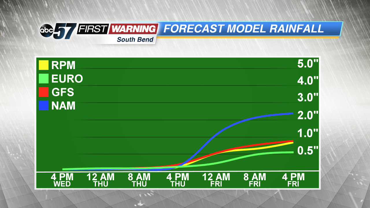
The wet weather pattern continues this week with more showers and storms Thursday, Friday and early Saturday. A slow-moving low pressure system crawls across the Midwest to end the week, keeping the threat of heavy rain and flooding in the forecast. High temperatures will be cooler than normal in the 70s but with the dewpoint in the mid-60s it will still feel damp/muggy. We clear and dry gradually through the weekend.
Tonight: Mostly cloudy, low of 62.
Thursday: Scattered showers and storms high of 76.
Friday: Scattered showers and storms, high of 74.
Saturday: AM showers, high of 72.
Sign up for the ABC 57 Newsletter