The heat breaks but not the humidity, heavy rain and storms.
Posted: Jun 18, 2018 4:32 PM EDT

-
2:22

5th annual Ivy Impact Gala held
-
0:37

13th annual Radiothon for Five Star Life takes place
-
1:05

Amazon investing $11 billion into New Carlisle data center
-
1:52

German company Verbio buys new ethanol plant in South Bend
-
0:54

61st annual Salvation Army Pancake Day held
-
5:26

Rep. Rudy Yakym calling for the protection of Jewish students...
-
1:26

Wet, warm & windy this weekend
-
4:24

Michiana Crime Stoppers shredding event
-
1:16

’IvyCares’ program setting students up for success in and...
-
1:45

Windy and wet this weekend, but unseasonable warmth as well
-
3:13

Local players react to $3 million investment in Byer Softball...
-
0:32

Layoffs at Whirlpool could affect workers in Benton Harbor

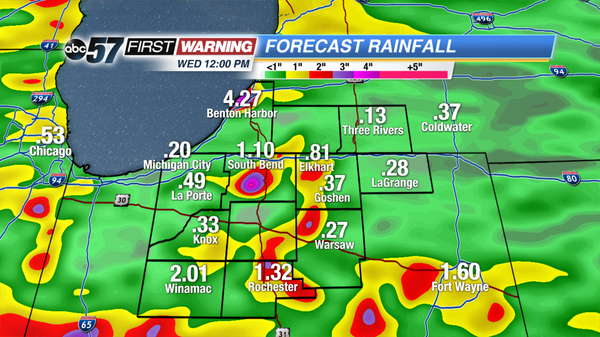
Scattered showers and thunderstorms Monday night will bring heavy downpours and break the heat but not the humidity.
The heat breaks Tuesday, as temps only warm into the low 80s but the mugginess persists for another day. Showers and storms stay in the forecast, the greatest threat being heavy rain and flooding. More than two inches of rain is possible through Wednesday. The forecast turns drier and milder midweek as skies clear Wednesday afternoon into Thursday.
Tonight: Scattered showers and storms, low 70.
Tuesday: Partly to mostly cloudy, scattered showers and storms, high of 80.
Wednesday: Morning showers and storms, high of 78.
Thursday: Mostly sunny, high of 80.
Sign up for the ABC 57Newsletter