
-
3:16

’It wasn’t safe for our community,’ Hispanic Heritage...
-
2:44

South Bend welcomes fans ahead of first home game
-
2:01

ABC57 Kickoff preview on the story of Bria Murphy
-
3:47

Kicking off the fall season with Oaktoberfest
-
1:21

Spotty storms Saturday, hotter Sunday
-
2:49

Dowagiac Football squad looks to tip 1-1 record heading into...
-
5:29

Sudden blindness, dealing with this rare hereditary disease
-
2:14

Elkhart update breakfast brings community together for answers...
-
3:02

New football coach at Benton Harbor looks to turn program around,...
-
1:58

Warming up and drying out, Isolated showers tomorrow
-
2:57

Supreme Court Justice Amy Coney Barrett set to speak at Notre...
-
1:20

Community gathers for 9/11 stair climb

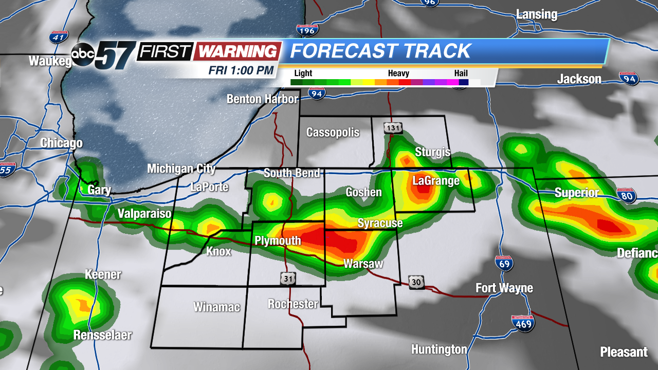 Short-Range RPM model with storms firing around 1 PM Friday.
Big changes in how storms look to develop Friday morning. A front that was expected to bring storms early is expected to stall overnight. The fewer showers we see early, the more likely storms could fire around noon Friday. Michiana will now be the starting point for storms Friday versus the ending point for Thursday night's storms. This scenario would still keep our severe threat low but storms could still bring heavy rain and gusty wind. Storms clear by mid afternoon and the humidity drops into Saturday.
Sign up for the ABC 57 Newsletter